

3.5 quake shakes Hawaii Island

Big Island Video News

Sep 26, 2013

STORY SUMMARY

HAWAII ISLAND – A preliminary magnitude 3.5 earthquake shook the Big Island of Hawaii at 8:36 a.m. on Thursday morning. The USGS Hawaiian Volcano…

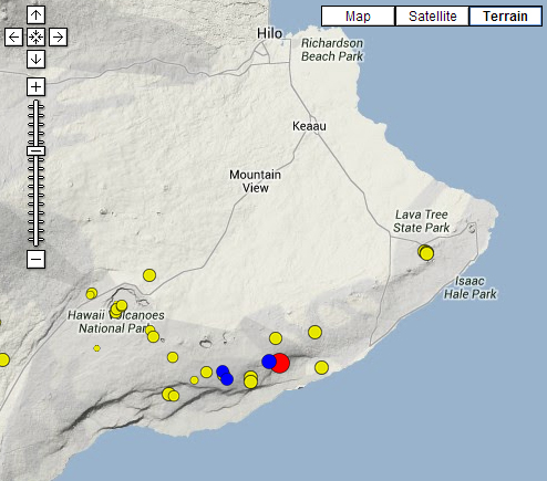
USGS HVO earthquake map
HAWAII ISLAND – A preliminary magnitude 3.5 earthquake shook the Big Island of Hawaii at 8:36 a.m. on Thursday morning.

The USGS Hawaiian Volcano Observatory located the temblor 4 miles south southeast of the active Pu`u `O`o Crater. The hypocentral depth was reported to be 4 miles below.

The rumbling was felt in Hilo, and as far as the northern end of the Hamakua Coast, according to the USGS Did You Feel It? page.

Its a timely temblor. Hawaii’s long history of destructive earthquakes and actions that residents can take to reduce injury during the next one will be the topics of two presentations on Tuesday, October 1. Both talks are open to the public.

About The Featured Image

USGS HVO earthquake map


Image placeholder

Big Island Video News has been serving Hawaiʻi island since 2008.

Leave a Comment