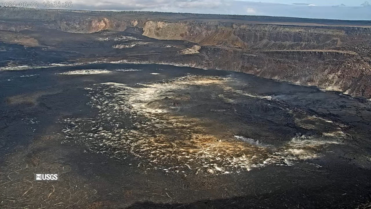
USGS webcam view of Halemaʻumaʻu crater from the northwest rim of the caldera on Sunday afternoon.
UPDATE – (6 p.m. HST) – Shortly after this article was published, the USGS Hawaiian Volcano Observatory raised the Kīlauea Volcano Alert Level from ADVISORY to WATCH.
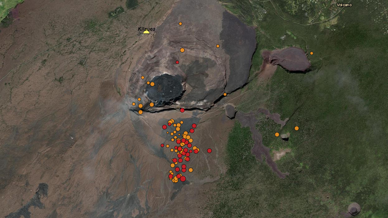
(BIVN) – Kīlauea volcano is not erupting, however a dramatic increase in the number of earthquakes beneath the summit began at noon on Sunday and continued into the evening.
The USGS Hawaiian Volcano Observatory maintained the Kīlauea Alert Level at ADVISORY, and issued a mid-day status report, saying:
On Sunday, June 2, 2024, earthquake activity beneath the south part of Kaluapele (Kīlauea’s summit caldera) increased at approximately 12:00 p.m. HST. Earthquake activity is ongoing at 1.2–1.8 miles (2–3 km) below the surface, along with an increase in the rate of ground deformation in the summit region. Currently, there are no signs of an imminent eruption; however, conditions could change quickly.
Scientists noted rates of seismicity and ground deformation remain low beneath the East Rift Zone and Southwest Rift Zone. Current activity is restricted to the summit region.
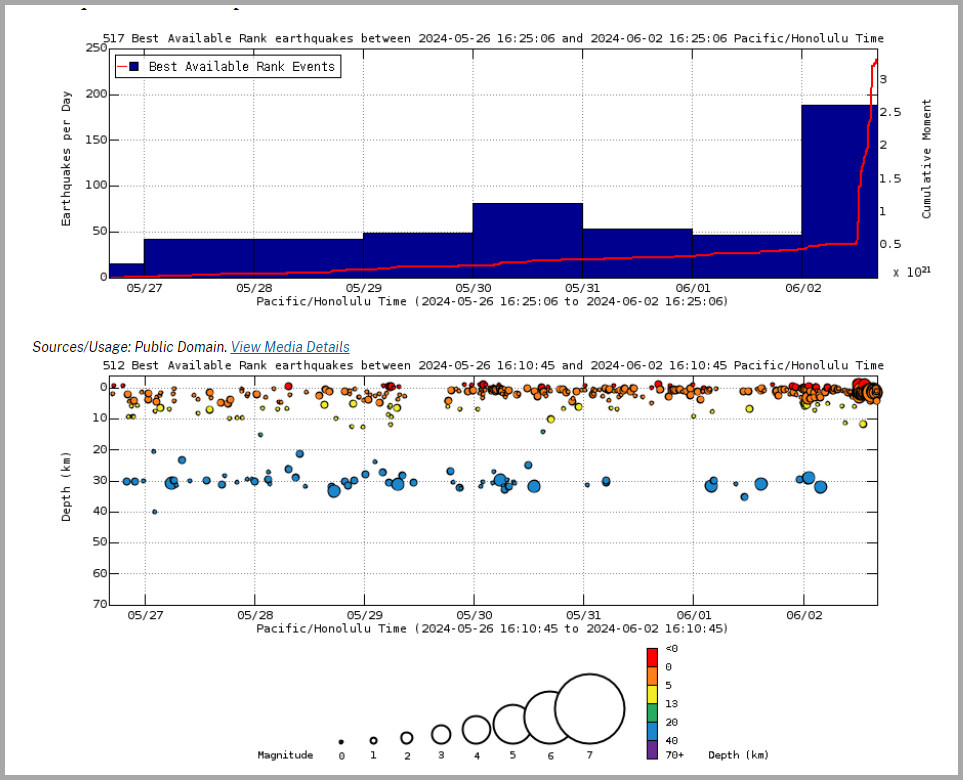
From USGS: Earthquake Rates and Depths on Sunday afternoon. Above Top: Number of earthquakes per day during the past week (blue bars). The red line is the cumulative moment (energy) release. Bottom: Depth of earthquakes during the past week in the area shown on the map above. Depth is reported relative to sea level, which is equal to a depth of zero on the above plot. On both figures, circle-size represents magnitude, and color indicates depth.
Kīlauea has been in a state of heightened seismic unrest beneath the summit over the past several days. The USGS HVO says magma has been pressurizing the system beneath Halemaʻumaʻu and the south caldera region, activating seismicity in the upper East Rift Zone, and in the caldera south of Halemaʻumaʻu.
Before Sunday’s earthquake swarm began, scientists warned that changes in the character and location of volcanic unrest can occur quickly, as can the potential for an eruption.
As of early Sunday evening, no closures have been announced within Hawaiʻi Volcanoes National Park due to the increase in seismic unrest.
The Hawaiian Volcano Observatory said it will continue to monitor Kīlauea for any changes and will issue additional notices as needed.

by Big Island Video News
on at
STORY SUMMARY
HAWAIʻI VOLCANOES NATIONAL PARK - There was a sharp increase in earthquake activity beneath the south part of Kīlauea’s summit caldera at noon on Sunday.