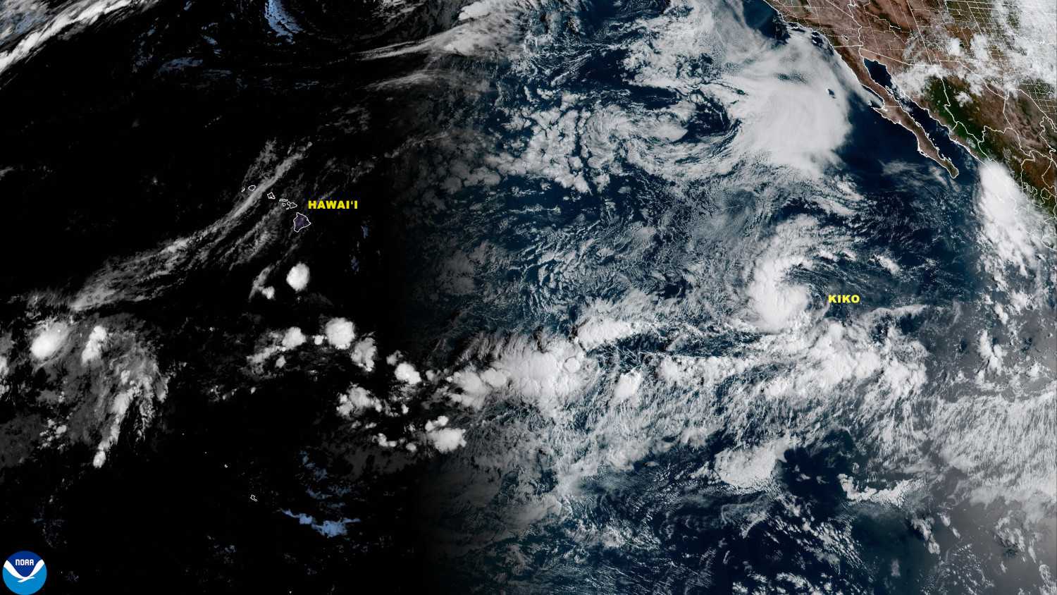
(BIVN) – A new tropical storm has formed in the Eastern Pacific, and forecasters expect it will strengthen into a hurricane as it moves west.
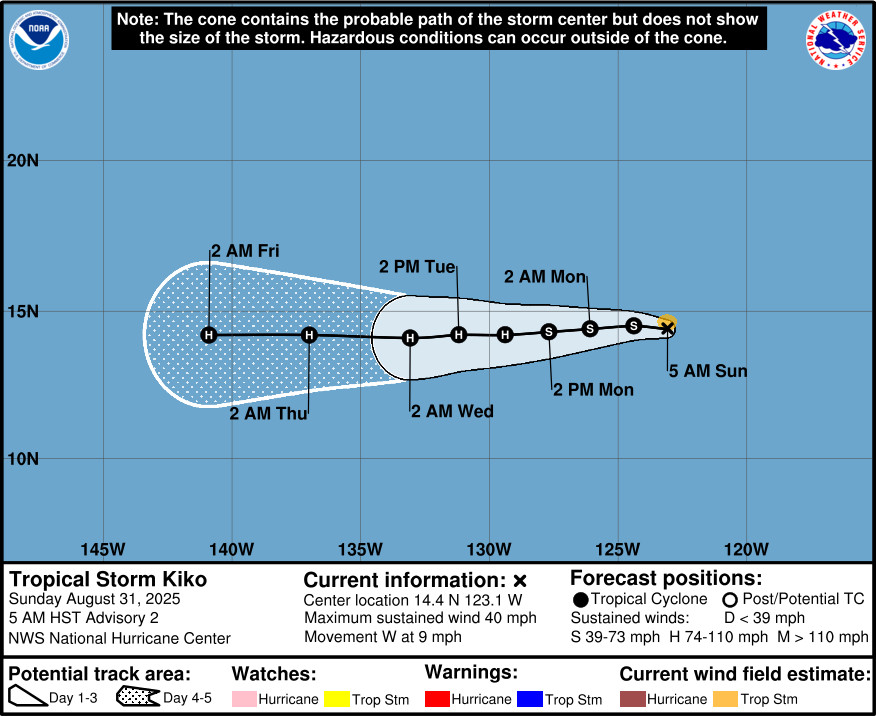
Tropical Storm Kiko is currently 1045 miles west-southwest of the southern tip of Baja California, moving west at 9 mph. Maximum sustained winds are near 40 mph (65 km/h) with higher gusts.
The National Hurricane Center forecasts Kiko to become a hurricane by Tuesday.
From a National Hurricane Center discussion posted Sunday morning:
Satellite imagery and a recent AMSR2 pass show a curved band wrapping around the western semicircle of the cyclone, along with a burst of deep convection developing over the center where cloud tops are near -80 C. The convective banding now wraps more than halfway around the circulation, which, along with Dvorak current intensity estimates of 2.5/35 kt from TAFB and up to 3.0/45 kt from SAB, supports upgrading the system to Tropical Storm Kiko with an initial intensity of 35 kt.
Kiko is moving westward near 8 kt, or 270/8 kt, steered by a strong subtropical ridge positioned to its north. This ridge is expected to remain in place throughout the 5-day forecast period, maintaining a general westward motion across the eastern Pacific and into the central Pacific basin by late this week. The official track forecast is nearly identical to the previous forecast and remains close to the consensus aids.
Environmental conditions of warm sea surface temperatures, moist mid-level air, and low vertical wind shear favor steady strengthening during the next couple of days. Kiko is forecast to reach hurricane intensity by around 48 hours (Tuesday). Thereafter, the cyclone’s track near the 26 C isotherm, along with the potential entrainment of mid-level dry air, could limit any additional significant intensification. Also, any deviation of the track slightly to the right of the forecast path could place the system over cooler waters and further inhibit strengthening. The intensity forecast is near the middle to higher end of the guidance envelope through midweek, then trends closer to the consensus thereafter.


by Big Island Video News8:45 am
on at
STORY SUMMARY
HONOLULU, Hawaiʻi - Kiko is forecast to become a hurricane by Tuesday as the storm moves west towards the Central Pacific.