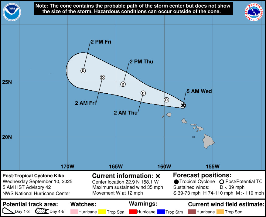
(BIVN) – The former Tropical Storm Kiko has become a remnant low, 110 miles north of Oʻahu.
There are currently no watches or warnings in effect for Hawaiʻi island, although forecasters say a wet day could be ahead.
From the National Weather Service in Honolulu:
An outer band that is currently coming across the eastern end of the state is increasing shower coverage across windward Big island and Maui during the pre-dawn hours. So, while Kiko will have no direct impacts to the islands, the indirect impacts will come from stationary cells within this favorable veered east-southeast flow that could easily produce a quick inch or two of rain within a hour. Higher resolution modeling solutions are not focusing the highest precipitation on any particular area, but they are suggesting that convection could anchor along Oahu’s Koolaus and Big Island’s windward Hilo, Puna and Ka’u regions. Thus, while we are currently holding off on a statewide Flood Watch, the radar will need to be closely monitored today in the event that isolated areas do receive a quick 2 to 4 inches, initiating downstream flooding issues.
As a part of its final public advisory concerning Kiko, the NWS Central Pacific Hurricane Center wrote:
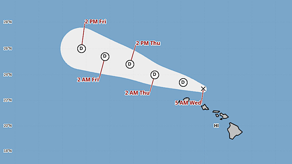
Kiko has not produced any deep convection for the past 12 hours. Global models show that the circulation will likely not form organized deep convection in the future, likely due to a dry environment and strong vertical wind shear. Kiko is now being designated as a post-tropical remnant low, and this will be the last advisory on the system. The cyclone has continued to weaken since the previous advisory so the initial intensity is lowered to 30 kt.
The shallow vortex is moving westward at 10 kt. A turn to the west-northwestward should occur soon and this general motion is forecast to continue for the next couple of days until Kiko opens into a trough and dissipates.

by Big Island Video News
on at
STORY SUMMARY
HAWAIʻI - The former hurricane continues to move off to the west, dragging a band of moisture that will bring needed rain to the islands.