UPDATE – (Saturday, October 25) – The Red Flag Warning for Hawaiʻi island has been cancelled.
The Winter Weather Advisory remains in place for the summits of Maunakea and Mauna Loa.
The Hawaiʻi County Civil Defense says the windward districts of North Kohala, Hāmākua, Hilo, Puna and island interiors could experience thunderstorms today. “Be aware for flooding and lightning in these areas,” emergency officials warned.
FIRST REPORT
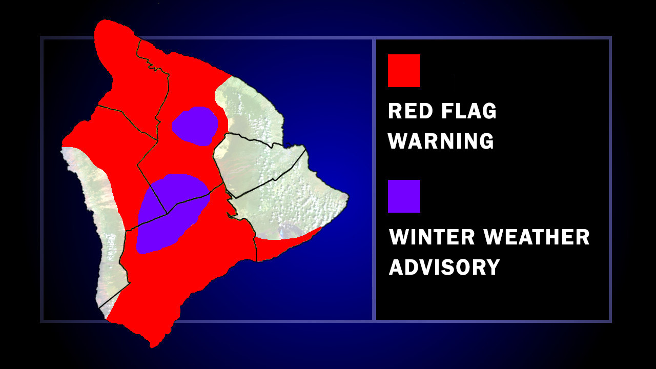
(BIVN) – The Red Flag Warning continues for parts of Hawaiʻi island, and a Winter Weather Advisory is in place for Big Island summits.
The National Weather Service says “dry and windy conditions will persist tonight and into Saturday for at least portions of the state as high pressure moves east and strengthens north of the islands.”
With relative humidity as low as 40% percent, and east winds at 20 to 35 mph, any fires that develop will likely spread rapidly.
Hawaiʻi County Mayor Kimo Alameda signed an Emergency Proclamation on Thursday, banning outdoor burning and open flames in the districts of Hāmākua, North Hilo, North and South Kohala, North Kona, Kaʻū and Puna. Hawaiian Electric says it is monitoring weather conditions, and may implement its Public Safety Power Shutoff program to proactively shut off power in communities with high exposure to wildfire risk.
The Red Flag Warning is expected to persist through 6 p.m. HST Saturday.
Meanwhile, 3 to 5 inches of snow will be possible at the summits of Maunakea and Mauna Loa, where a Winter Weather Advisory has been issued. The National Weather Service says an upper level low will move over the Big Island tonight and will be located just west of the state Saturday. An increase in moisture over the eastern end of the state could bring ice, snow, and freezing rain to the higher elevations.
“Travel could be very difficult,” forecasters warned. “Blowing snow will significantly reduce visibility at times, with periods of zero visibility.”
The Winter Weather Advisory will be in place from Friday evening to 6 a.m. HST Sunday.

by Big Island Video News
on at
STORY SUMMARY
ISLAND OF HAWAIʻI - Fire weather concerns will persist through 6 p.m. HST Saturday, while Maunakea and Mauna Loa could see snow accumulations of 3 to 5 inches.