
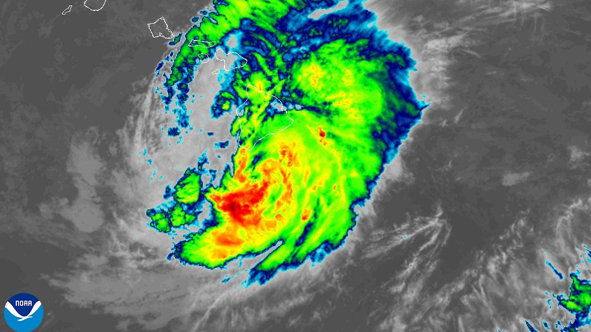

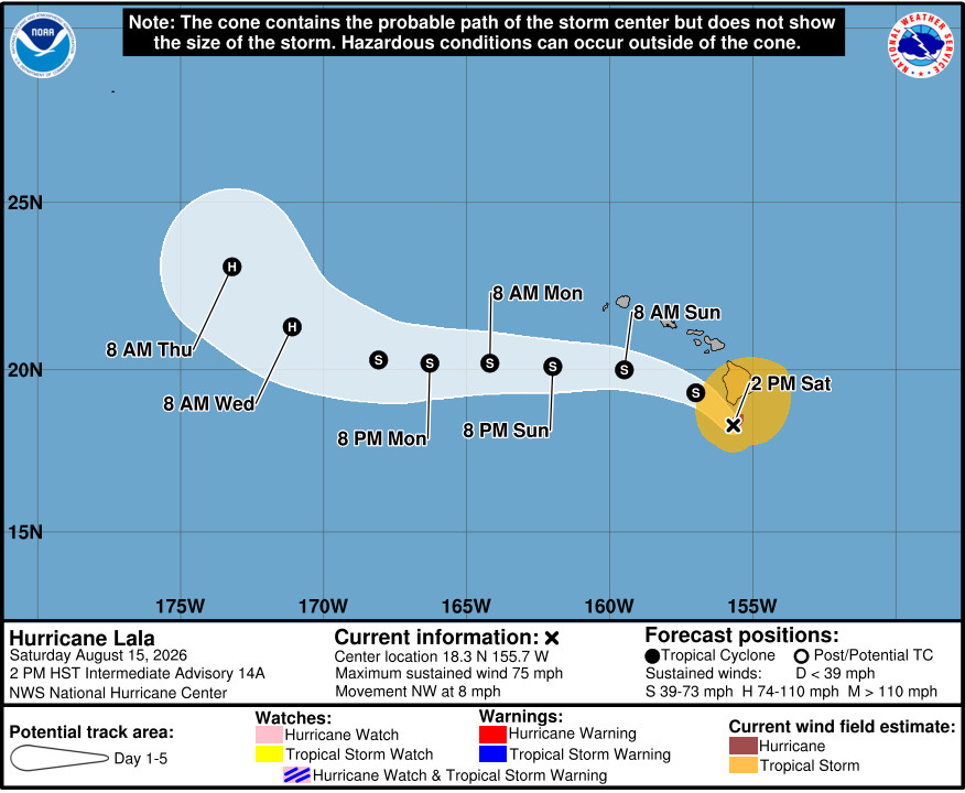
(BIVN) – As of 2 p.m. Saturday afternoon, Hurricane Lala was located 50 miles south of South Point on Hawaiʻi island, and moving northwest at 8 mph.
Lala’s maximum sustained winds are near 75 mph (120 km/h) with higher gusts. A Hurricane Warning remains in effect for Hawaiʻi island.
As of 11 a.m., about 18,700 Hawaiian Electric customers were without power in North and South Hilo, North and South Kohala, Hāmākua and Puna. “On the Hāmākua coast, crews are assessing a 42-mile span of transmission lines after fallen trees knocked down multiple poles and structures,” the company reported. Since that time, the number of outages has likely increased.
A Flash Flood Warning remains in place for East Hawaiʻi. “Throughout the hurricane, windward areas could see rain accumulations of as much as 15-20 inches, with the possibility of some isolated areas exceeding 30 inches,” the County of Hawaiʻi reported.
Wind gusts near 80 mph have been reported in South Kohala.
“We are receiving reports of downed trees and road closures across the island, and hazardous weather conditions will continue to intensify today,” said Mayor Kimo Alameda. “While road crews are working hard to clear debris as conditions allow, we need all residents and visitors to heed all warnings, move into safe shelter, and stay off the roadways. For your safety, and the safety of our first responders, we urge our community to continue to hunker down until this hurricane passes.”
Road Closures (as of 12:30 p.m. Saturday, Aug. 15)
- Highway 250: both lanes closed between mile markers 1 and 19.
- Highway 19: both lanes closed at mile marker 53.7.
- Highway 11: both lanes closed between mile markers 57 and 62.
- Highway 11: both lanes closed between mile markers 66 and 68.
- North Kulani Road.
- Government Beach Road from Hawaiians Shores to Waa Waa Road (residents only).
- Haao Springs Road.
- Kaʻalaiki Road (Cane Haul Road).
- East Kawailani Street between Hoonani Place and Kamalii Street.
- Mud Lane.
- Puako Beach Drive.
