

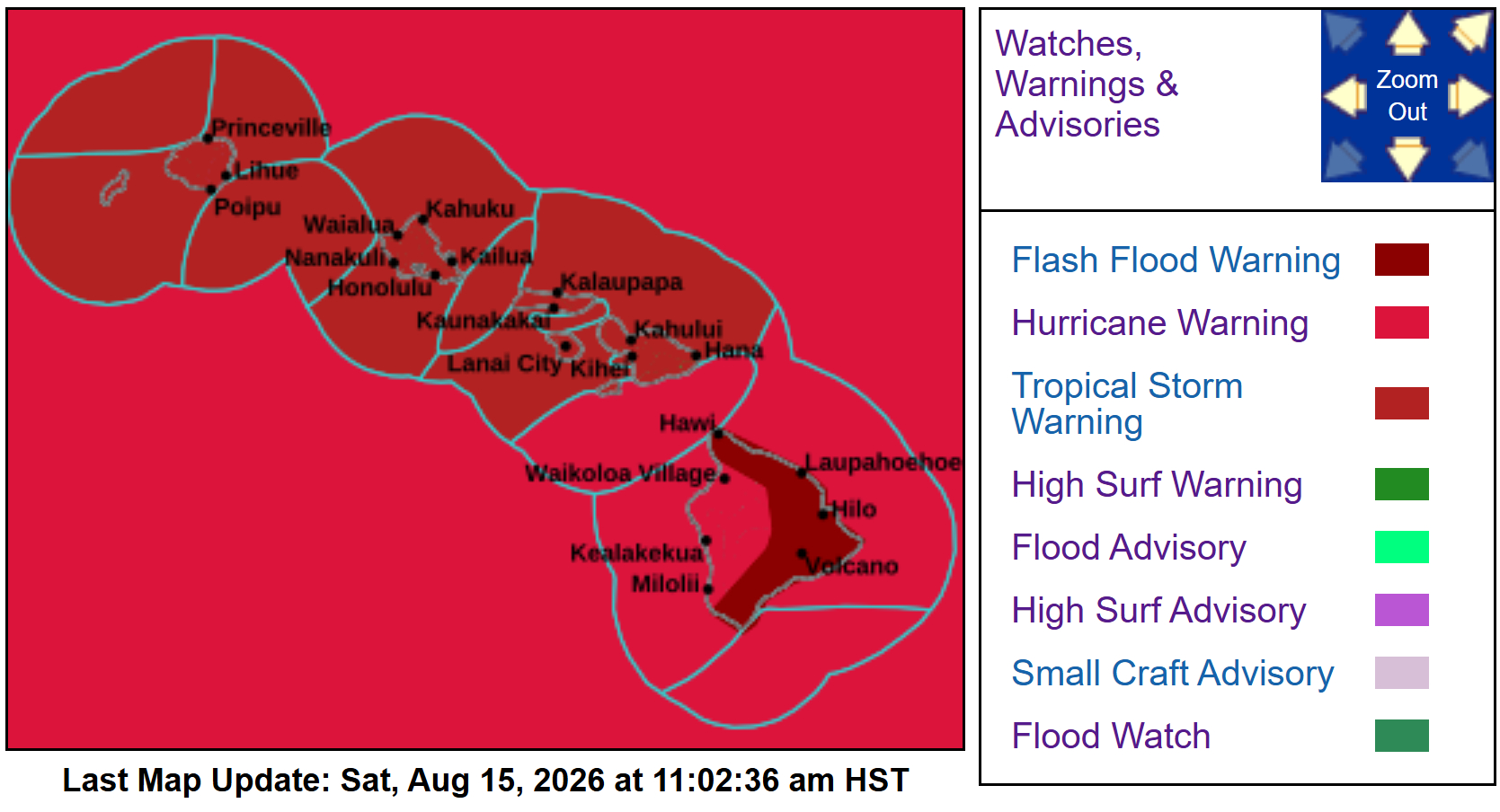
(BIVN) – Hurricane Lala, with maximum sustained winds of 75 mph, continues to impact Hawaiʻi island. Winds are increasing on the Big Island, and a Flash Flood Warning is now in effect for East Hawaiʻi as heavy rain drenches the windward side.
Heavy rain bands from Hurricane Lala are moving onshore across windward and southeast Big Island. “Additional heavy rain bands are anticipated over the next few hours, especially across the Kaʻū and Puna Districts,” the National Weather Service stated. “Radar estimates that rain is falling at a rate of 1 to 2.5 inches per hour. Flash flooding is ongoing or expected to begin shortly.”
Multiple roadways are closed due to landslides, downed trees, and utility lines, the Hawaiʻi County Civil Defense reports. “Due to these conditions, The Mayor’s Office and Civil Defense ask that you continue to shelter-in-place and stay off the roads until the hurricane passes,” an emergency message stated.
Effective immediately and until further notice, the Department of Water Supply is requesting customers to limit water use to essential needs only, as power island-wide power outages are impacting water availability.
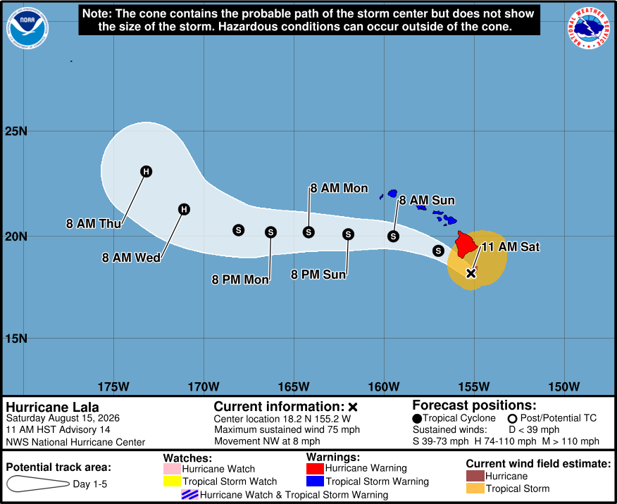
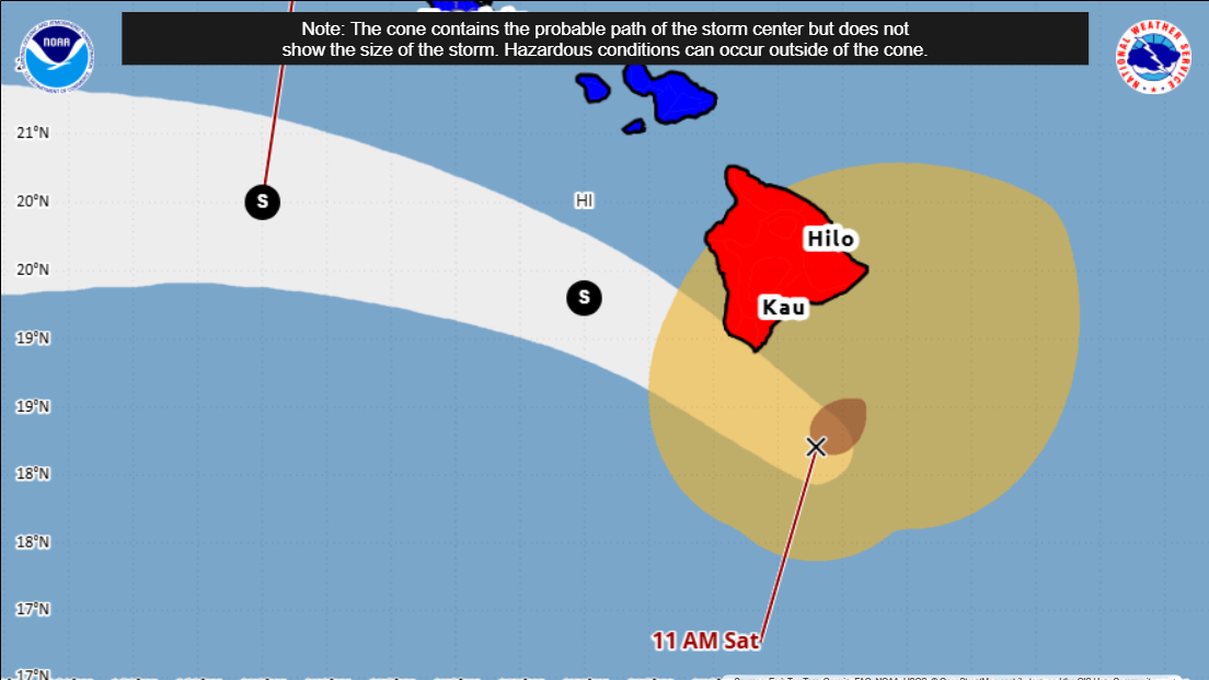
As of 11 a.m., Hurricane Lala was located 65 miles south southeast of South Point. Lala is moving slowly northwest at 8 mph. The speed and direction of the hurricane are being influenced by the storm’s interaction with Hawaiʻi island. Forecasters were anticipating this erratic motion, which was detailed in a 11 a.m. discussion posted by the Central Pacific Hurricane Center:
Lala’s radar and satellite presentation has improved since earlier this morning, including a ragged eye appearing in visible and infrared satellite images. The Dvorak intensity estimate from WFO Honolulu increased to T4.0/65 kt at 1800 UTC, and radar data from the South Point, Hawaii, site have been showing patches of winds around 70 kt at 8,000 to 10,000 ft to the northeast of the center. Based on this data, Lala was upgraded to a hurricane on the 9 AM HST (1900 UTC) Tropical Cyclone Update, and the initial intensity is still estimated to be 65 kt.
Recent radar fixes of Lala’s center suggest the hurricane is feeling the influence of the Big Island of Hawaii, and it’s now moving more slowly toward the northwest (305/7 kt). Dynamical model fields continue to show the center getting pulled northwestward into or near the Big Island later this afternoon while at the same time a lee-side trough or broad low forms west of the island. This will likely cause a discontinuous track that is not reflected in the official forecast points or track forecast cone. This also makes it unclear if Lala will actually make a landfall on the Big Island. Whatever is left of the cyclone after interacting with the Big Island is expected to turn westward on Sunday and continue on that track through Tuesday. A shortwave trough moving across the northern Pacific around the middle of next week may weaken the ridge enough to allow Lala to turn toward the west-northwest and then northwest, potentially approaching western portions of the Northwestern Hawaiian Islands, but there is quite a bit of track guidance spread around day 5.
Lala could strengthen a little more over the next few hours before the circulation becomes disrupted by the Big Island. The interaction is expected to cause the cyclone to weaken significantly, and the NHC intensity forecast has been lowered a bit while Lala moves south of the remainder of the main Hawaiian Islands. Some re-strengthening could occur after 48 hours, and the NHC forecast is closest to the Google DeepMind ensemble mean.
NHC will continue to issue hourly position updates via the Tropical Cyclone Update product (HFOTCUCP2) as long as the eye remains well defined in radar imagery.
Key Messages:
1. Damaging hurricane-force winds are expected on the Big Island of Hawaii today, with the strongest wind gusts expected in areas of higher terrain. Residents are urged to stay in their shelter through tonight. Tropical-storm-force wind gusts are also spreading across portions of the smaller islands and should continue through Sunday.
2. Heavy rainfall will continue to overspread the Big Island this afternoon and then spread westward across the remainder of the island chain tonight and Sunday. This rainfall will produce life-threatening flooding and mudslides, especially in areas of steep terrain.
3. Large and dangerous waves are expected across portions of the Hawaiian Islands this weekend. Surf is building along east-facing shores and will increase along exposed southern shores as Lala passes through the region. This heavy surf may cause localized coastal flooding and significant beach erosion.
