
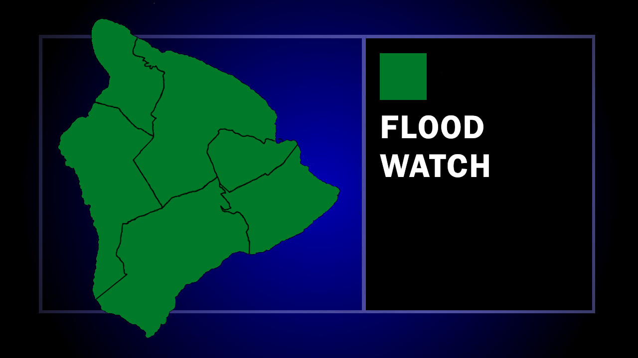

(BIVN) – A Flood Watch has been issued for Hawaiʻi island, and will be in effect from late Saturday night through Monday afternoon, as a potential tropical storm is expected to track south of the Big Island.
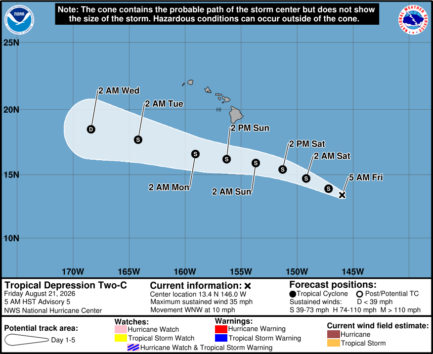
As of 5 a.m. HST, Tropical Depression Two-C was located 745 miles southeast of Hilo, and moving west-northwest at 10 mph. The system is expected to gradually strengthen and become a tropical storm later today.
“Tropical Depression Two-C is forecast to bring periods of heavy rain to the Big Island from late Saturday night through Monday afternoon,” the National Weather Service stated in its Flood Watch message. “Rainfall totals of 5 to 10 inches, locally up to 15 inches, are possible on windward and southeast Big Island. It will not take a significant amount of rain to cause flash flooding due to saturated grounds from recent heavy rains.”
In a Thursday evening radio message, the Hawaiʻi County Civil Defense said that due to the threat:
- Hawaii Island residents and businesses, please prepare for Damaging Winds, Flooding Rains, High Surf, possible worsening of power outages, loss of communications, and road closures.
- Please take this time to review your emergency plan, make sure you prepare adequate food, water, medication, fuel, have flashlights with working batteries and emergency contact information.
- Please identify outdoor items that could become airborne or pose a threat to your property – and take action.
- If your area is prone to flooding or you consider your location unsafe, please make sure to have an evacuation plan.
- If you have storm-related needs, please go online and fill out a Request for Assistance at VibrantHawaii.org or call Civil Defense at (808) 935-0031.
- To stay informed of Civil Defense alerts, please text HawaiiAlerts at 888777.
From the Central Pacific Hurricane Center discussion at 5 a.m. HST:
Satellite and microwave imagery depicts deeper convective bands associated Two-C north of the center. The latest subjective intensity estimates from HFO and JTWC are T2.0/30 kt and T1.5/25 kt, which correlates well with the objective intensity estimates from UW-CIMSS, supporting around 30 kt intensities as well. Based on these estimates, the initial intensity is held at 30 kt. Later today, NOAA and Air Force reconnaissance aircraft are scheduled to investigate Two-C.
The depression is maintaining a west-northwestward track of 295/9 kt, and that is expected to persist as the cyclone progresses south of the Hawaiian Islands. The latest model guidance showcases a more westward track through the weekend as broad ridging builds in the Central Pacific just north of the Hawaiian Islands. The latest NHC track forecast is largely just an update of the previous one, and a blend of the consensus models and the guidance of the Google DeepMind ensemble mean.
The latest model and satellite trends suggest Two-C will likely strengthen over the next 48 h, as environmental conditions remain generally favorable. While the cyclone will experience light, southwesterly shear during the early portion of its life cycle, significantly warmer SSTs and a relatively moist atmosphere will help counter any negative shear effects. However, multi-model intensity consensus and SHIPS intensity guidance portray gradual weakening thereafter as the cyclone should succumb to increasing vertical wind shear and drier relative humidity values.
Key Messages:
1. Heavy rainfall associated with the system will begin to impact the Big Island of Hawaii late Saturday night, with rain spreading westward across the remainder of the Hawaiian Islands Sunday into Monday. This rainfall may produce life-threatening flooding and mudslides for the windward and southeast Big Island, especially in steep terrain and over areas that were affected recently by Lala.
2. Although the strongest winds associated with the system are expected to pass south of the Hawaiian Islands, strong gusty winds are likely, particularly in areas within and downslope of higher terrain on the Big Island.
3. Swells generated by the system may cause life-threatening surf and rip current conditions this weekend and early next week for portions of the Hawaiian Islands.
