
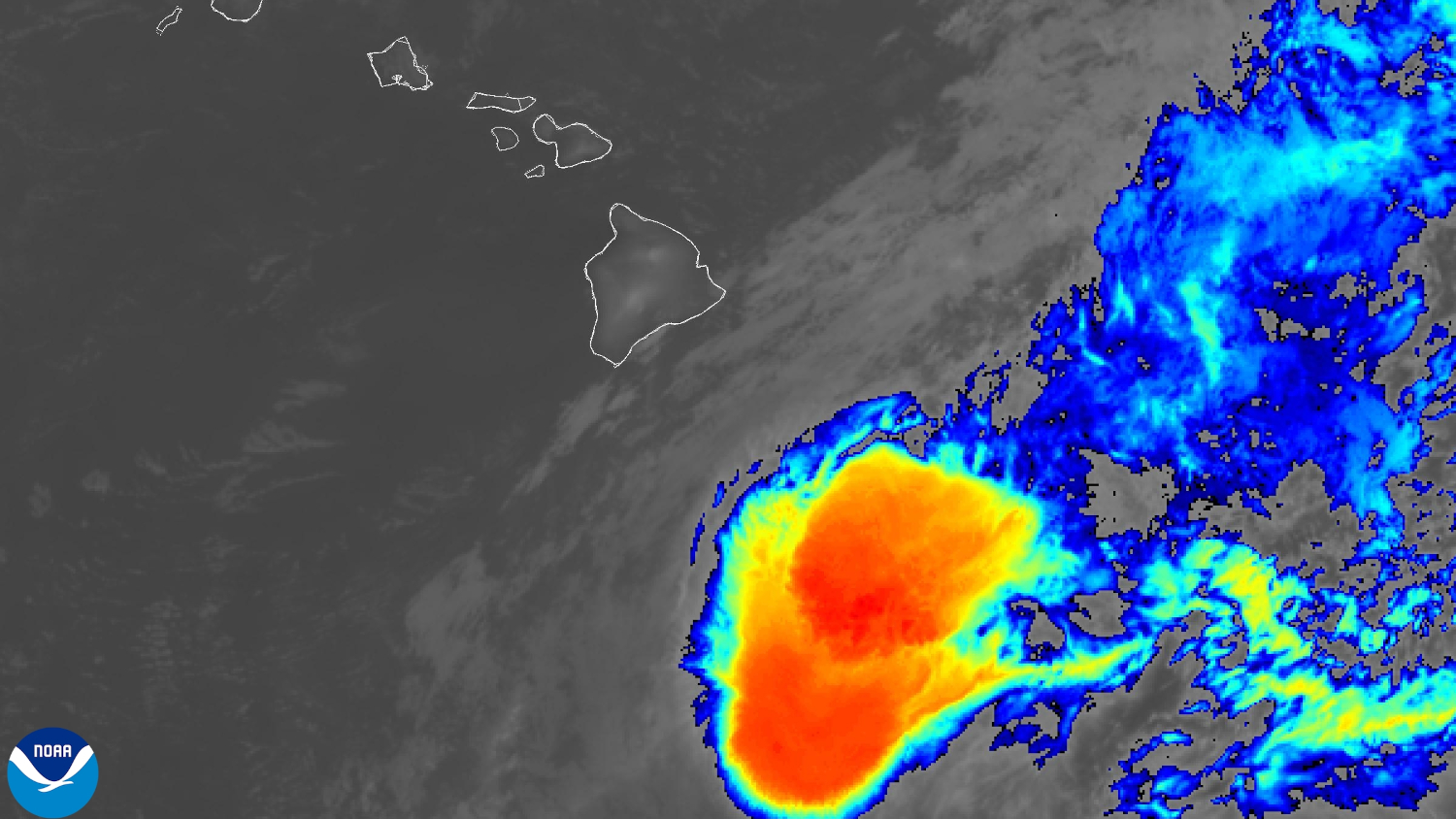

(BIVN) – As of Saturday night at 11 p.m., Tropical Storm Moke was 330 miles south-southeast of Hilo, moving west at 12 mph.
The Central Pacific Hurricane Center says Moke is holding steady this evening, with maximum sustained winds maintained at 45 mph with higher gusts. Tropical-storm-force winds extend outward up to 115 miles from the center of the storm.
Little change in strength is expected overnight, forecasters say, but a gradual weakening trend is forecast to begin on Sunday, as Moke passes south of Hawaiʻi island.
A Flood Watch is in effect for the entire island of Hawaiʻi, and a Wind Advisory has been issued for several areas. From the National Weather Service in Honolulu:
Trade winds have increased to moderate to locally strong this evening, and will continue to edge higher tonight into Sunday as Moke passes south of the state. The Wind Advisory looks on track for select wind prone zones in Maui County and the Big Island. Winds in these zones have been averaging sustained 25 to 30 mph with gusts 40 to 50 mph. A deeper push of moisture is still expected to reach eastern portions of the Big Island later tonight with shower coverage on the increase. Expect some heavier activity to become embedded in the showers, especially on Sunday. The Flood Watch for the Big Island looks to be in good shape, beginning later tonight and continuing through Monday afternoon. It will not take a significant amount of rain to cause flash flooding due to saturated grounds from recent heavy rain. The deeper push of moisture will then push across the remaining smaller islands midday Sunday into Monday, but with less intense rainfall than expected on the windward and southeastern sides of the Big Island.
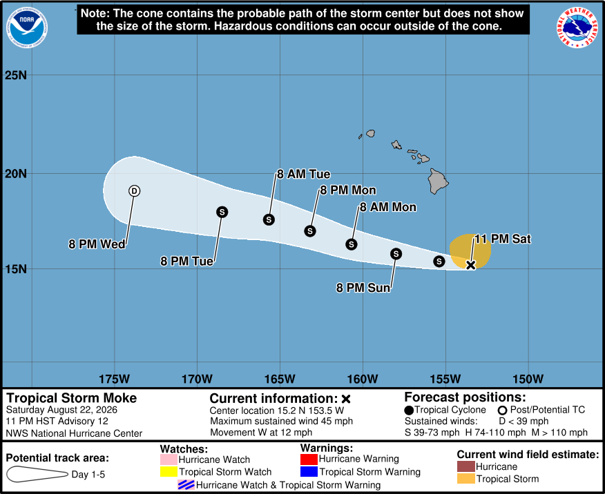
From the Central Pacific Hurricane Center discussion at 11 p.m. HST:
Moke’s overall organization has changed little during the past several hours. Persistent southwesterly vertical wind shear and dry mid-level air have eroded much of the convection that was present earlier, leaving the low-level circulation exposed. Convective coverage remains limited, aside from occasional bursts of deep convection near and north of the center. Recent satellite-derived wind data showed peak winds of around 40 kt north of the circulation, while recent Air Force Reserve Hurricane Hunter aircraft data measured peak 850-mb flight-level winds of 46 kt in the northeastern quadrant. These data, along with the overall satellite presentation, support maintaining the initial intensity at 40 kt for this advisory.
Moke continues to move west-northwestward, with an initial motion of 280/10 kt. A general west-northwestward motion is expected to continue during the next several days as a strong low- to mid-level ridge remains to the north of the cyclone. This track should bring the center of Moke a couple of hundred miles south of the Big Island on Sunday and then well south of the smaller main Hawaiian Islands thereafter. The track guidance remains in good agreement, and the NHC forecast is very similar to the previous forecast. Despite the center of Moke remaining south of the Hawaiian Islands, the cyclone is expected to pass close enough to produce a period of gusty winds and heavy rainfall across portions of the islands during the next couple of days.
Moke has likely peaked in intensity over the past 24 h. Although vertical wind shear is forecast to decrease somewhat during the next day, an increasingly dry and stable surrounding environment should limit any chances for additional strengthening and likely cause Moke to begin a steady weakening trend on Sunday. Thereafter, increasing vertical wind shear and continued entrainment of dry air should cause Moke to weaken further through early next week. By around 96 h, both the GFS and ECMWF depict Moke becoming largely devoid of deep convection, and the cyclone could degenerate into a remnant low by Wednesday, then dissipate by day 5. The latest NHC intensity forecast is similar to the previous advisory and lies near the middle of the guidance envelope.
Key Messages:
1. Heavy rainfall associated with Tropical Storm Moke will begin to impact the Big Island of Hawaii early Sunday morning. Rain will then spread westward across the remainder of the Hawaiian Islands through Monday. This rainfall may produce life-threatening flooding and mudslides for the windward and southeast Big Island, especially in steep terrain and over areas that were affected recently by Lala.
2. Although the strongest winds associated with Moke are expected to pass south of the Hawaiian Islands, strong gusty winds are likely, particularly in areas within and downslope of higher terrain.
