

(BIVN) – Kīlauea summit seismicity increased on Wednesday, and shallow ground deformation within Halemaʻumaʻu hint at a possible change in eruptive behavior.
According to the USGS Hawaiian Volcano Observatory, tremor began increasing around noon on Wednesday, September 30th. A swarm of small earthquakes occurred beneath the existing vent area between 2 p.m. and 3 p.m.
Summit tilt accelerated around 2:30 p.m. with inflation centered near the vents. The vents have been active with intermittent, low-level lava activity over the past few days.
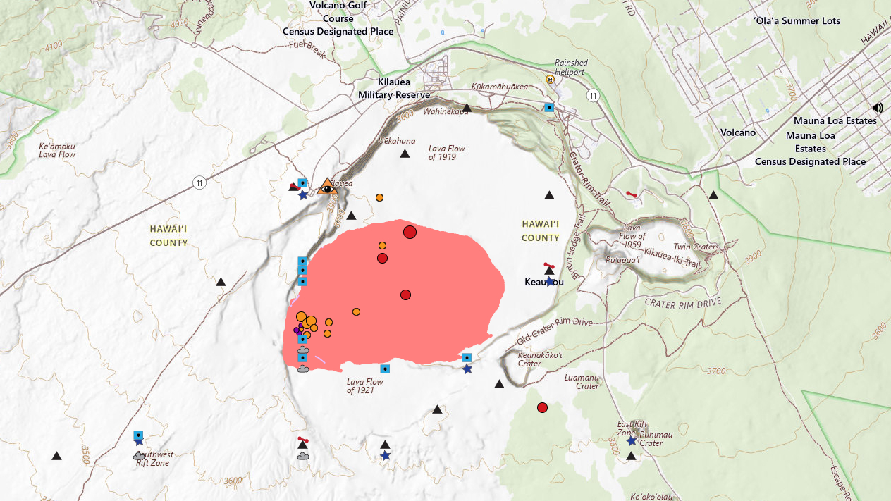
On Wednesday evening, a “marked increase in shallow deformation and seismicity” was reported in the same vent region. One earthquake was measured at a magnitude 3.4. According to USGS maps, the earthquake was located on the north side of Halemaʻumaʻu crater, away from the existing vents.
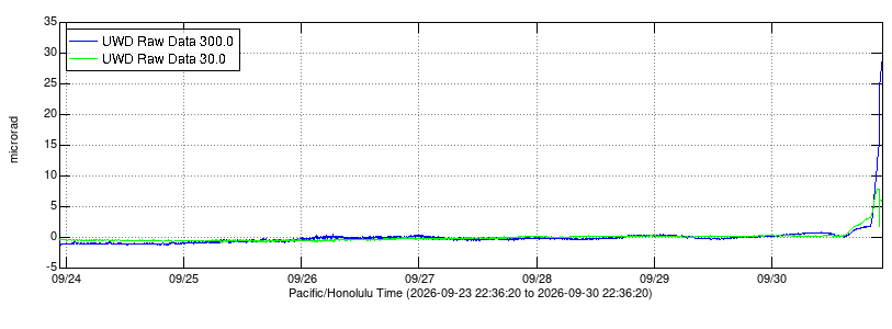
“Patterns of inflation and earthquakes suggest that a shallow east-west dike is being emplaced in this area,” the Observatory stated.
The USGS Volcano Alert Level for Kīlauea remains at WATCH and the Aviation Color Code is ORANGE.
The USGS HVO issued this status report just before 11:30 p.m. Wednesday night:
Summary: A shallow intrusion of magma is occurring within the summit region near the existing eruption location in Hawai’i Volcanoes National Park.
Activity Summary: Earthquake activity has increased in the summit region of Kīlauea beneath Halemaʻumaʻu crater and the south caldera region. Ground deformation patterns recorded by summit tiltmeters suggest that magma is intruding beneath the ground in this area, in an east-west orientation, near the western or southern part of Halemaʻumaʻu crater.
Increased earthquake activity began this afternoon, September 30, 2026, at approximately 2 p.m. HST, underneath Halemaʻumaʻu. Since then, about 40 earthquakes have been detected and activity is still on-going. The largest event, so far, a magnitude 3.4 earthquake, occurred at 9:52 p.m. HST, 1.4 km (0.9 miles) beneath the surface in the northeast part of Halemaʻumaʻu. Starting around 8 p.m. HST., summit tiltmeters began to show extremely rapid changes consistent with crack growth in an east-west orientation possible near the current vent area, suggesting that magma is intruding in this region.
Historically, east-west trending fissures have erupted in the southeastern part of Halemaʻumaʻu and extending through the Keanakākoʻi crater area all the way to Chain of Craters Road near Lua Manu. The last east-west fissure in this area erupted in September 2023 and extended from the middle of Halemaʻumaʻu to the eastern wall just beneath the Keanakākoʻi overlook. An event of this type is also possible under current conditions.
Currently, there are no signs of a change at the surface as the existing eruptive vent complex in Halemaʻumaʻu, including the north and south vents, continue to intermittently spatter with strong glow and flames; however, conditions could change quickly. It is possible that this event ends without reaching the surface or it produces a fissure eruption in a new location within the summit caldera region.
Current activity is restricted to the summit region of Kīlauea. No anomalous activity has been detected in the East Rift Zone or Southwest Rift Zone.
The USGS Hawaiian Volcano Observatory is monitoring the situation closely and will issue additional messages as needed.
Kīlauea Volcano Alert Level/Aviation Color Code remains at WATCH/ORANGE. HVO is continuing to closely monitor Kīlauea and is in contact with Hawai‘i Volcanoes National Park and the Hawai‘i County Civil Defense Agency.
