
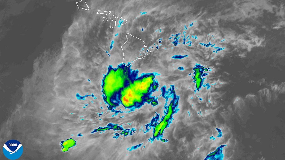

(BIVN) – Tropical Storm Moke has weakened to a tropical depression.
In an update issued at 5 p.m. on Sunday, the Central Pacific Hurricane Center reported maximum sustained winds generated by Moke are now near 35 mph. Continued weakening is forecast, and Moke is expected to degenerate to a remnant low pressure area by Tuesday.
Moke has passed Hawaiʻi island to the south. The storm is now located 335 miles to the south-southwest of Hilo, as of 5 p.m. on Sunday.
Tropical Depression Moke is still expected to produce additional rainfall totals of 3 to 6 inches across the Big Island through Monday across the Big Island.
According to the National Weather Service on Sunday afternoon:
A flood threat will continue for the Big Island through Monday, and winds will remain elevated through this evening. As Moke continues to move westward, low- to mid-level flow on the Big Island will shift out of the east to east-southeast, which could optimize orographic lift and increase rainfall on windward and southeast slopes. The guidance continues to show large variation in potential total precipitation, meaning that confidence is lower than normal, but the main window for flooding will be through early Monday morning on windward areas, with a chance for spotty afternoon showers to produce localized flooding across the Kona Districts. A Flood Watch is posted for Big Island through Monday afternoon.
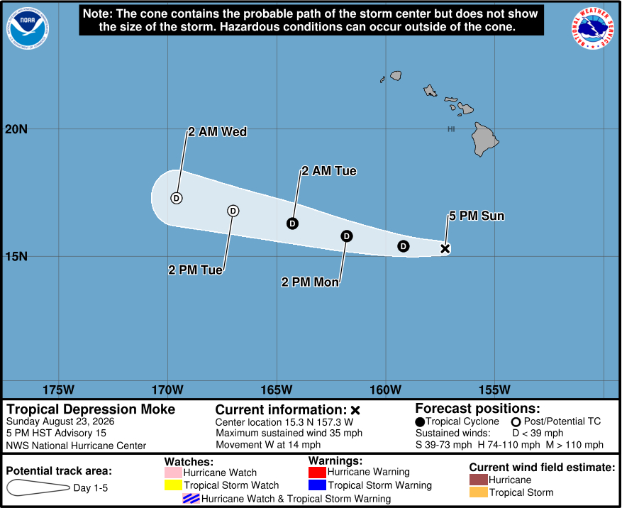
From the Central Pacific Hurricane Center at 5 p.m. HST:
Convection associated with Moke has decreased significantly during the past several hours. The cyclone is now comprised of an exposed swirl of low- to mid-level clouds, with the remaining convection now located just south of the Island of Hawaii well to the northeast of the center. Just-received OSCAT data shows maximum winds of 25 to maybe 30 kt, and based on this Moke is being downgraded to a tropical depression.
A combination of southwesterly shear and dry air entrainment should continue to inhibit Moke’s ability to develop convection. The dynamical models forecast the cyclone to keep weakening, with the system likely to degenerate to a remnant low by 48 h at the latest and to a trough by 72 h. The intensity forecast follows this, and it is possible that Moke will dissipate faster than currently forecast if significant convection does not re-develop.
The initial motion is 275/12 kt. A strong low- to mid-level ridge should steer the cyclone generally westward for the remainder of its life, keeping Moke well south of the main Hawaiian Islands. The guidance again nudged southward, and the new forecast track is a little south of the previous track. Despite this nudge and the weakening of the cyclone, Moke is still expected to pass close enough to the Hawaiian Islands to produce a period of gusty winds and heavy rainfall across portions of the islands during the next day or two.
Key Messages:
1. Rain bands associated with Tropical Depression Moke will continue over the Big Island while spreading westward across the remainder of the Hawaiian Islands through Monday. This rainfall may produce life-threatening flooding and mudslides for the windward and southeast Big Island, especially in steep terrain and over areas that were affected recently by Lala.
2. Although the strongest winds associated with Moke are expected to pass south of the Hawaiian Islands, strong gusty winds are likely, particularly in areas within and downslope of higher terrain.
