

(BIVN) – The ongoing eruption at Kīlauea is paused. From this week’s Volcano Watch article, written by USGS Hawaiian Volcano Observatory geologist Kendra J. Lynn:
In July, USGS Hawaiian Volcano Observatory (HVO) scientists visited an exposure of tephra and lava flows in the western wall of Kaluapele. The layers were exposed by the 2018 summit collapse and hold important clues to Kīlauea’s long-term eruptive history.
Because Kīlauea is so frequently active, most of the volcano is covered by young lava flows that are less than 1,000 yrs old. This means there are few samples, observations, or data for older eruptions, especially at the summit.
Yet we know that Kīlauea has been in its shield-building stage for longer than 200,000 years, so how do scientists learn about the volcano’s history? One way is to search along faults, where older rocks are exposed at the surface. But the summit region is tricky because it is constantly changing.
Sometimes Kīlauea’s dynamic nature provides us unique opportunities for geologic investigations. Over the course of a few months in the summer of 2018, part of the summit caldera collapsed as magma drained to feed an eruption on the lower East Rift Zone. Afterwards, Kaluapele had a 1640 foot (500 meter) deep collapse crater where Halema‘uma‘u was.
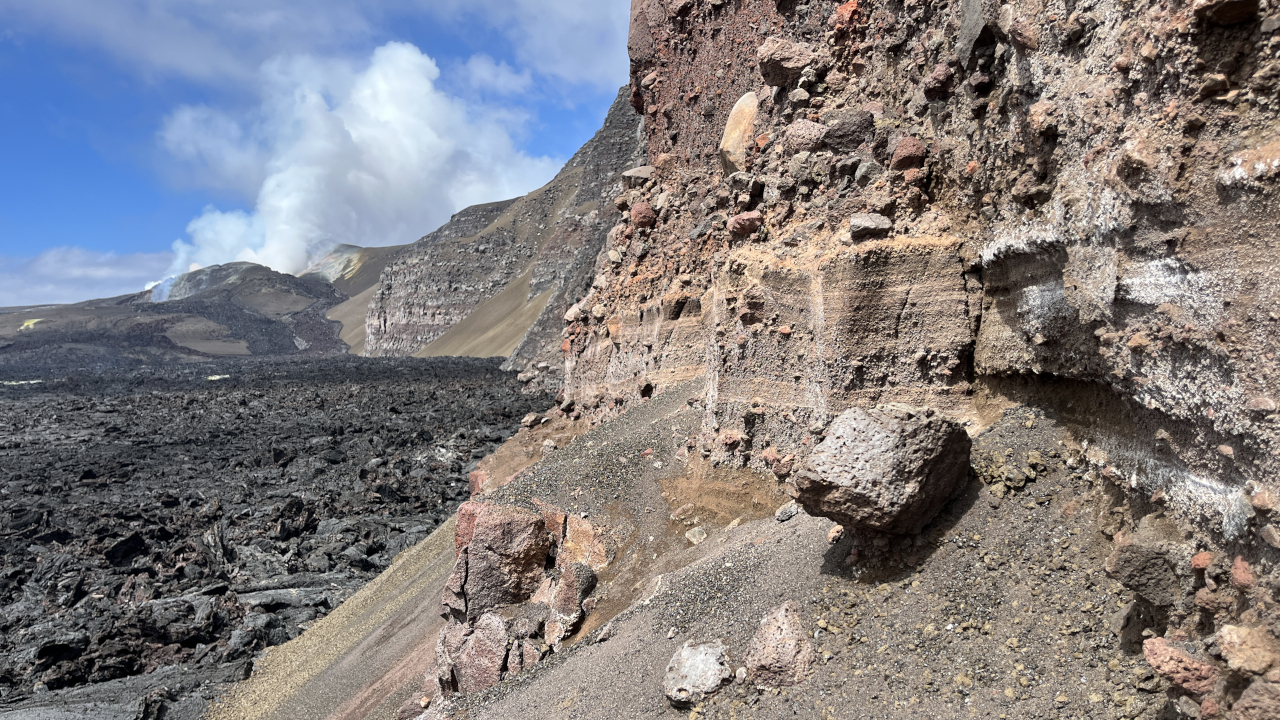
This hulihia—a dramatic change—exposed lava flows and tephra sections that had not been seen at Kīlauea since the founding of HVO in 1912. These new exposures preserved deposits from some of the oldest eruptions scientists have ever cataloged near Kīlauea’s summit.
After the 2018 collapse HVO geologists collected high resolution photographs of the west wall of Kaluapele via uncrewed aircraft systems (“drones”) and stitched together a large mosaic of the caldera cliff south of Uēkahuna (the highest point on Kīlauea). From these images, several sections of explosive tephra were identified, sandwiched among the lava flows.
Since 2023, HVO geologists have visited the newly exposed lava and tephra layers in search of new insights into Kīlauea’s evolution. Our first missions focused on the deepest tephra exposure and its surrounding lava flows, likely the oldest tephra ever studied near the summit caldera.
The deepest tephra exposure has since been re-buried by lava flows filling in the 2018 collapse. Then starting this past spring, HVO staff were carefully monitoring the rising lava in Halema‘uma‘u as it approached the second tephra section of interest.
Episodic lava fountain forecasting aided in accessing this exposure, as field work could be planned for periods between episodes to maximize safety. It was during one such pause this summer, between episodes 50 and 51, that HVO geologists returned to the crater wall to examine the tephra.
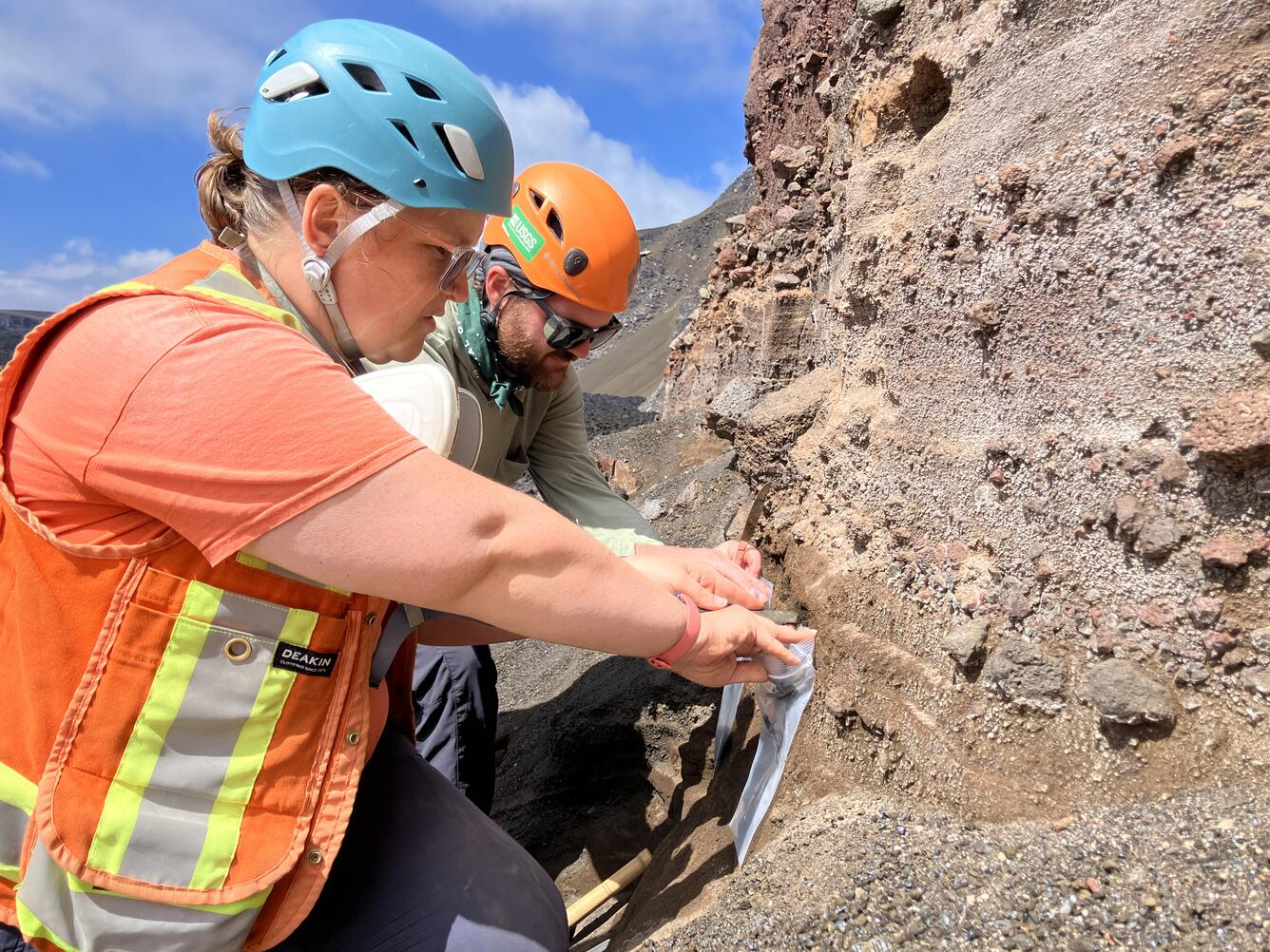
When they landed, the geologists traversed fresh lava flows over to the caldera wall where tephra from recent lava fountains had accumulated. The tephra exposure was about 20 feet (6 meters) above the caldera floor, where over a few hours the crew described and sampled the lava flows and tephra layers preserved in the crater walls.
A week later, episode 51 sent lava flows to the north along the western crater wall and raised the surface of Halema‘uma‘u to just beneath the tephra sequence. Episode 52, in late July, once again sent lava flows to the north. An overflight on July 29 after the episode confirmed that the tephra is now buried again, after being exposed for less than eight years following the 2018 eruption.
There are additional lava flow and tephra exposures that HVO scientists will visit as the floor of Halema‘uma‘u rises, if conditions allow. Each sample provides a unique glimpse of summit eruptive history that cannot be found anywhere else on the volcano.
One of the largest tephra sections identified in the new caldera walls was previously partially exposed in the early 19th century, and was last documented during a visit by Thomas Jaggar in July 1913. A few years later it was buried by the 1919 summit eruption. Re-exposed in 2018, HVO scientists wonder if it could be associated with the Uēkahuna Ash (which is 1-2 thousand years old), as it sits at a similar level in the caldera walls to other exposures further to the north in Kaluapele.
Tephra exposures HVO geologists visited in 2023 and 2026 are lower and could be much older than the Uēkahuna Ash. Therefore, they could represent eruptions never before studied. Analysis of the samples will help us determine when and how they erupted, providing insight into a murky period of Kīlauea’s eruptive history.
