
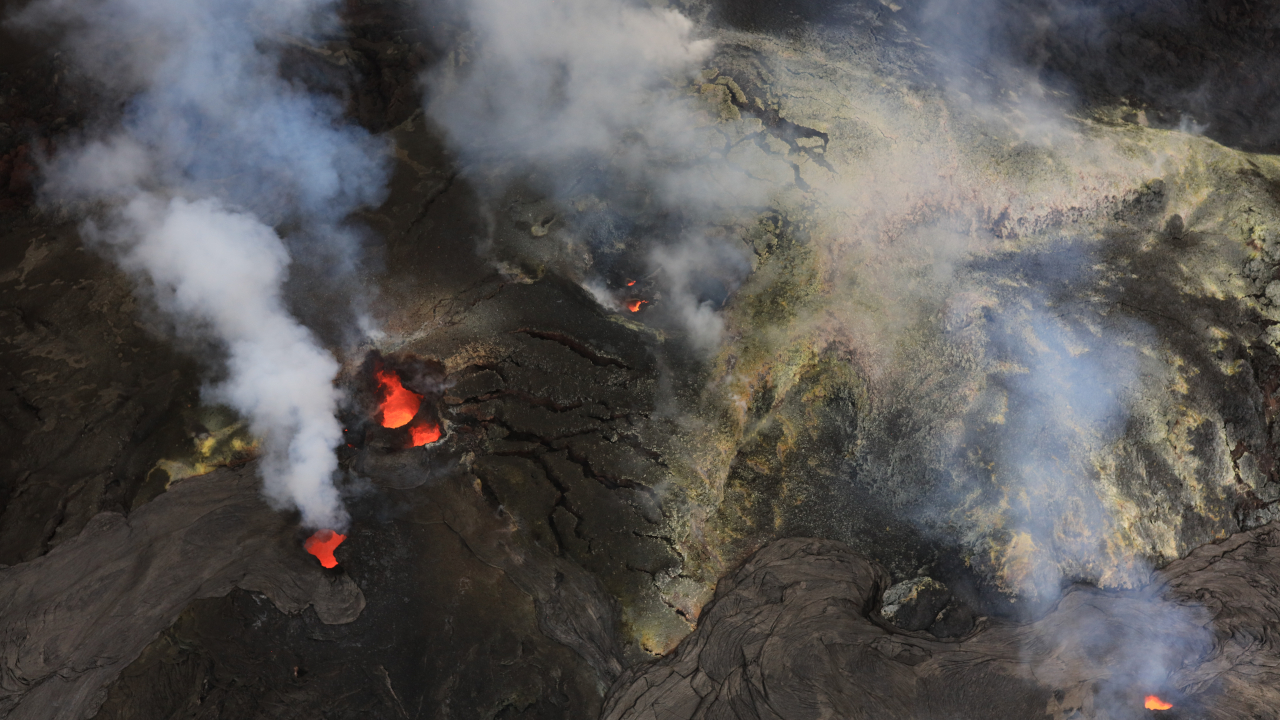

(BIVN) – Kīlauea has been relatively quiet the last day or so, following the increased seismicity and ground deformation associated with a magma intrusion in the summit area.
The September 30th event did not result in new eruptive behavior. It is the subject of this week’s Volcano Watch article, written by U.S. Geological Survey Hawaiian Volcano Observatory scientists and affiliates:
As flames, spatter, and lava flows erupted from the north and south vents in Halemaʻumaʻu at the summit of Kīlauea on the night of September 30, 2026, magma was also making a new path below the surface of the caldera. How does an intrusion happen during an ongoing eruption?
Kīlauea summit has remained at a high level of pressurization since early September. Typically, these conditions culminate in a lava fountaining episode from the north or south vents, which then depressurizes the system until fountaining stops. This cyclical process has been episodic in Halemaʻumaʻu since December 2024.
However, lava has not fountained since episode 54 ended on August 25. The current high level of pressurization has persisted since early September, accompanied by an increase in the number of small earthquakes beneath Kīlauea summit region. Six new vents on and near the northwest wall of Halemaʻumaʻu crater erupted from September 14–16, generating small lava flows on the crater floor but no high-fountaining. These new vents were not accompanied by earthquake swarms or drastic changes in ground deformation, suggesting the lava exploited existing crack systems in the caldera.
The high level of summit pressurization continued for the next two weeks with lava flows and spatter erupting intermittently from the north and south vents in Halemaʻumaʻu.
Beginning at approximately 2:00 p.m. HST on September 30, a flurry of earthquakes occurred about 1 mile (1.5 km) below the active vents of Halemaʻumaʻu. This initial swarm persisted for about six hours and produced more than 30 located events.
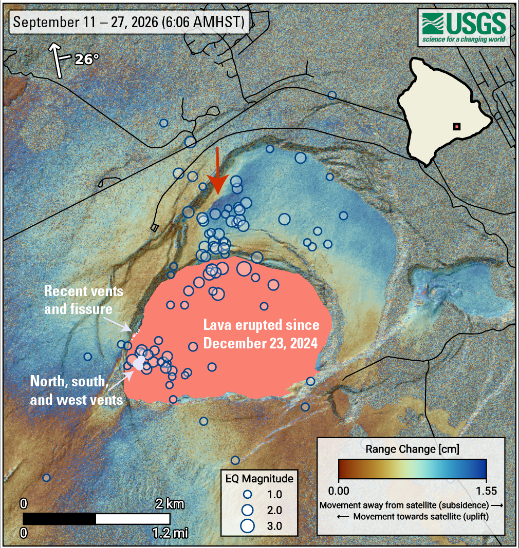
Seismic activity migrated northeast of the active vents around 8:00 p.m. HST. This phase of the activity, which continued at high rates for nearly eight hours, was centered near an area where ground changes were observed via satellite between September 11–27. The largest event, a magnitude 3.4 located about 1 mile (1.4 km) below the surface within the northern cluster, happened at 9:52 p.m. and prompted 30 submitted felt reports. In total, more than 50 earthquakes were detected in the second swarm before activity subsided around 4:00 a.m. HST on October 1, although seismic activity in the region is ongoing.
During all this shaking, a section of the summit of Kīlauea was deforming dramatically. Beginning just after 8:00 p.m. HST, tiltmeters in the summit region of Kīlauea began to show extremely rapid changes consistent with crack growth in an east-west orientation near the current vent area. Elevated rates of ground deformation continued along with the earthquakes until about 3 a.m. HST. In total, the Uēkahuna tiltmeter (UWD) recorded about 40 microradians of inflation.
Overflows from the existing vent complex in Halemaʻumaʻu stopped just prior to the onset of the intrusive activity on Wednesday afternoon. Flames and spatter continued throughout the intrusive episode. Overflows resumed once the seismicity migrated away from the current vents and continued, even after the intrusive activity slowed and stopped.
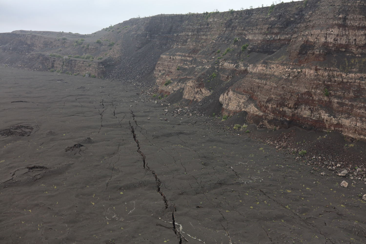
USGS Hawaiian Volcano Observatory geologists conducted a monitoring overflight mission over Kīlauea summit on the morning of October 1. Visual and thermal camera observations did not detect any anomalously hot areas or obvious new ground cracks as a result of the intrusion the night before. However, much of the caldera floor is already littered with cracks from the 2018 summit collapse and the numerous eruptions and intrusions since then. Lava was observed deep within the north vent.
What does this mean? There is still a possibility that another fountaining event could occur from the north/south vent complex in Halemaʻumaʻu. However, lava could also erupt passively from the September 30 intrusion or from other existing crack systems, as occurred between September 14–16. Alternatively, magma could intrude new areas of the summit region, as occurred the night of September 30, which may be accompanied by earthquake swarms and changes in ground deformation patterns. New intrusions could stay beneath the ground or could result in the formation of new vents in the summit region.
While activity has been confined to the summit region of Kīlauea for nearly the past two years, there is always a possibility that magma could eventually migrate out of the summit region with little to no warning. So far, there are no signs of that, and the USGS Hawaiian Volcano Observatory has been constantly monitoring Kīlauea for signs of change.
