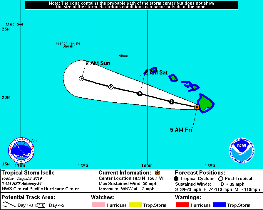
(ABOVE) The 5-Day Forecast Track shows the center of Iselle departing the Big Island as a Tropical Storm and leaving the state to the south.
Hawaii County Civil Defense “post hurricane update” (Aug. 8, 6:13 a.m.)
HILO, Hawaii – Hawaii County is currently under Tropical Storm Warning. Iselle’s maximum sustained winds are near 50 miles per hour with higher gusts. Additional weakening is forecast during the next 48 hours, with Iselle becoming a post-tropical remnant low by Saturday afternoon, according to the National Weather Service.

Based on wsr-88d data… Iselle made landfall along the Big Island’s Ka’u coast around 230 am HST… And is tracking west-northwest over leeward Big Island as of advisory time. The cyclone is weakening rapidly… As the high terrain of the Big Island is disrupting the circulation while the system is also encountering 25 to 30 kt of northwesterly shear… As depicted by the ships guidance and uw-cimss analyses.
Initial motion estimate is 290/11 kt…As Iselle lies along the southwestern periphery of the subtropical ridge… With a weakness in the ridge located to the north. Iselle is expected to continue tracking west-northwestward after emerging from the Big Island later this morning. A mid and upper level trough aloft digging southward along the forecast track will add to the already strong shear… With 20 to 30 kt of northwesterly shear forecast for the next 36 hours. This should lead to the eventual decay of the system… With remnant low status forecast by tau 36… And dissipation anticipated by day 3.National Weather Service at 5 a.m. HST
Hawaii County Civil Defense will now conduct a damage assessment, looking for downed trees, power lines and heavy ponding to determine the condition of the roads. That assessment will be complete by 9 a.m., and people are being asked to stay off the roads until that time. Shelter occupants should remain at the shelters until that time, as well.