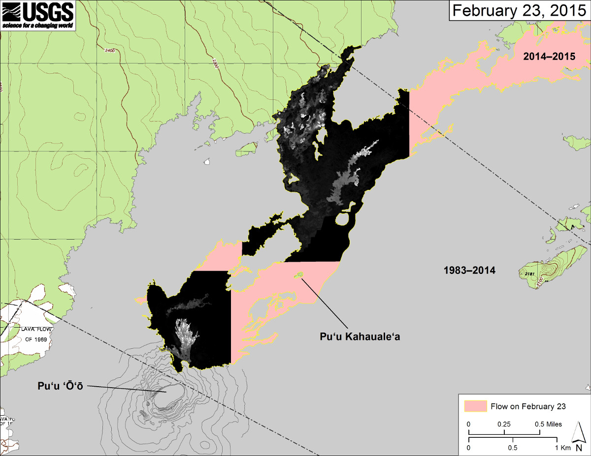
Feb. 23, 2015 (USGS) This map overlays a georegistered mosaic of thermal images collected during a helicopter overflight of Kīlauea’s active East Rift Zone lava flow near Puʻu ʻŌʻō on February 23 at about 12:00 PM. The perimeter of the flow at that time is outlined in yellow. Temperature in the thermal image is displayed as gray-scale values, with the brightest pixels indicating the hottest areas (white shows active breakouts).

by Big Island Video News
on at
STORY SUMMARY
Feb. 23, 2015 (USGS) This map overlays a georegistered mosaic of thermal images collected during a helicopter overflight of Kīlauea’s active East Rift Zone lava flow near Puʻu ʻŌʻō on February 23 at about 12:00 PM. The perimeter of the flow at that time is outlined in yellow. Temperature in the thermal image is displayed as gray-scale values, with the brightest pixels indicating the hottest areas (white shows active breakouts).