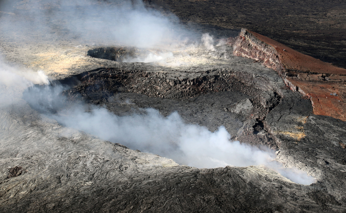
USGS: A view of Pu‘u ‘Ō‘ō Crater looking west, with the main crater in the center of the photo. In the background the west pit – which has an active lava pond inside – can be seen adjacent to the larger crater. The northeast spillway vent is in the lower right.
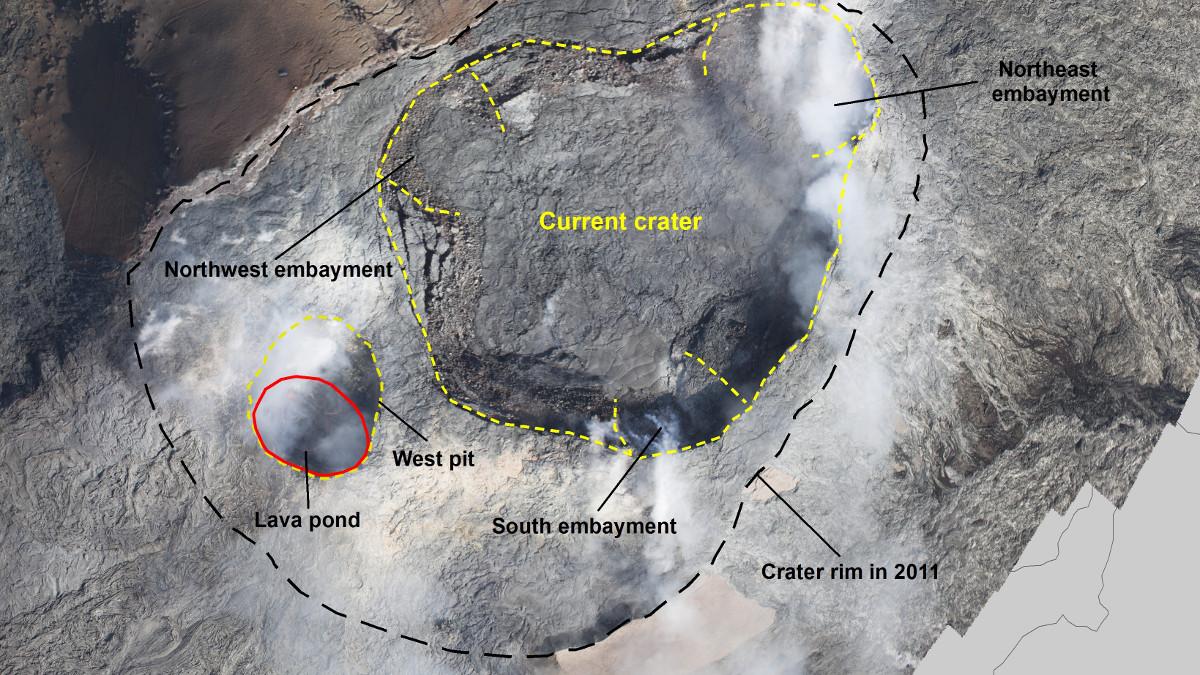
(BIVN) – No significant changes are evident at Puʻu ʻŌʻō, scientists reported on Sunday. However, there have been enough changes over the last few years at the vent to warrant a new annotated map of the active crater on Kilauea Volcano’s East Rift Zone.
The map, produced by the USGS Hawaiian Volcano Observatory and dated November 29, shows the state of Pu‘u ‘Ō‘ō Crater on November 22, with labels of the crater’s main features.
From the most recent USGS volcano activity update:
 USGS Hawaiian Volcano Observatory
on Dec. 3, 2017
Puʻu ʻŌʻō Observations: No significant changes are evident at Puʻu ʻŌʻō. Glow has been persistent at long-term sources within the crater and from a small lava pond on the west side of the crater. Low rates of seismic activity and ground surface deformation continue. The sulfur dioxide emission rate from the East Rift Zone vents has been steady over the past several months and remains significantly lower than the summit emission rate.
Lava Flow Observations: The episode 61g flow is still active. Based on overnight web camera images, surface lava flow activity persists on the upper portion of the flow field, on the pali and in scattered areas along the coastal plain. These lava flows pose no threat to nearby communities at this time. A plume from the Kamokuna ocean entry area is not evident.

(USGS) The black dashed line outlines where the crater rim was located in 2011. Yellow dashed lines show the current crater (center), west pit (left), and spillway vent (right). The lava pond (outlined in red) within the west pit, which formed in early 2015, was active on November 22.

by Big Island Video News
on at
STORY SUMMARY
HAWAII VOLCANOES NATIONAL PARK - Scientists with the USGS Hawaiian Volcano Observatory just published a new product detailing the volcanic vent on Kilauea's East Rift Zone.