Big Island Video News

Serving Hawaii County

  • Hawaiʻi Island News Regions
    • Hamakua
      • Mauna Kea
    • Hilo
    • Kau
    • Kona
    • Kohala
    • Puna


Video from various sources, audio from 11 am media conference call

VIDEO: Eruption Update – Conference Call, Cinder Road Advisory
Avatar photo

by Big Island Video News
on Jul 9, 2018 at 5:09 pm

Subscribe to Big Island Video News (FREE)

* indicates required

STORY SUMMARY

HAWAII ISLAND - Although there is no immediate threat at this time, residents in the Cinder Road area are advised to be prepared for voluntary evacuation if necessary, civil defense says.

USGS MAP: Map as of 2:00 p.m. HST, July 9, 2018. Given the dynamic nature of Kīlauea’s lower East Rift Zone eruption, with changing vent locations, fissures starting and stopping, and varying rates of lava effusion, map details shown here are accurate as of the date/time noted. Shaded purple areas indicate lava flows erupted in 1840, 1955, 1960, and 2014-2015.

https://www.bigislandvideonews.com/wp-content/uploads/2018/07/Eruption-7-9-18-3.mp3
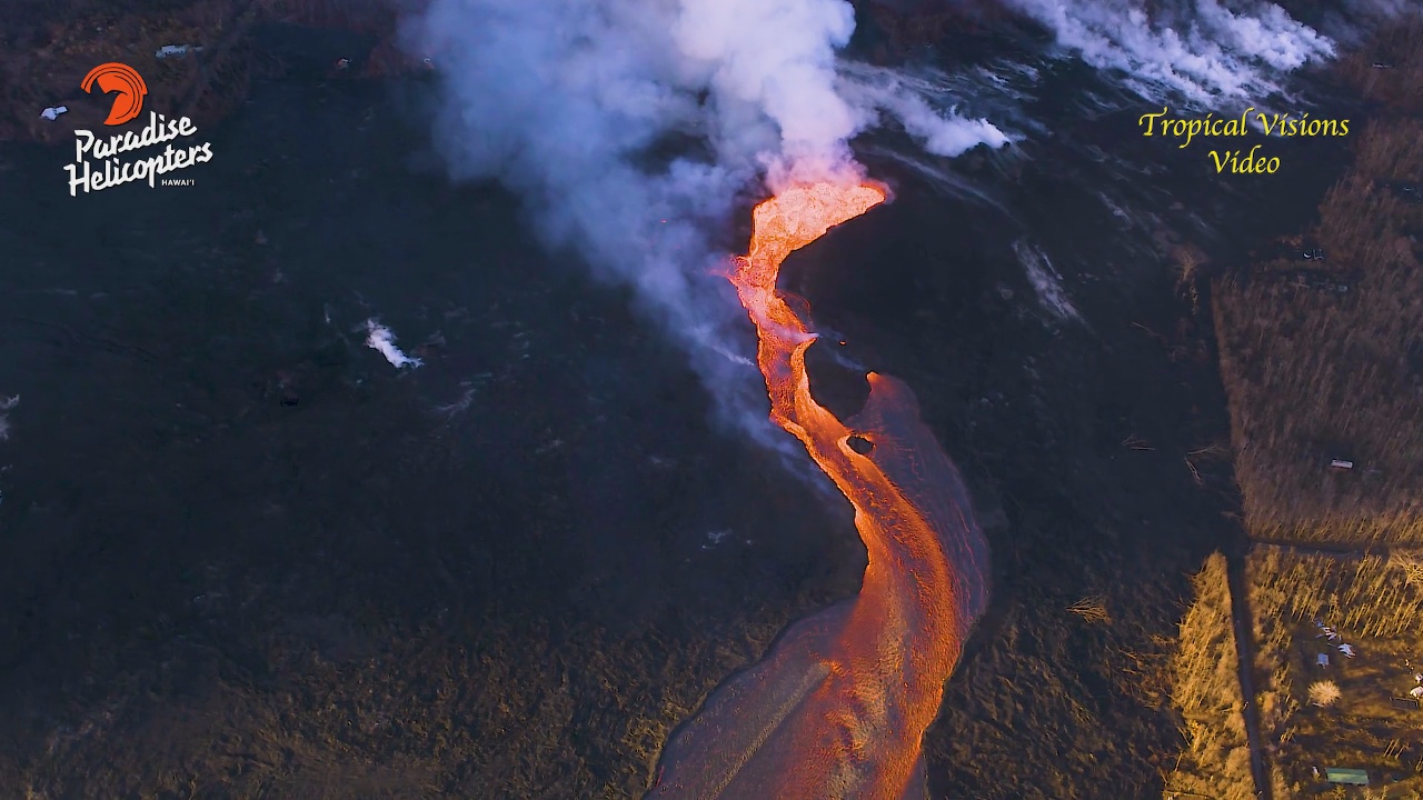
(BIVN) – Residents in the Cinder Road area are advised to be prepared for voluntary evacuation if necessary, Hawaii County Civil Defense said at 4 p.m. Monday, as lava from the Fissure 8 channel continues to expand into Kapoho Beach Lots and north of Four Corners intersection.

There is no immediate threat at this time, officials say. However, the Kapoho Beach Lots and Four Corners area remain closed to any access. “Be aware that spill overs of the channel and other breakouts are possible on the active flow field,” civil defense repeated, adding “do not access the active flow field due to extreme hazard.”

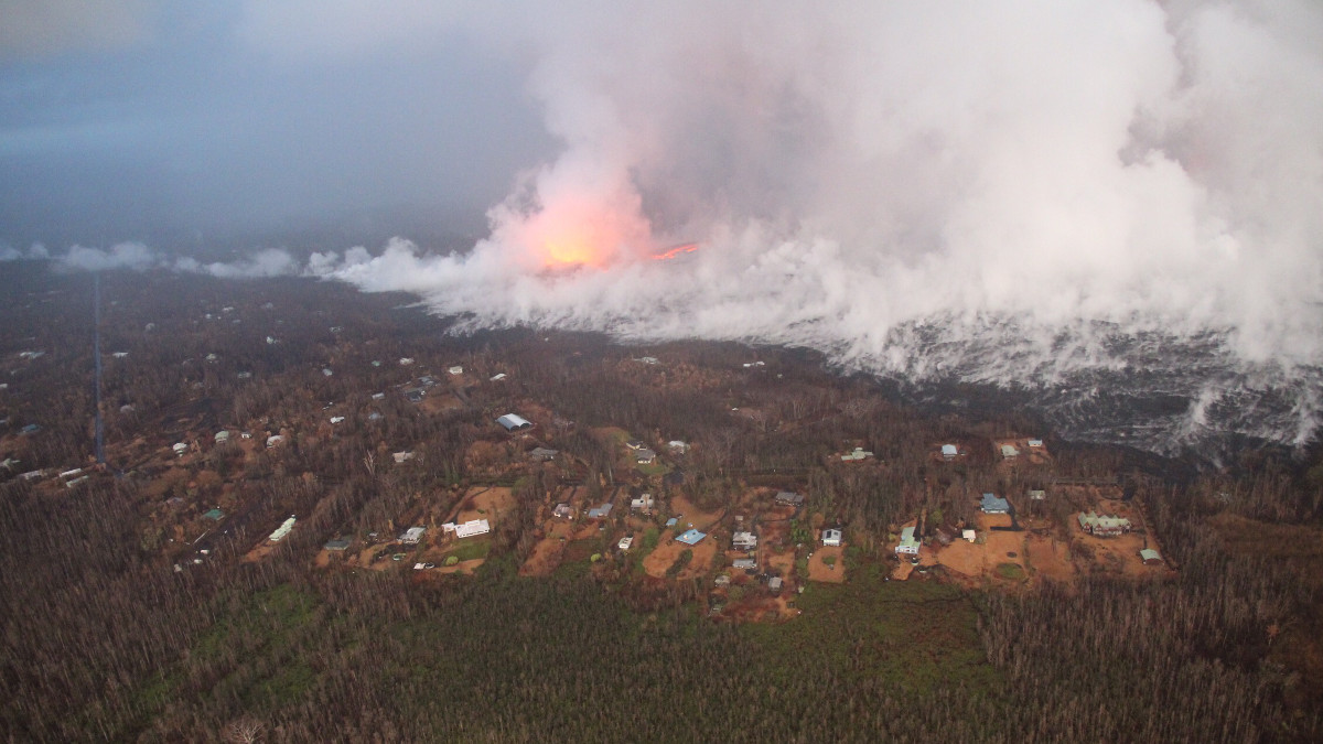
Reports say the official number of homes destroyed by the eruption has reached 700.

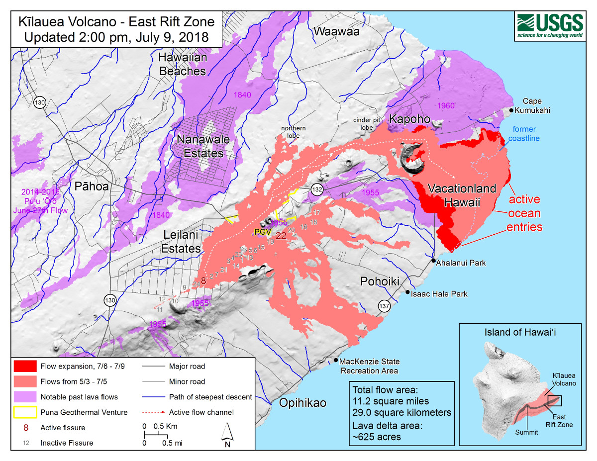
Today during an 11 a.m. media conference call, scientists with the USGS Hawaiian Volcano Observatory and the National Weather Service talked mostly about the affect the lower East Rift Zone eruption is having on the local weather, as well as the approach of lava on the southern end of the flow margin.

The south-side lava is just north of the Ahalanui Park Beach Park, home of the Puna’s popular warm ponds. The flow margin is estimated to be about 500 m, or 0.3 miles, from the park. Kua O Ka Lā Public Charter School is also nearby.

USGS: Fissure 8 and Leilani Estates viewed from the south. Houses in the foreground are located in the southern portion of Leilani Estates. Fissure 8 and surrounding lava and tephra deposits are shrouded in steam, caused by rain water being heated by the warm deposits.

A rain gauge in Leilani Estates recorded 9 inches of rain in a 24 hour period recently. The downpour was enhanced by the eruption.

The National Weather Service forecasts showery light trade wind conditions through tonight. Some areas will experience elevated SO2 levels, officials say. “You are reminded to take actions by sheltering in place or leaving affected areas,” Hawaii County Civil Defense says.


Filed Under: Video Report Tagged With: Ahalanui Park, Cinder Road, Kilauea, lava

LATEST NEWS

Mass Dolphin Harrassment In Hōnaunau Under Investigation

East Hawaiʻi Police Officer, Firefighter Of The Year Named

Bathroom Burns Down At Old Airport Park In Kona

Hawaiʻi County Mass Transit Launches New Website

Edith Kanakaʻole Quarter Released Into Circulation

Magnitude 4.1 Earthquake Off Hawaiʻi, No Tsunami

About Big Island Video News

  • Privacy Policy

Copyright © 2023 · Dynamik-Gen on Genesis Framework · WordPress · Log in