
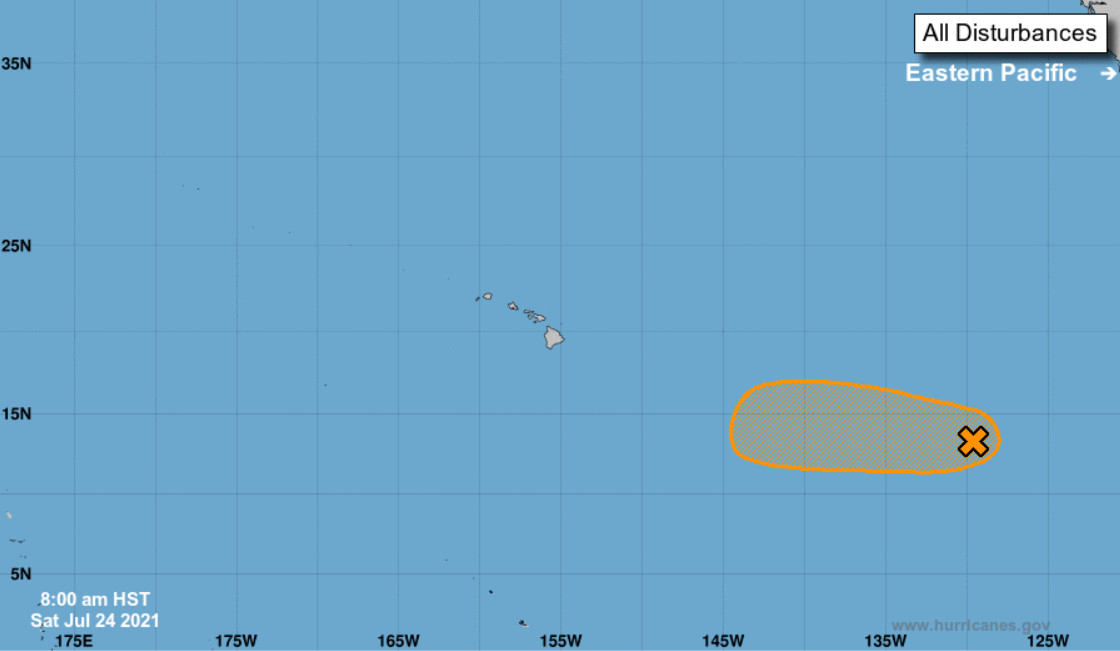

(BIVN) – A concentrated area of showers and thunderstorms approaching the Central Pacific could become a tropical depression later this week, but it is not likely to strengthen as it passes south of the Hawaiian islands.
The Central Pacific Hurricane Center in Honolulu says a broad area of low pressure located about 1,700 miles east-southeast of Hilo “has become a bit better organized, but the system currently lacks a well-defined low-level circulation,” as of a Saturday morning update.
“Environmental conditions are forecast to be conducive for further development,” the forecasters stated, “and this system could become a tropical depression later this weekend or early next week before reaching cooler waters while moving westward at 10 to 15 mph.”
The Central Pacific Hurricane Center says there is a medium chance (50%) of formation through 48 hours, and a medium chance (60%) of formation through 5 days.
“As we head into the middle of the week, the forecast continues the more typical trade winds showers,” the National Weather Service in Honolulu wrote on Saturday morning. “However a disturbance may pass south of the islands, which could once again tighter the pressure gradient over the islands.”
Elsewhere, no tropical cyclones are expected during the next 5 days.
This story has been edited to clarify the area of low pressure is not yet in the Central Pacific.
