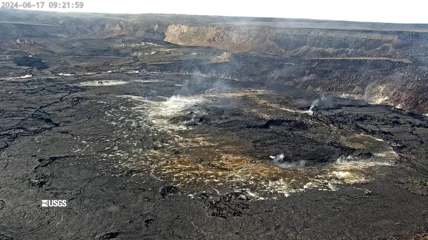
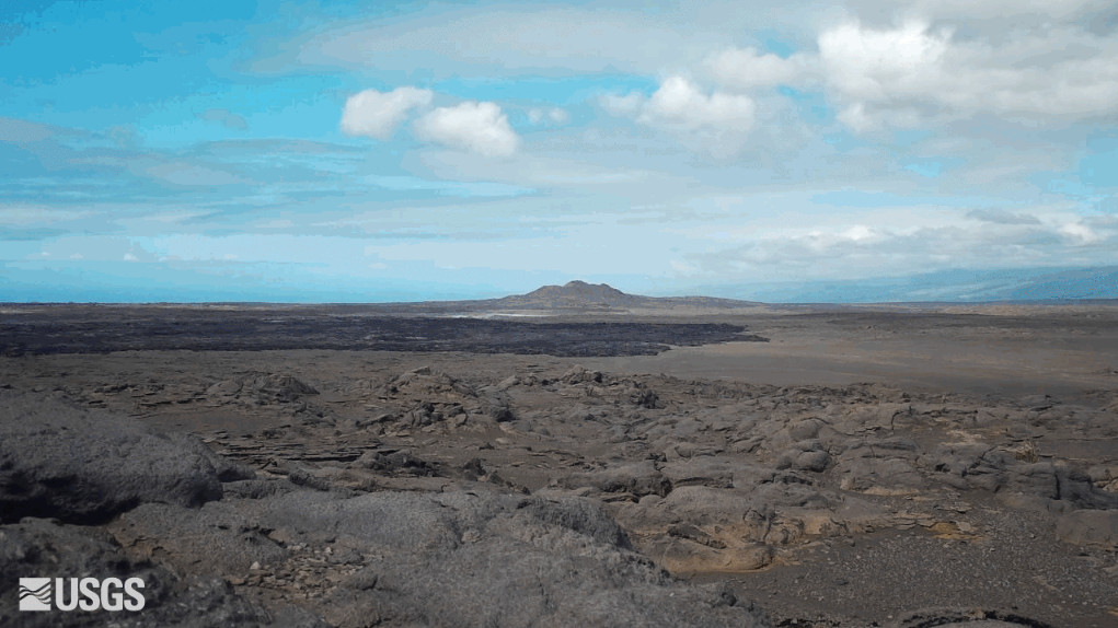
USGS webcam view shows the site of the recent eruption on the upper Southwest Rift Zone
(BIVN) – Kīlauea volcano is not erupting, and the USGS Volcano ALert Level remains at ADVISORY.
The USGS Hawaiian Volcano Observatory noted on Monday morning that although earthquake counts and rates of inflation in the summit and upper rift zones have been somewhat elevated recently, both seismicity and deformation have been “slightly diminished over the past two days.”
Scientists continue to say that additional or renewed increase in seismicity and/or deformation “could result in new eruptive episodes within or near the summit region.”
From the June 17th update by the USGS HVO:
Recent Eruption Site Observations: Kīlauea erupted briefly on Monday, June 3, southwest of Kaluapele (Kīlauea caldera) within a closed area of Hawai’i Volcanoes National Park. Glow from fissure vents is no longer visible in webcam imagery. SO2 emissions from the eruption site have likely decreased since the most recent measurement and may be around 50-100 tonnes per day (t/d) (similar to background emission levels at the summit). Seismic activity remains low at the eruption site.
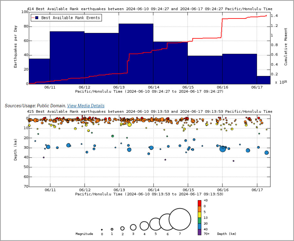
Above Top: Number of earthquakes per day during the past week (blue bars). The red line is the cumulative moment (energy) release. Bottom: Depth of earthquakes during the past week in the area shown on the map above. Depth is reported relative to sea level, which is equal to a depth of zero on the above plot. On both figures, circle-size represents magnitude, and color indicates depth. (USGS graphs)
Summit and Upper Rift Zone Observations: Rates of seismicity beneath the summit, upper East Rift Zone, and upper Southwest Rift Zone were slightly diminished over the past two days. Less than 10 earthquakes occurred over the past 24 hours. Earthquakes were mostly located beneath the south caldera region and upper East Rift Zone, at depths of 1.5-3 km (1–1.8 miles), with magnitudes under M2.5. Ground deformation of the summit continued yesterday with variable small amounts of alternating inflation and deflation. As of this posting, tilt seems to have resumed inflation. The Uēkahuna tiltmeter northwest of the summit recorded overall inflation of approximately 3 microradians over the past 24 hours. The Sand Hill tiltmeter southwest of the summit recorded approximately 1 microradian of inflation over the past 24 hours. The most recent summit SO2 emission rate measured was approximately 50 t/d on June 10, 2024; accordingly, total SO2 emissions from the summit and recent eruption site are likely less than 200 t/d.
Lower Rift Zone Observations: Rates of seismicity and ground deformation beneath the middle and lower East Rift Zone and lower Southwest Rift Zone are low. Eruptive activity and unrest have been restricted to the summit and upper rift zone regions. Measurements from continuous gas monitoring stations downwind of Puʻuʻōʻō in the middle East Rift Zone remain below detection limits for SO2, indicating that SO2 emissions from Puʻuʻōʻō are negligible.
Analysis: Following the June 3 eruption, magma has been repressurizing the storage system beneath Halemaʻumaʻu and the south caldera region, activating earthquakes in the upper East Rift Zone and in the caldera south of Halemaʻumaʻu. At this time, it is not possible to say whether this increase in activity will lead to an intrusion or an eruption in the near future, or simply continue as seismic unrest at depth. Changes in the character and location of unrest can occur quickly, as can the potential for eruption, but there are no signs of imminent eruption at this time.
The USGS HVO says it will continue to provide daily updates for Kīlauea volcano.

by Big Island Video News
on at
STORY SUMMARY
HAWAIʻI VOLCANOES NATIONAL PARK - Earthquake counts and rates of inflationary ground deformation have been slightly diminished over the past two days.