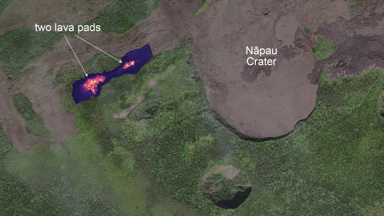
USGS: “A brief, small eruption occurred on the middle East Rift Zone of Kīlauea late on September 15. The eruption produced two small pads of lava just west of Nāpau Crater, which is west (uprift) of the former Pu‘u‘ō‘ō eruption site.” (USGS photo by M. Patrick)
(BIVN) – The eruption on the middle East Rift Zone of Kīlauea volcano resumed on Monday evening, after a day-long pause in activity.
The eruption, located west of Nāpau Crater, began on the night of September 15, but had stopped by the morning. However, the increased seismicity and ground deformation in the area did not cease, indicating that the magmatic intrusion into the region had not ended. Scientists warned that “renewed episodes of intense unrest or eruption” were possible and could occur with little warning.
At approximately 6 p.m., the eruption resumed.
The eruption does not currently pose an immediate threat to human life or infrastructure, the USGS Hawaiian Volcano Observatory reported in a new Volcanic Activity Notice issued Monday night.
The Volcano Alert Level for ground-based hazards at Kilauea remains at WATCH and the Aviation Color Code remains at ORANGE, as of 9 p.m. on September 16th.
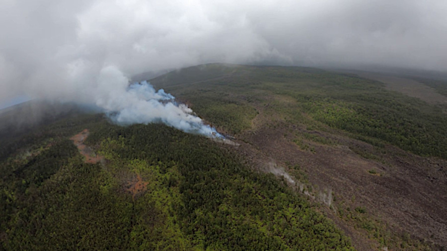
“Chain of Craters Road, which is closed, is located downslope and downwind of the erupting fissures,” wrote the USGS HVO. “Residents of nearby subdivisions may experience volcanic gas emissions related to this activity, which may wax and wane over the coming days.”
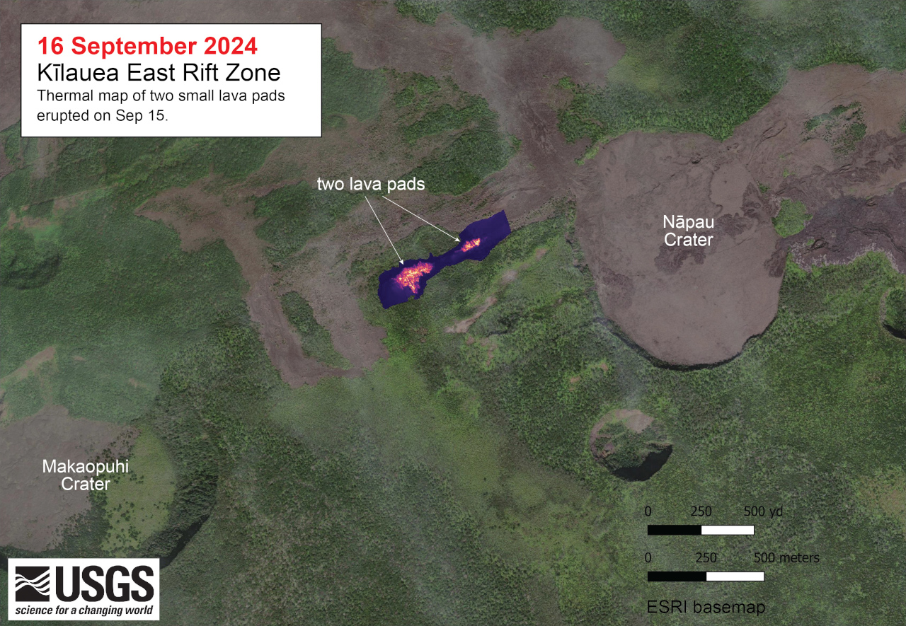
This thermal map shows two small lava pads erupted late on September 15, just west of Nāpau Crater on the East Rift Zone of Kīlauea. This small eruption resulted from magma intruding from the summit into the East Rift Zone, and was associated with an increase in earthquake activity along the East Rift Zone. The largest of the two lava pads was only about 200 m (yards) long.
Current activity is restricted to Kīlaueaʻs middle East Rift Zone, scientists said. Rates of seismicity and ground deformation beneath the lower East Rift Zone and Southwest Rift Zone remain low.

by Big Island Video News
on at
STORY SUMMARY
ISLAND OF HAWAIʻI - The eruption, which resumed at 6 p.m. Monday evening, is occurring within a closed and remote area of Hawaiʻi Volcanoes National Park.