(BIVN) – The ongoing eruption at the summit of Kīlauea is paused. The most recent episode, Episode 28, occurred on July 9, with approximately 9 hours of lava fountaining from the north vent.
This week’s Volcano Watch, written by U.S. Geological Survey Hawaiian Volcano Observatory scientists and affiliates, details one of the monitoring challenges of the current eruptive activity: the growing field of tephra.
From the Volcano Watch:
The USGS Hawaiian Volcano Observatory (HVO) maintains a network of nearly 150 monitoring instruments on Kīlauea, which track activity above and below the surface. The ongoing high fountain eruption episodes in Halemaʻumaʻu present new challenges to maintaining parts of the Kīlauea summit monitoring network near and immediately downwind of the eruptive vents.
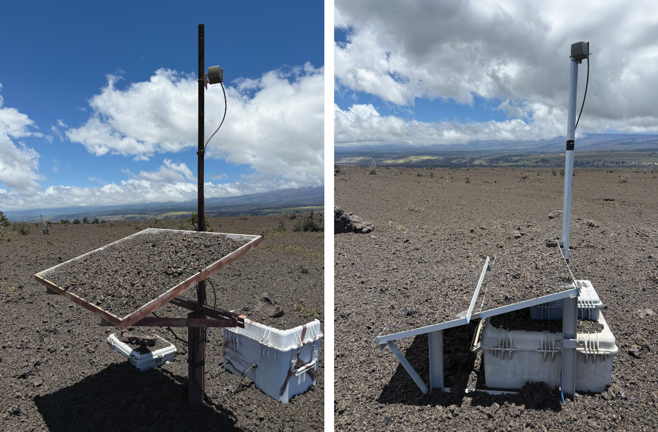
USGS: “Following episode 27 of the Kīlauea summit eruption on June 29, USGS Hawaiian Volcano Observatory field engineers visited several sites southwest of Halemaʻumaʻu on July 1 to remove tephra that had accumulated on the solar panels and station infrastructure.” (USGS photos by M. Warren)
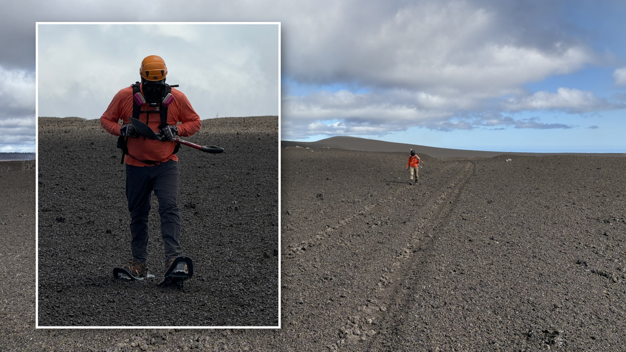
On July 10, HVO field engineers strapped snowshoes on as they prepared to work in the closed area of Hawaiʻi Volcanoes National Park, southwest of the two eruptive vents in Halemaʻumaʻu. With each step, the ground crunched and their feet sunk a little. The large footprint of snowshoes keep the field engineers walking on top of the frothy pumice everywhere, rather than through it. Tiny pieces of volcanic glass shimmered in the air, which was filled with the soft sound of clinking glass. They wore full-face respirators to protect themselves from these particles, called tephra.
Tephra is a word for any volcanic material that is erupted and travels through the air before landing on the ground. It includes very small particles, such as volcanic ash, as well as light and frothy rocks full of holes called reticulite, more robust rocks like scoria, larger pieces called bombs, and ever-present Pele’s Hair.
Lava fountains of the ongoing episodic eruption in Halemaʻumaʻu have created a growing tephra blanket downwind of the eruptive vents. On the crater rim closest to the vents, the tephra is as thick as 80 feet (25 meters). Lava flows fed by these fountaining episodes have also covered nearly 850 acres (344 hectares) of Halemaʻumaʻu crater floor, up to 236 feet (72 meters) thick in some areas.
HVO staff have moved several monitoring stations that were located in areas too close to lava flows or areas buried by falling tephra. The instruments themselves remained functional and most, including the F1 thermal camera, KWcam, B1cam, and continuous laser rangefinder, have been redeployed near the V1 streaming camera, an area less likely to be impacted by the eruption. The B2cam on the crater floor underwent a full melt down, but its solar power supply survived and was airlifted to the south rim to power the new V3 livestream camera.
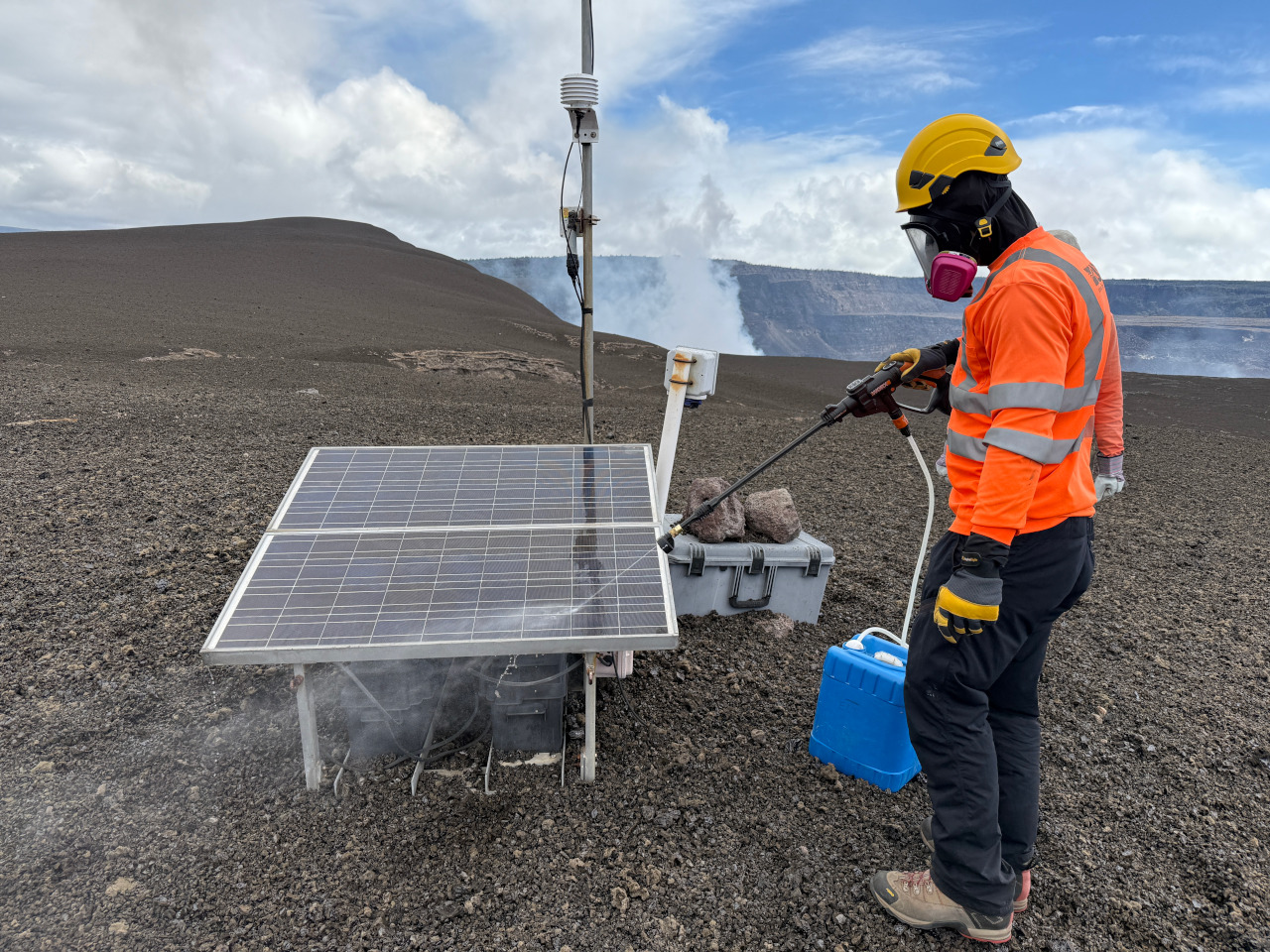
USGS: “Solar panels that power USGS volcano monitoring equipment can be covered with tephra during eruptive episodes at the summit of Kīlauea. These tephra particles can range in size from fine ash to tennis-ball sized and larger. USGS field engineers visit these stations after eruptive episodes to clean them off and restore power to the stations.” (USGS photo by M. Warren)
Several other monitoring stations are located farther away from the vents but are still being impacted by the eruption. The instruments at these stations, many of which measure volcanic gas, are positioned southwest of the summit because that direction is usually downwind of summit eruptions during common trade wind conditions. Being downwind of the ongoing eruption means that, in addition to the gas they are designed to measure, the stations are subjected to tephra fall.
Infrastructure at monitoring stations in this area can be covered by tephra depending on the wind direction during an eruptive episode. Following eruptive episodes, HVO staff have visited these sites to dig them out and to remove tephra from solar panels, restoring power to the station.
Sulfur dioxide emission rates, which HVO measures to help track eruptive activity, are not possible when this part of the network is down. HVO staff are exploring other methods for obtaining sulfur dioxide emission rates. In the meantime, numerous measurements during past pauses and eruptive episodes allow us to generally estimates these emissions during different types of activity. During past eruptive pauses, sulfur dioxide emission rates have been measured as around 1,200-1,500 tonnes per day During past eruptive episodes, sulfur dioxide emission rates have been measured up to 75,000 tonnes per day. It’s likely that sulfur dioxide emission rates have been even higher during recent eruptive episodes, though measurements have not been possible.
High lava fountains can also temporarily block radio telemetry, preventing data flow from monitoring stations. Most telemetry paths have been re-routed to avoid this issue, but several instruments, including the Sandhill tiltmeter, Cone Peak (CNPK) GPS, and several seismic stations (WRM, SDH, CPKD, OTLD), may continue to be affected during episodes with high lava fountains.
The area southwest of eruptive vents can be difficult to access. Depending on the wind direction during lava fountaining episodes, more tephra can blanket the landscape (and access road) to the southwest. After each episode, HVO staff assess the feasibility of visiting monitoring sites with staff safety being the primary priority.
Although a small portion of the Kīlauea monitoring network is being impacted by the summit eruption, HVO is still able to adequately monitor Kīlauea. Maintaining the instrument network during eruptions is one of the challenges that comes with monitoring one of the most active volcanoes on Earth.

by Big Island Video News
on at
STORY SUMMARY
HAWAIʻI VOLCANOES NATIONAL PARK - On Kīlauea's crater rim closest to the active vents, the blanket of tephra is as thick as 80 feet (25 meters).