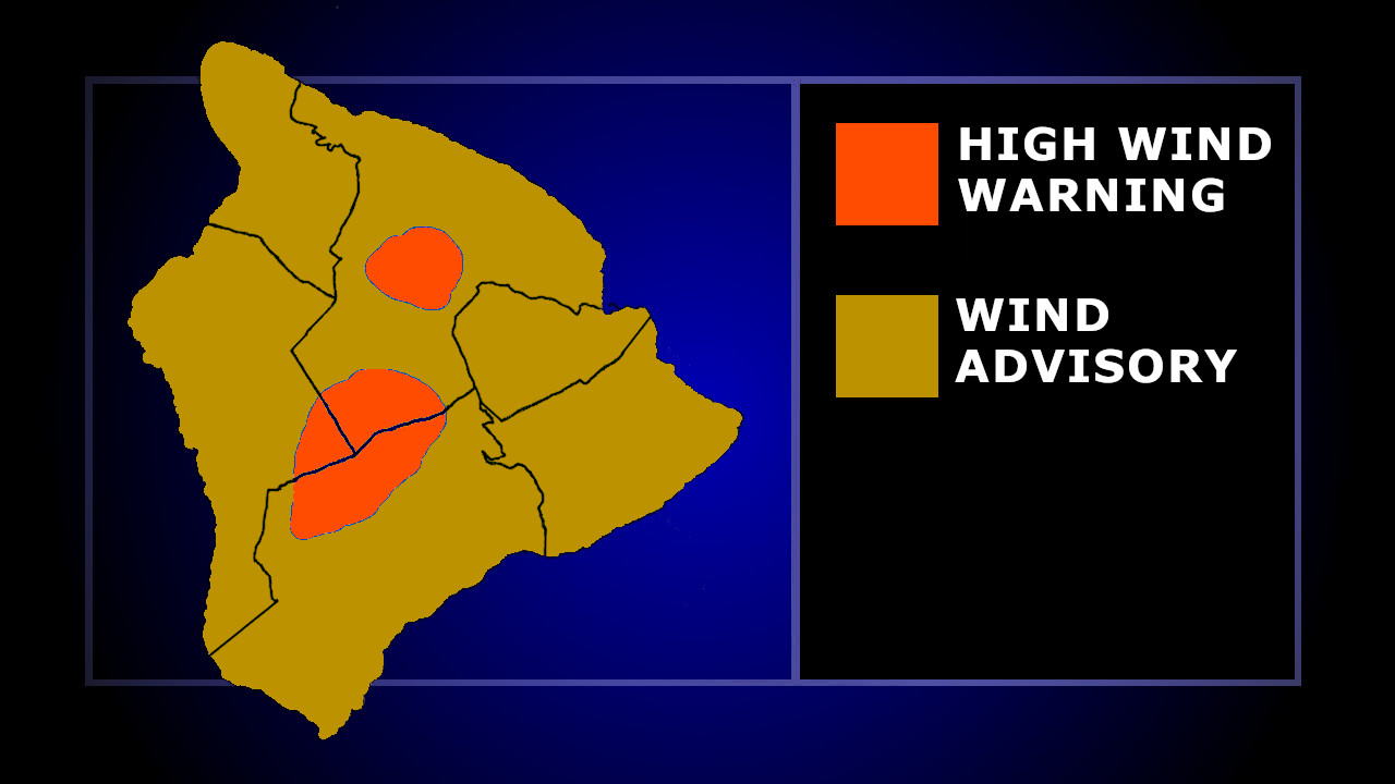
(BIVN) – A Wind Advisory has been issued for the Hawaiian Islands on Monday, with a more severe High Wind Warning issued for the summits of Maunakea and Mauna Loa.
The National Weather Service says south to southwest winds at 20 to 30 mph, with gusts up to 50 mph, will be possible for all lower elevations until 6 a.m. Tuesday morning.
On Hawaiʻi island summits, west winds will be increasing to 40 to 60 mph, with stronger gusts.
The National Weather Service discussion posted on Monday morning details the passage of an approaching cold front:
The cold front continues to quickly approach the Hawaiian Islands from the northwest direction this morning, the front will swiftly march eastward down the island chain through Tuesday. The highest rainfall amounts will develop over a four to six hour time period along the main frontal cloud band as it passes through each island. Based on all available data, the front will move into Niihau and Kauai around noon, reaching Oahu by mid afternoon, then onward to Molokai and Lanai in the evening hours, into Maui around midnight, and finally the remnants of the frontal band with significantly less shower activity will reach the Big Island on Tuesday morning. Expect cooler and drier northwesterly winds to develop after frontal passage. This drier air will keep cooler overnight to early morning temperatures in the 60`s as the atmosphere will more efficiently radiate heat into outer space each night.
Forecasters say a stronger weather system may reach Hawaiʻi this weekend, producing “more significant weather impacts” with the potential for periods of heavy rain and thunderstorms.

by Big Island Video News
on at
STORY SUMMARY
HAWAIʻI - South to southwest winds 20 to 30 mph will be possible on all the Hawaiian Islands today, with stronger winds on Big Island summits.