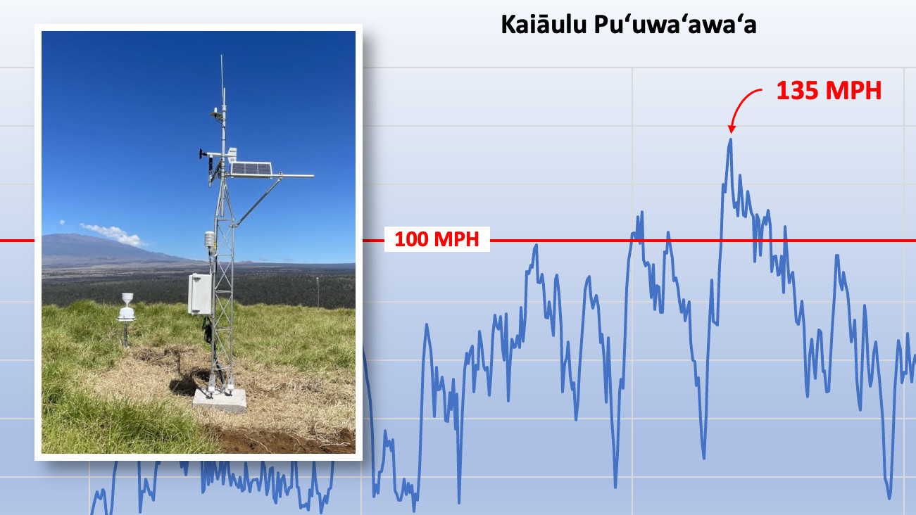
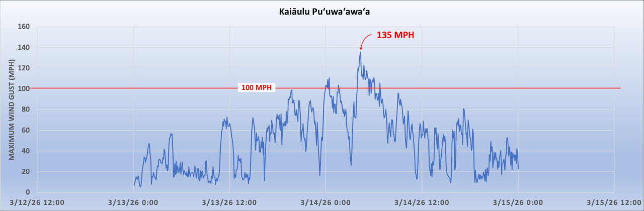
(BIVN) – A 135 mph wind gust was recorded on Hawaiʻi island during last weekend’s kona low storm.
The University of Hawaiʻi’s Hawaiʻi Mesonet weather monitoring system captured the extreme wind gust at 4:20 a.m. on March 14. A High Wind Warning was in effect for the entire Big Island at the time.
The UH Hawaiʻi Climate Data Portal team created a report on the storm, which highlighted the extreme wind event at Puʻuwaʻawaʻa in the North Kona district. “That day, the Kaiāulu Puʻuwaʻawaʻa Hawaiʻi Mesonet station recorded wind speeds that frequently exceeded 100 mph between midnight and 6:45 AM,” the report stated.
courtesy the University of Hawaiʻi
Between 4:10 a.m. and 4:25 a.m., sustained wind speeds averaged 105 mph, equivalent to a Category 2 hurricane.
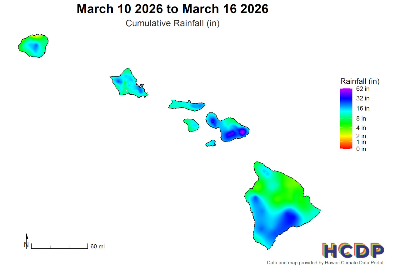
“Hawaiʻi Island also saw heavy precipitation, with areas recording 16–32 inches, and isolated spots also nearing 62 inches,” the University reported. Flash flooding was reported across the island.
courtesy the University of Hawaiʻi
“Before the project began, Hawaiʻi was one of only 20 states without a comprehensive statewide weather monitoring system, meaning we previously had no access to information in many of these areas,” said Tom Giambelluca, Hawaiʻi Mesonet project lead, in a University news release. “Now, the system is constantly collecting data on rainfall, soil moisture, and other weather variables that can tell us in real time if an area is highly susceptible to fires or flooding, which ultimately allows us to be as prepared as possible.”
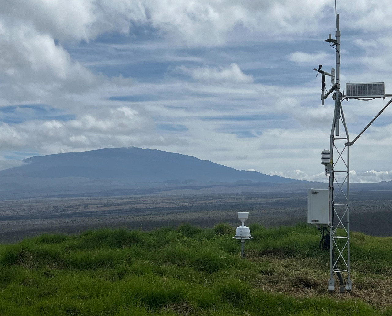
The Kaiāulu Puʻuwaʻawaʻa Hawaiʻi Mesonet station with Maunakea in the background (courtesy the University of Hawaiʻi)

by Big Island Video News
on at
STORY SUMMARY
HAWAIʻI ISLAND - The University of Hawaiʻi’s Hawaiʻi Mesonet recorded the hurricane-force wind gust at Kaiāulu Puʻuwaʻawaʻa.