(BIVN) – The National Weather Service has extended the Flood Watch for Hawaiʻi island into Saturday, as the band of heavy rainfall that soaked Kauai and Oʻahu on Thursday and Friday shifts towards Maui and the Big Island overnight.
From the National Weather Service at 8:39 p.m. HST:
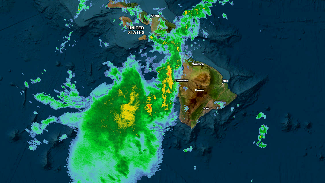
Through tonight, the axis of deep tropical moisture and associated band of heavy rainfall continues to shift eastward, with the primary focus now transitioning to Maui County and the Big Island. Similar impacts to those observed farther west remain possible, including periods of intense rainfall rates, isolated thunderstorms, and flash flooding into early Saturday morning.
The initial shortwave responsible for the most organized large-scale lift earlier is continuing to shift northeast away from the state, and upper-level support is expected to gradually weaken into Saturday. As a result, rainfall intensity should begin to ease somewhat by Saturday over the eastern end of the state where the axis of deep moisture will linger. Over the western end of the state, drier air is beginning to filter in from the west, which should limit rainfall chances.
At 11:40 p.m. HST, heavy rain was observed over western slopes of the Big Island from Upolu Point to South Point. A Flood Advisory was issued, while rain was falling at a rate of 1 to 2 inches per hour.
The Winter Weather Advisory will also remain in effect until Saturday morning.
Due to the extended Flood Watch, the Hawaiʻi County Civil Defense advises:
- Residents in flood prone areas should be on the alert and prepare for heavy rains and potential flooding
- Road closures may occur without notice
- Be aware of possible ponding of water on roadways
- Do not attempt to cross flowing water in a vehicle or on foot; turn around don’t drown.
- Remember, if lightning threatens your area, the safest place to be is indoors.
Weather improvements on Saturday are expected to be temporary. From the National Weather Service:
Guidance continues to show another shortwave rotating through the broader trough northwest of the state Saturday night into early next week. This feature is expected to reinvigorate the deep moisture plume already draped across the islands and support another round of widespread showers with periods of heavy rainfall. Confidence continues to increase that renewed flooding impacts may develop by Sunday and persist into early next week.
Antecedent conditions are now becoming the primary concern statewide. With soils saturated, streams running elevated, and some areas already having received significant rainfall totals, flooding impacts will be much easier to realize with the next round of heavy rain. While some guidance continues to suggest an additional several inches may be possible through the duration of the next event, exact storm totals are less important than rainfall intensity and duration. Any period of intense rainfall rates could quickly lead to renewed flash flooding impacts.

by Big Island Video News
on at
STORY SUMMARY
HAWAIʻI ISLAND - The band of heavy rainfall that produced significant impacts over Kauai and Oʻahu is shifting towards Maui and Hawaiʻi island.