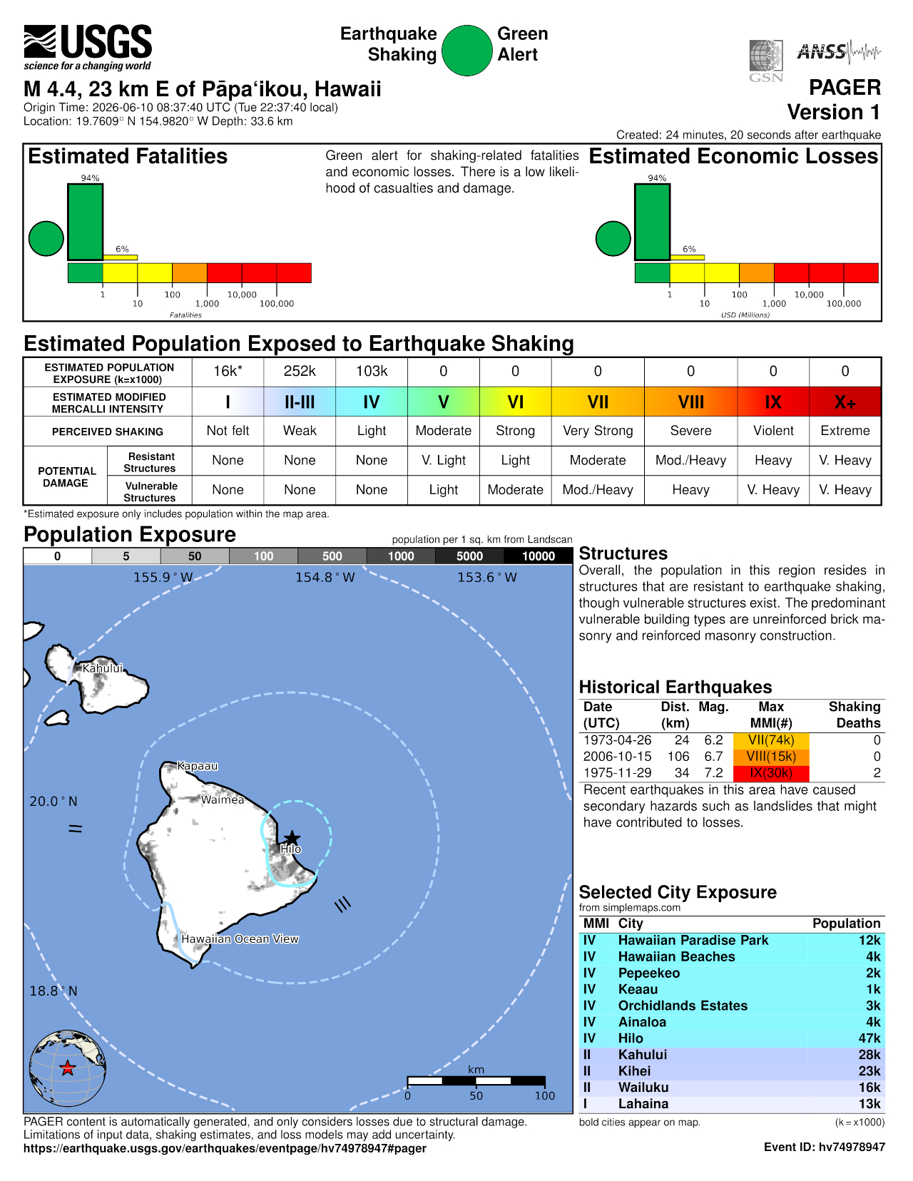
(BIVN) – A magnitude-4.7 earthquake shook Hawaiʻi island at 10:37 p.m. HST on Tuesday evening.
UPDATE – (11:05 p.m.) – The magnitude of the earthquake was revised from a magnitude-4.9 to a magnitude-4.7.
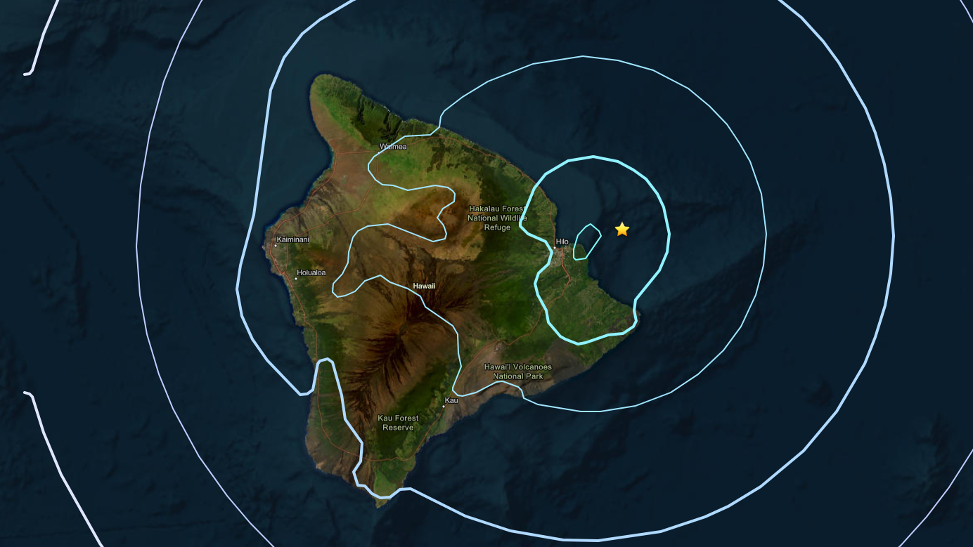
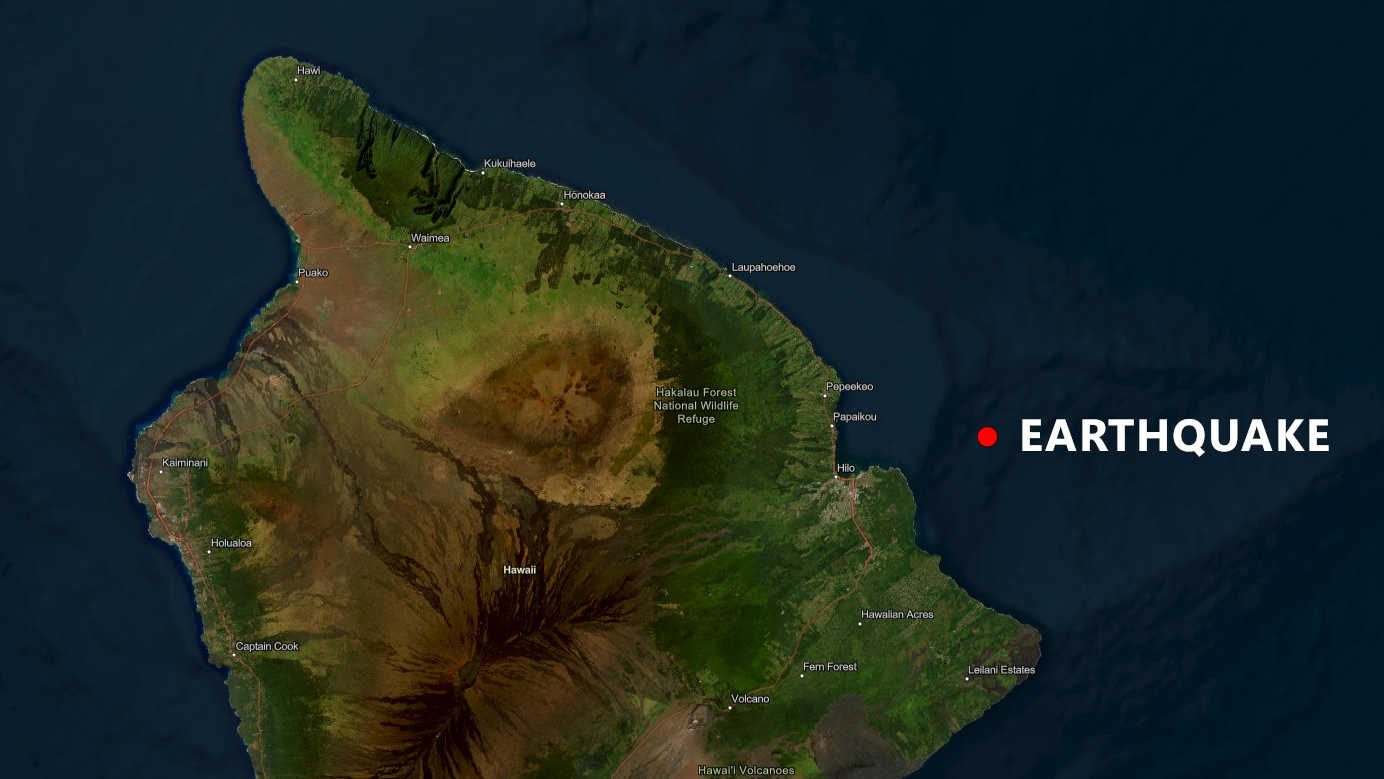
The earthquake occurred off the coast of Hilo, about 13.8 miles east of Pāpaʻikou, at a depth of 37 km below sea level.
No tsunami was expected, the Pacific Tsunami Warning Center in Honolulu reported, although “some areas may have experienced shaking”.
UPDATE – (11:30 p.m.) – In an Information Statement, the USGS Hawaiian Volcano Observatory said the earthquake had no apparent impact on either Mauna Loa or Kīlauea volcanoes.
From the Observatory:
The depth, location, and recorded seismic waves of the earthquake suggest a source due to bending of the Pacific plate from the weight of the Hawaiian island chain, a common source for earthquakes in this area. These earthquakes are generated below the volcanoes and the ocean crust in the upper mantle beneath the Hawaiian Islands. The earthquake today is similar in origin but unrelated to the magnitude-6 that occurred on May 22 and the magnitude-4.6 that occurred on June 2 on the west side of the island. All of these earthquakes are likely related to stress from the weight of the island on the underlying rigid mantle and were not directly related to volcanic processes or magma movement. Light shaking was reported during this event, which is not expected to cause damage. The USGS Hawaiian Volcano Observatory continues to monitor Hawaiian volcanoes for any changes.