
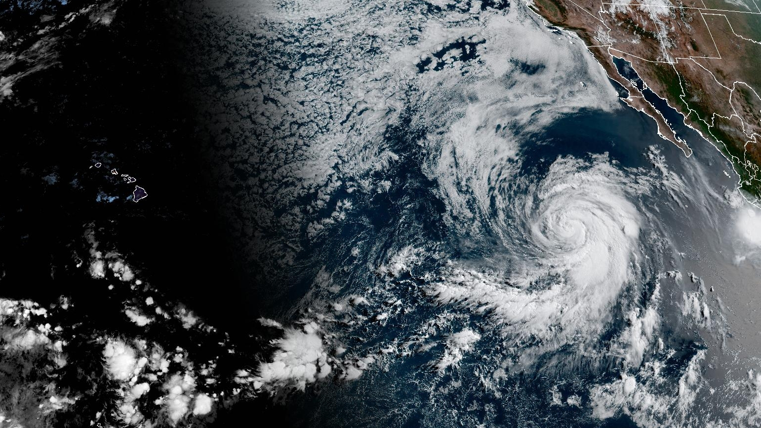

(BIVN) – Hurricane Fausto, about 855 miles west southwest of the southern tip of Baja California, continues to move towards the west-northwest over open Pacific waters.
Fausto’s maximum sustained winds are near 80 mph with higher gusts. The National Hurricane Center forecasts some gradual strengthening during the next day or so, followed by slow weakening on Friday and into the weekend.
It is expected to be at tropical storm strength, or weaker, at is approaches Hawaiʻi next week.
The National Weather Service in Honolulu says guidance is “generally tracking the system near or just north of the islands during the mid- week period.”
“So far it is too early to know exact details on how this storm will effect our weather, as it will be heavily dependent on the eventual track and intensity,” the NWS stated.
Larger surf generated by Hurricane Fausto is possible this weekend, and could bring advisory level surf along east facing shores of Hawaiʻi.
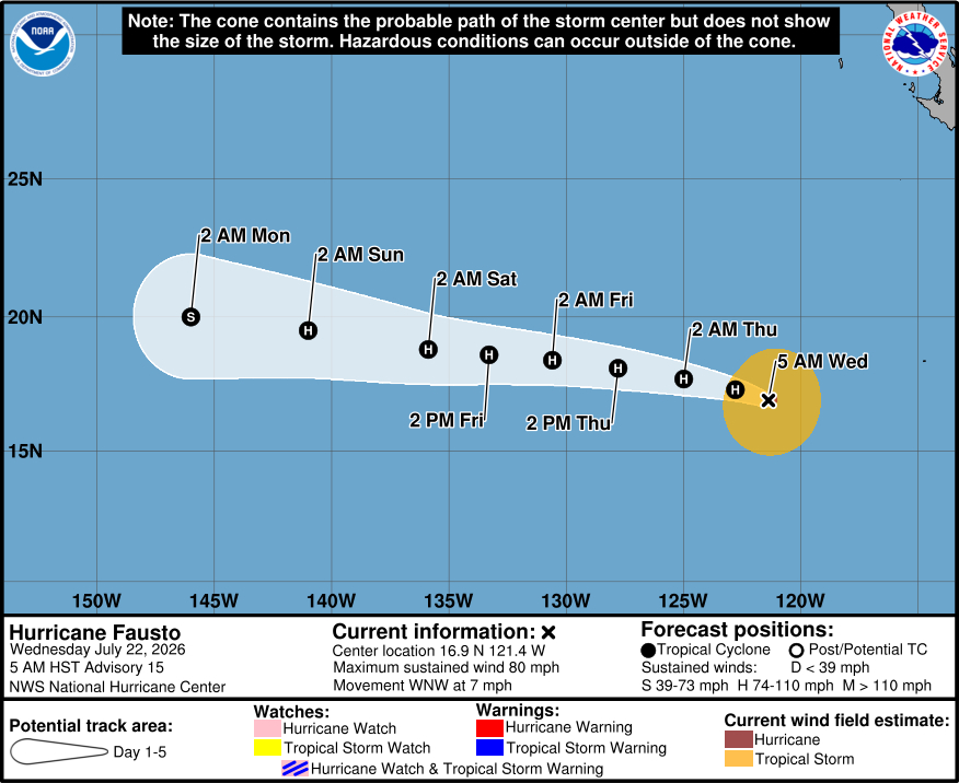
From the National Hurricane Center discussion on Wednesday morning:
Fausto appears to be contending with intrusions of dry air based on its deteriorated satellite structure this morning. Recent AMSR-2 and GMI passive microwave images show the mid-level eyewall of the hurricane is no longer closed, and dry slots are evident in geostationary satellite images. As a result of these changes, the satellite intensity estimates have decreased this morning. The initial intensity is set at 70 kt, which is in good agreement with the latest UW-CIMSS D-PRINT, D-MINT, and SATCON estimates.
Fausto continues moving west-northwestward (285/6 kt) while being steered by a subtropical ridge to its north. This feature is forecast to strengthen over the next few days, which should keep Fausto on a west-northwestward to westward heading with some increase in forward speed later this week and over the weekend. The track models are in good agreement through 72 h, with increased cross-track spread noted at days 4-5. The Google Deep Mind and HCCA remain on the southern side of the guidance envelope, while the GFS and regional hurricane models are still slower and farther north. Little change was made to the official NHC track forecast, which continues to follow HCCA on the southern side of the guidance suite.
Some restrengthening is possible during the next day or two while Fausto moves over warm waters in a light to moderate shear environment. However, continued intrusions of dry air may limit the potential for further intensification, and the NHC forecast only shows modest strengthening during the next 24-36 h. As Fausto moves westward, it is predicted to encounter a drier and more stable air mass over the weekend while tracking near the 26 deg C isotherm. Thus, slow weakening is shown during the latter half of this forecast period. The latest NHC intensity forecast remains on the higher side of the intensity guidance. Note that any large northward track deviations would likely cause Fausto to weaken even faster than shown in this forecast.
