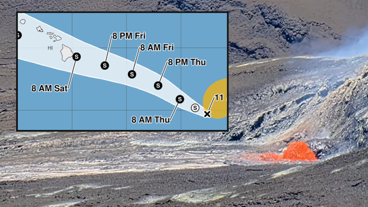
(BIVN) – We are monitoring two developing situations on Hawaiʻi Island right now. One is the next episode of high lava fountaining at Kilauea volcano, expected at any moment The other is a potential tropical cyclone developing to the southeast of the Big Island which could potentially impact the State of Hawaiʻi this weekend.
Within Hawaiʻi Volcanoes national Park, episode 53 precursory low-level lava activity has started as inflation builds at the summit. The USGS Volcano Alert Level was raised from ADVISORY to WATCH and the Aviation Color Code from YELLOW to ORANGE in anticipation of the event, which is likely to start today.
Meanwhile, weather forecasters are keeping an eye on potential tropical cyclone 1-C, which is expected to become a tropical depression soon as it tracks towards the islands. Here’s what the Central Pacific Hurricane Center forecast map looks like as of Wednesday.
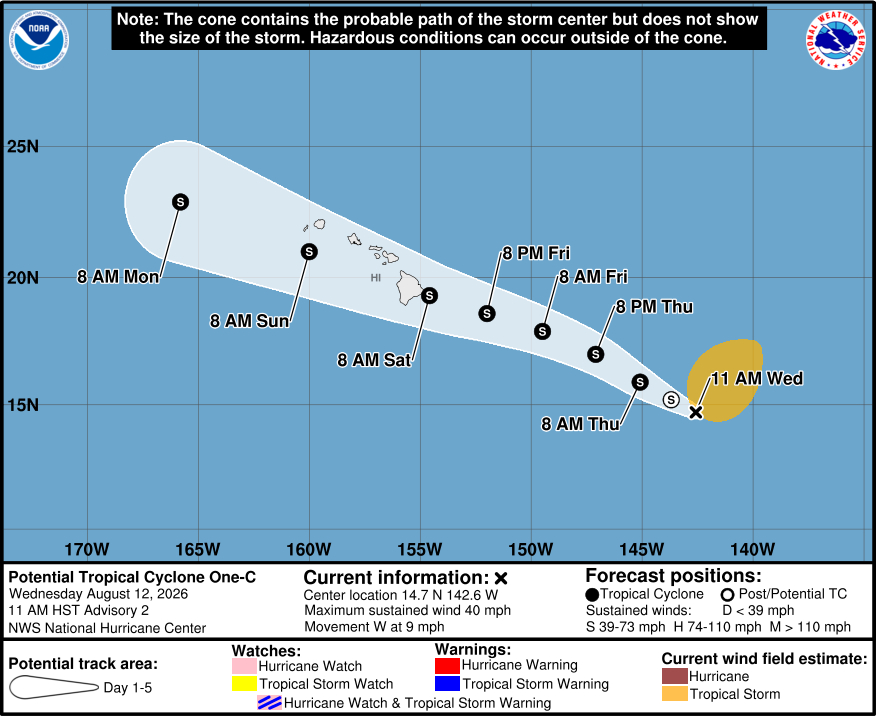
Some weekend events on Hawaiʻi island are already being canceled, and the U.S. Coast Guard has set port heavy-weather condition WHISKEY for commercial harbors of Maui and Hawaiʻi Counties.
It’s still very early in the development of this storm system, so precise impacts are not known. Emergency officials are urging residents to prepare for heavy rain, warning level surf, and possible wind impacts.
Forecasters have also said that fire weather could be a concern on Friday when high winds mix with dry conditions ahead of the approaching storm.
On Tuesday, fire crews were already fighting two wildlife fires that closed the Daniel K Inouye Highway. As of this morning, those fires had burned over 160 acres and were 60 percent contained.