
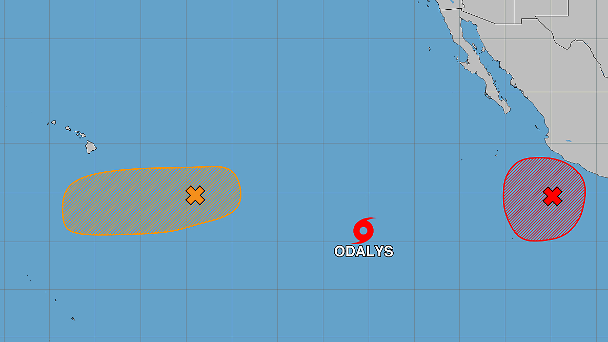

(BIVN) – A new tropical storm has formed in the Eastern Pacific, as a storm system to the southeast of Hawaiʻi could develop sometime this week.
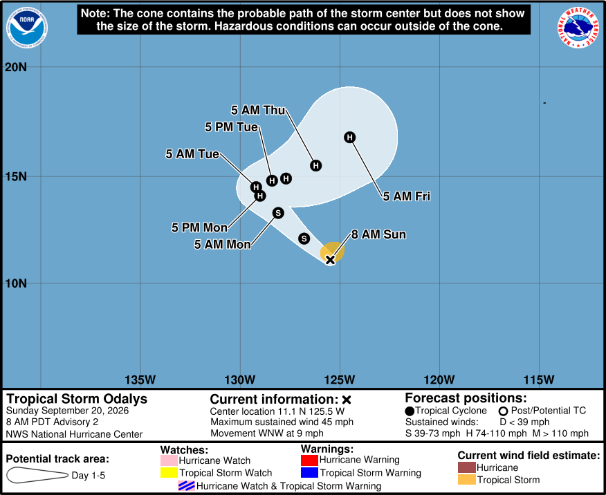
Tropical Storm Odalys was about 1,310 miles southwest of Baja California on Sunday morning, moving west northwest at 9 mph.
Odalys is forecast to become a hurricane by Monday, and is expected to take a sharp turn and head northeast. However, “there is significant uncertainty in the 3-5 day track of Odalys due its potential interaction with a developing tropical cyclone to its east,” the National Hurricane Center says. The storm does not appear to pose a threat to Hawaiʻi at this time.
Meanwhile, showers and thunderstorms associated with the former Tropical Depression Fifteen-E are located well east-southeast of the Hawaiian Islands. “Environmental conditions appear conducive for some development of this system by the middle to latter portion of this week as the system moves westward to west-southwestward, and a tropical depression could form to the south or southeast of the Hawaiian Islands once the environment becomes more favorable,” the National Weather Service says.
“As that system moves to the west, a trough associated with it will bring moisture towards the islands, which will increase shower activity mid- to late week,” the National Weather Service in Honolulu stated. “That trough will also help to disrupt the trade wind flow. As the previous discussion mentioned, global models suggest that unstable air associated with the trough should approach the Big Island by sometime early Wednesday. With precipitable water vales reaching over 2 inches, and with this surface feature nearby to provide sufficient lift, heavier showers are likely. Isolated thunderstorms were added to the forecast over primarily the eastern end of the state with this morning`s forecast package.”
The forecasters are recommended the public keep an eye on the storm system in the coming days due to the possibility of continued development.
