
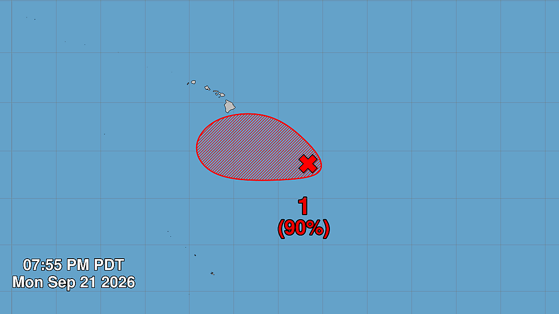

(BIVN) – Hawaiʻi officials are monitoring a developing storm located to the southeast of the Big Island, and the Hawaiʻi County Civil Defense issued its first radio message concerning the weather system on Monday.
As of 5 p.m. Monday evening, the remnants of Tropical Depression Fifteen-E were located several hundred miles southeast of the Hawaiian Islands. Environmental conditions are forecast to be conducive for further development, the National Hurricane Center says, and a tropical depression is likely to form around midweek while it moves slowly west-northwestward or northwestward.
“Interests in the Hawaiian Islands should monitor the progress of this system,” the National Hurricane Center advised.
The Hawaiʻi County Civil Defense said the storm “may pose a threat of bringing flooding rains and high winds to Hawaiʻi Island as early as Wednesday, that could linger into this weekend.”
“As a precaution, residents of Hawaiʻi Island are asked to remain vigilant and to take this time to develop your personal, family, and business emergency preparedness plans for possible heavy rain and windy conditions,” the emergency message stated.
From a Hawaiʻi County news release:
Although the impact still is unclear, the storm development is concerning because some forecasts show the storm following a track similar to Hurricane Lala in August.
“The possibility of another round of heavy rainfall in areas hit hard by Hurricane Lala is a major concern,” said Mayor Kimo Alameda. “As this develops, we will continue to provide the public with updates as well as work closely with the weather service and our other partners to prepare for whatever this storm might send our way.”
Preparedness to respond to the evolving storm hazards and reduce risk to life and property will be vital as forecasters gather more data about the potential cyclone and its path, said Darryl Oliveira, acting Civil Defense Administrator. “We can hope it stays weak or stays away, but we need to respect the potential power of the storm and be ready for whatever it brings,” he said.
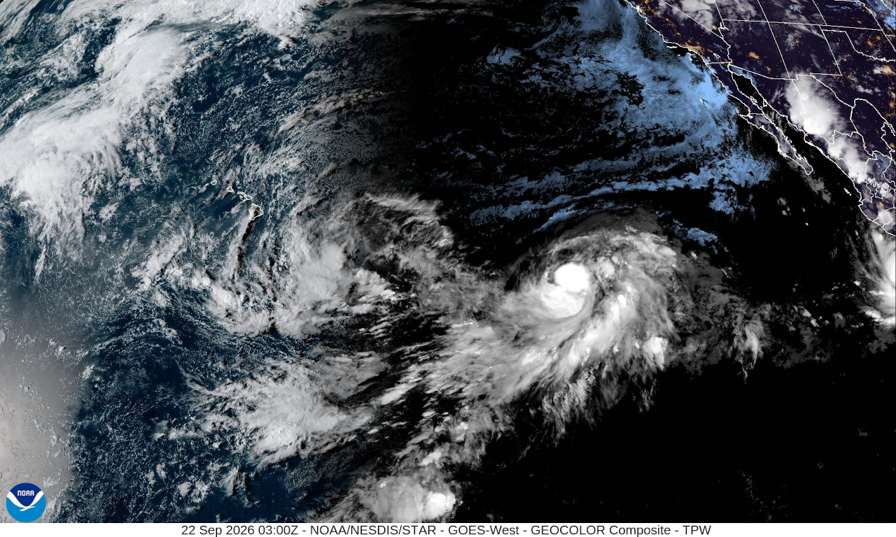
From the National Weather Service in Honolulu on Monday afternoon:
Satellite is showing increasing rotation this afternoon, and convection is increasing. Model spread remains large on the track of this system, and this is not likely to improve until Tuesday or Tuesday night, at the earliest. The latest ensembles continue to display a large spread in timing and location of the track. The general consensus continues to show the storm remaining south of the islands. However, there is a large spread concerning how far south… from just barely (brushing right up against the Big Island) to several hundred miles. The latest Google DeepMind ensemble shows this spread well.
Ensembles in general show the developing system moving WNW to a position roughly several hundred miles south of the Big Island sometime Wednesday night, then turning north Thursday. After that, there are too many possible solutions to reasonably describe with words. We are looking forward to when NHC begins to issue forecasts, and that should be sometime Tuesday or Wednesday.
This continues to be a rapidly evolving situation. Our best guess at this time is that impacts could start with increased rainfall on Big Island (and perhaps Maui County) as early as Wednesday or as late as Thursday. Winds will increase across the eastern end of the state regardless of which track the system takes, most likely Thursday into Friday. How strong the system gets, combined with how far away it is, will determine how high the wind speeds get. Rainfall totals covering the period from 6 AM HST Wednesday to 6 AM HST Saturday could exceed 10 inches on windward Big Island and 3 inches leeward, with over 4 inches on windward Maui. We currently expect 1 to 3 inches elsewhere (leeward Maui and all other islands). Note that this forecast may change *considerably*.
Isolated thunderstorms are possible, mainly over the eastern end of the state, from Tuesday night through Saturday night. Moist and deep tropical air will be advected northward over Big Island starting Wednesday (PW values over 2 inches). This airmass will likely move over Maui County as well, perhaps Wednesday night into Thursday. It is presently not clear if it will make it to Oahu and Kauai, as it depends on the exact track of the storm. This airmass will obviously make it easy to get heavy rain rates and increase the risk of flash flooding. A flood watch will likely be issued before Wednesday, and the timing of issuance depends on how confidence in the track evolves.
