
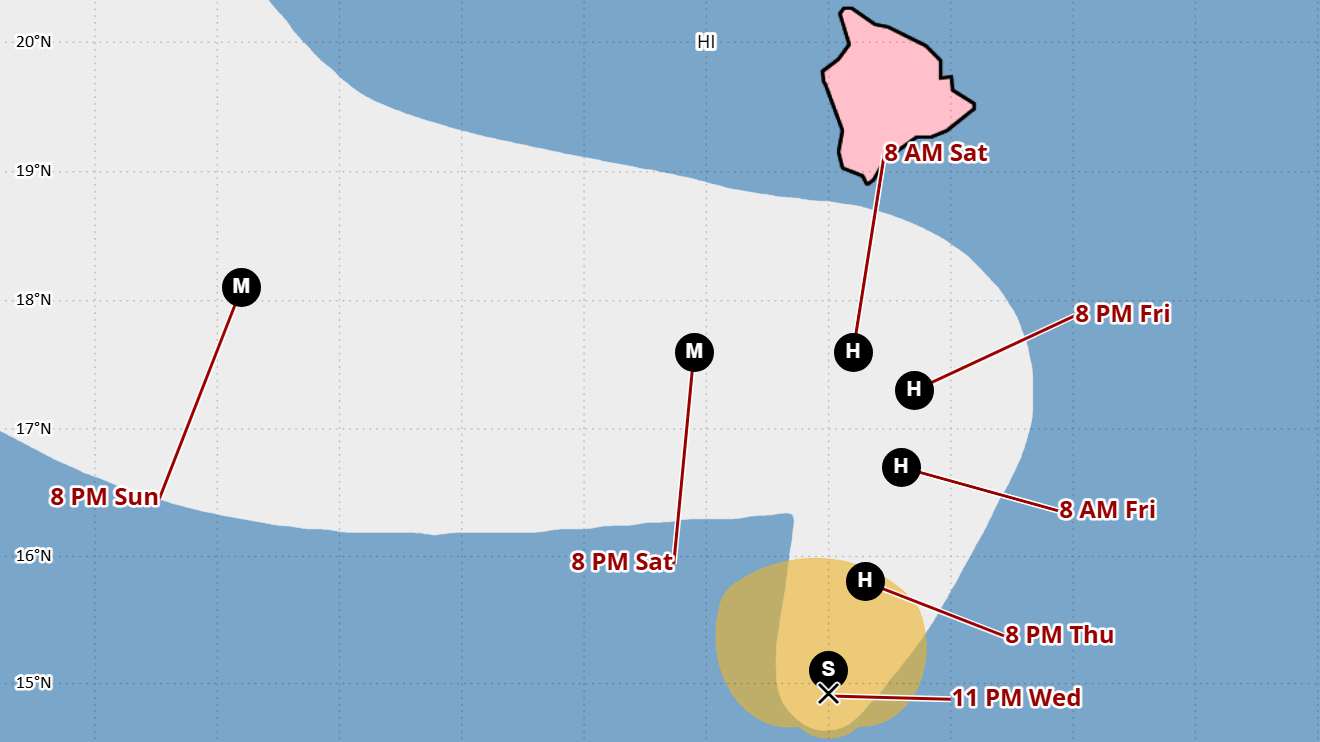

(BIVN) – Tropical Storm Nolo is strengthening to the south of Hawaiʻi island as the storm makes its way north at a slow 2 mph.
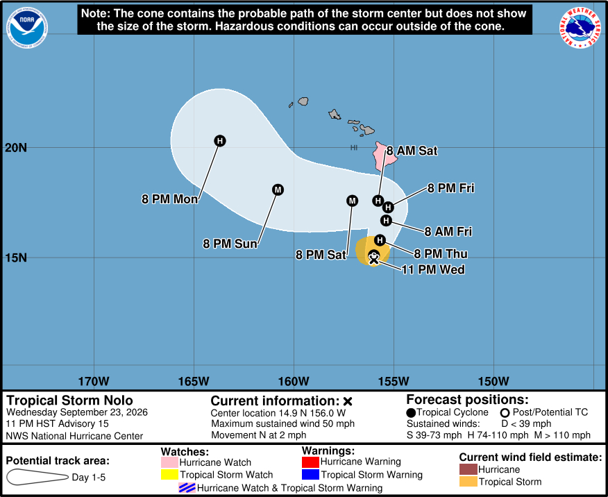
As of 11 p.m. on Wednesday evening, Nolo was located about 285 miles south of Kaʻū. Nolo is forecast to move north through Friday as it gathers strength, likely becoming a hurricane by Thursday night. Nolo is expected to make a sharp westward turn by Saturday in the vicinity of the Big Island.
“Rainfall along the northern edge of the system will gradually increase across the Big Island and Maui, leading to the potential for significant to locally catastrophic flooding mainly on windward and southeast Big Island,” the National Weather Service reported. Rainfall totals of 15 to 20 inches are forecast for across the Big Island, with maximum amounts of 35 inches in isolated areas.
From the Central Pacific Hurricane Center at 11 p.m. HST:
Nolo’s convective organization has gradually improved during the past several hours, with a curved band of persistent deep convection tightening around the circulation center. The latest subjective Dvorak intensity estimates from JTWC and HFO are both T2.5/35 kt, while objective intensity estimates range from 35 to 55 kt. Given the improved convective organization and the higher objective estimates, the initial intensity is raised to 45 kt.
Nolo has slowed considerably and appears to be making its anticipated northward turn, with an initial motion of 360/2 kt. A weakening subtropical ridge northeast of Hawaii should allow Nolo to continue moving slowly northward into Thursday, followed by a north-northeastward motion as an upper-level trough deepens northwest of the Hawaiian Islands. As the trough shifts westward and the subtropical ridge rebuilds north of the cyclone, Nolo is forecast to make a sharp westward turn Friday night into Saturday. The latest GDMI and HCCA guidance has shifted slightly northward, bringing the system closer to the Big Island. Given the run-to-run inconsistencies in the guidance, the NHC track forecast is essentially an update of the previous advisory and shows Nolo passing south of the Big Island on Saturday before continuing westward south of the smaller Hawaiian Islands through the latter portion of the weekend. However, considerable uncertainty remains regarding the influence of the deepening upper-level trough on Nolo’s track, as well as the timing and strength of the subtropical ridge rebuilding north of the cyclone. Even relatively small differences in the evolution of these steering features could significantly alter the timing and location of Nolo’s sharp westward turn and, ultimately, how close its center passes to the Big Island. A track closer to the Big Island could also result in interactions with the island’s terrain that could further influence the cyclone’s subsequent motion. Given these uncertainties, confidence in the track forecast remains lower than normal.
Environmental conditions remain favorable for strengthening, with very warm sea surface temperatures and plenty of mid-level moisture along the forecast track. However, around 10 kt of easterly vertical wind shear may temper the rate of intensification during the next 24h or so. As the shear relaxes and Nolo continues to develop an inner core, a faster rate of intensification is forecast while the cyclone moves northward to north-northeastward during the next couple of days. These conditions could support a period of rapid intensification, and Nolo is forecast to become a hurricane by Thursday night and reach major hurricane strength on Saturday as it passes south of the Big Island. The latest NHC intensity forecast hovers near the upper end of the guidance envelope throughout the forecast period. A track closer to the Big Island could substantially increase the threat of damaging winds, particularly over higher terrain, along exposed ridges, and in areas downwind of the ridges.
Key Messages:
1. Tropical Storm Nolo is expected to strengthen into a hurricane by Thursday night as it moves northward to north-northeastward, potentially making its closest approach to the Big Island of Hawaii as a major hurricane on Saturday. A Hurricane Watch remains in effect for the Big Island, and residents there should follow advice given by local officials, including evacuating if told to do so.
2. The time to prepare for significant heavy rain and flooding impacts on the Big Island is now, as heavy rain becomes more likely by Thursday and Friday. Periods of heavy rain are likely to continue across the Big Island and Maui through the weekend. Life-threatening, catastrophic flooding and mudslides are possible, especially in areas of steep terrain across the Big Island and Maui. Across the remainder of Hawaii, lesser rainfall totals are expected, with isolated flooding possible.
3. Large and damaging waves are possible along portions of the Big Island’s coastline into the weekend.
4. Interests elsewhere in Hawaii should closely monitor the latest forecast updates and ensure that they have their preparedness plans in place.
