
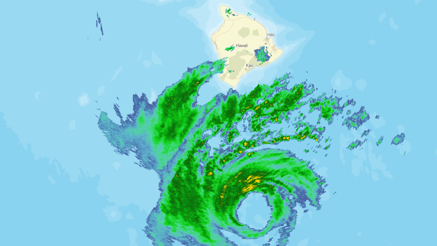

(BIVN) – Hurricane Nolo was stationary for much of Friday evening, located about 145 miles south of Kaʻū. Still, gusts in excess of 50 mph have been reported over the Big Island and Maui in the last couple of hours. The Hawaiʻi Police Department reported that Kohala Mountain Road in North Kohala was closed due to a high winds, between mile markers 1 and 20.
A Tropical Storm Warning and Hurricane Watch remain in place for Hawaiʻi County.
As of Friday evening, Nolo’s hurricane-force winds were extending outward up to 45 miles from its center, and tropical-storm-force winds were extending outward up to 140 miles.
The National Weather Service reported some of the outer-most rainbands were beginning to move over the Big Island southeast slopes at 9 p.m.
Hurricane Nolo is expected to begin its turn to the west over the next several hours.
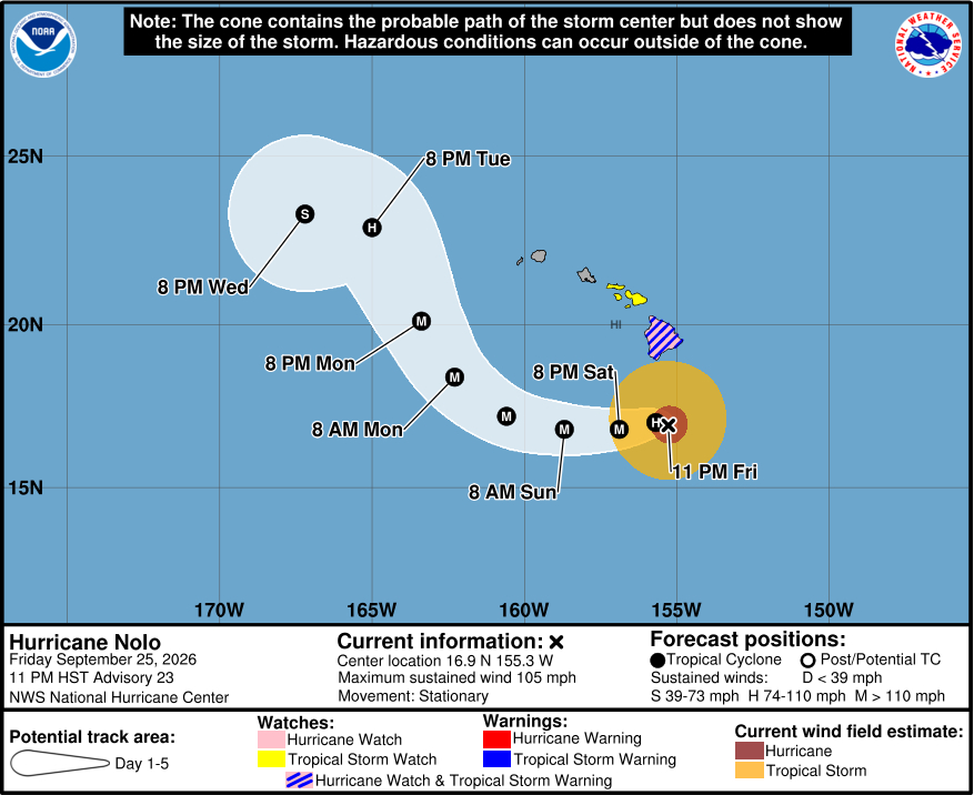
From the Central Pacific Hurricane Center’s most recent discussion posted at 11 p.m. HST:
Nolo’s satellite and radar presentations have improved slightly during the past few hours, with less erosion of the convection noted on the eastern side of the circulation. However, an Air Force Reserve Hurricane Hunter aircraft currently investigating the storm has only measured a maximum 700-mb flight-level wind of 85 kt, and dropsonde data suggest the central pressure continues to oscillate around 985 mb. The current intensity is maintained at 90 kt while the plane continues its mission sampling the wind field.
Radar and aircraft fixes indicate that Nolo’s center has been nearly stationary, or meandering, for the past 6 hours or so. Mid-level high pressure is building north of the Hawaiian Islands, which is expected to force Nolo to begin moving slowly westward Saturday morning, and then gradually increase in speed over the next couple of days. The mid-level trough that had been steering Nolo northward is forecast to re-amplify west of the main Hawaiian Islands by the end of the weekend, which should cause Nolo to turn northwestward and north-northwestward by Monday and Tuesday. Nolo’s interaction with the mid-level trough/low could then cause the storm to turn westward again by day 5. For the most part, the NHC official forecast is unchanged from the previous advisory, except a little bit faster and to the west on day 5, and it lies close to the HCCA consensus aid.
The shear that has been affecting Nolo is expected to diminish and reach a minimum in about 36 to 48 hours. As a result, strengthening is still forecast, with Nolo likely becoming a major hurricane on Saturday and reaching a peak intensity by late Sunday. The NHC forecast lies near the upper end of the intensity guidance envelope. Deep-layer shear is expected to increase substantially in about 3 days when Nolo begins to interact with the trough, and that should cause the hurricane to weaken and potentially become a tropical storm by day 5.
Key Messages:
1. Nolo is expected to remain south of the Big Island of Hawaii through Saturday before turning westward and moving away from the island. Tropical storm conditions are occurring on the Big Island, especially in areas of steep terrain, and hurricane conditions are possible in those areas on Saturday. Residents should follow advice given by local officials, including evacuating if told to do so.
2. Periods of heavy rain are expected to expand across the Big Island and eastern Maui tonight, then continue through the weekend. Significant, life-threatening flooding and mudslides are possible, especially in areas of steep terrain across the eastern and southern portions of the Big Island and Maui. Across the remainder of Hawaii, lesser rainfall totals are expected.
3. Large and damaging waves are likely along portions of the Big Island’s coastline into the weekend.
4. A Tropical Storm Watch is in effect for Maui County, where gusts to tropical storm force are already occurring in some areas of steep terrain. Regardless of the exact track of Nolo, strong and gusty winds are expected for all of the Hawaiian Islands through the weekend.
