
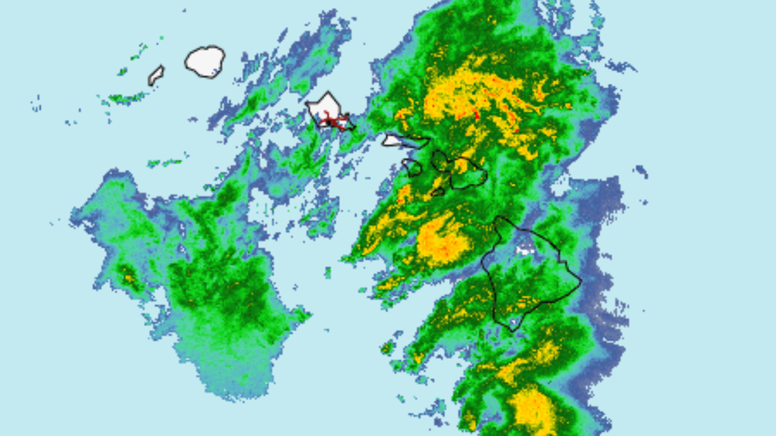

(BIVN) – A Flood Watch remains in effect for the entire State of Hawaiʻi, and a High Wind Warning continues for the summit of Maunakea and Mauna Loa.
A trough is moving over the state, bringing tropical moisture that is expected to produce heavy rain and isolated thunderstorms though this evening. The weather conditions could result in flash flooding, with the greatest flood threat to Oʻahu and Maui County. However, officials say all islands are at risk.
Big Island summits are forecast to experience southwest winds of 30 to 40 mph, with gusts up to 65 mph.
The Maunakea Summit Access Road is closed to the public at the Visitor Information Station.
Hawaiʻi Volcanoes National Park reports the Mauna Loa Summit, Puʻuulaula (Red Hill) and the cabins are temporarily closed due to severe weather through October 28.
From the National Weather Service discussion posted on Wednesday morning:
Showers and a few isolated thunderstorms are ongoing across the state this morning. The bulk of the rain has stayed over the central portions of the state with heavier rain moving towards Molokai, Lanai and Maui. Total rainfall that has fallen ranges from a half inch to 2 inches over portions of Oahu. Slow moving cells may become anchored along the terrain of the islands, which could lead to flash flooding anywhere. The High Wind Warning for the Big Island summits continues through noon. The Flood Watch will also continue and the possibility of extending it will be evaluated today. A few thunderstorms with localized damaging gusty winds may develop along the trough.
The threat of heavy rainfall will diminish Thursday and Friday. The jet stream aloft will lift to the north as the upper level trough moves to the west and an upper level low develops along the trough. The weak surface trough, with ample moisture will likely linger, providing a chance for spotty heavy showers.
Friday night into Saturday a brief period of trade winds may return as the lingering moisture associated with the trough is pushed south of the islands. The GFS and ECMWF are showing breezy northeast winds developing Sunday as a shallow front moves near or over the state.
