

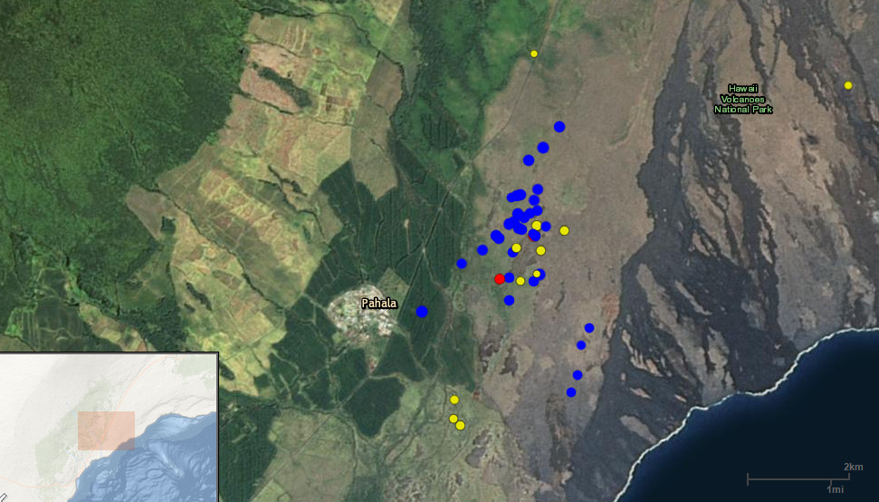
Earthquake Swarm Observed Near Pahala

Big Island Video News

Oct 27, 2015

STORY SUMMARY

PAHALA: A small increase in earthquake activity on the southwest rift of Kīlauea near Pahala has been observed over the past few days.

Screen capture taken Monday showing the USGS interactive earthquake map. The swarm is makai of Highway 11, north of Pahala town.

PAHALA, Hawaii – A small increase in earthquake activity on the southwest rift of Kīlauea near Pahala has been observed over the past few days.

An interactive USGS map shows the location of the quakes, and the USGS Hawaiian Volcano Observatory had this to say in Tuesday’s Kilauea status update:

USGS

“The increase in earthquake activity on the southwest rift of Kīlauea continues. Earthquake swarms in this area are not unusual, and have not correlated with any significant change in activity of the volcano. These deep earthquakes (20-40 km or 12-25 miles) are associated with the conduit supplying magma from the mantle hotspot to the volcano’s summit. “USGS Hawaiian Volcano Observatory on Oct. 27, 2015

About The Featured Image

Screen capture taken Monday showing the USGS interactive earthquake map. The swarm is makai of Highway 11, north of Pahala town.


Image placeholder

Big Island Video News has been serving Hawaiʻi island since 2008.

Leave a Comment