HAWAII VOLCANOES NATIONAL PARK, Hawaii – Two lava flow breakouts from the north and east flanks of Puʻu ʻŌʻō, which began on May 24, continue to be active.
The USGS Hawaiian Volcano Observatory reports the most recent aerial observations showed that neither flow had advanced significantly in the past week and are primarily resurfacing areas they had already covered. Both lava flows are within 0.8 miles of their respective vents on the flanks of Puʻu ʻŌʻō.
On June 2, scientists plotted the recent changes to Kīlauea’s active East Rift Zone lava flow field, and posted this new map on the USGS HVO webpage.
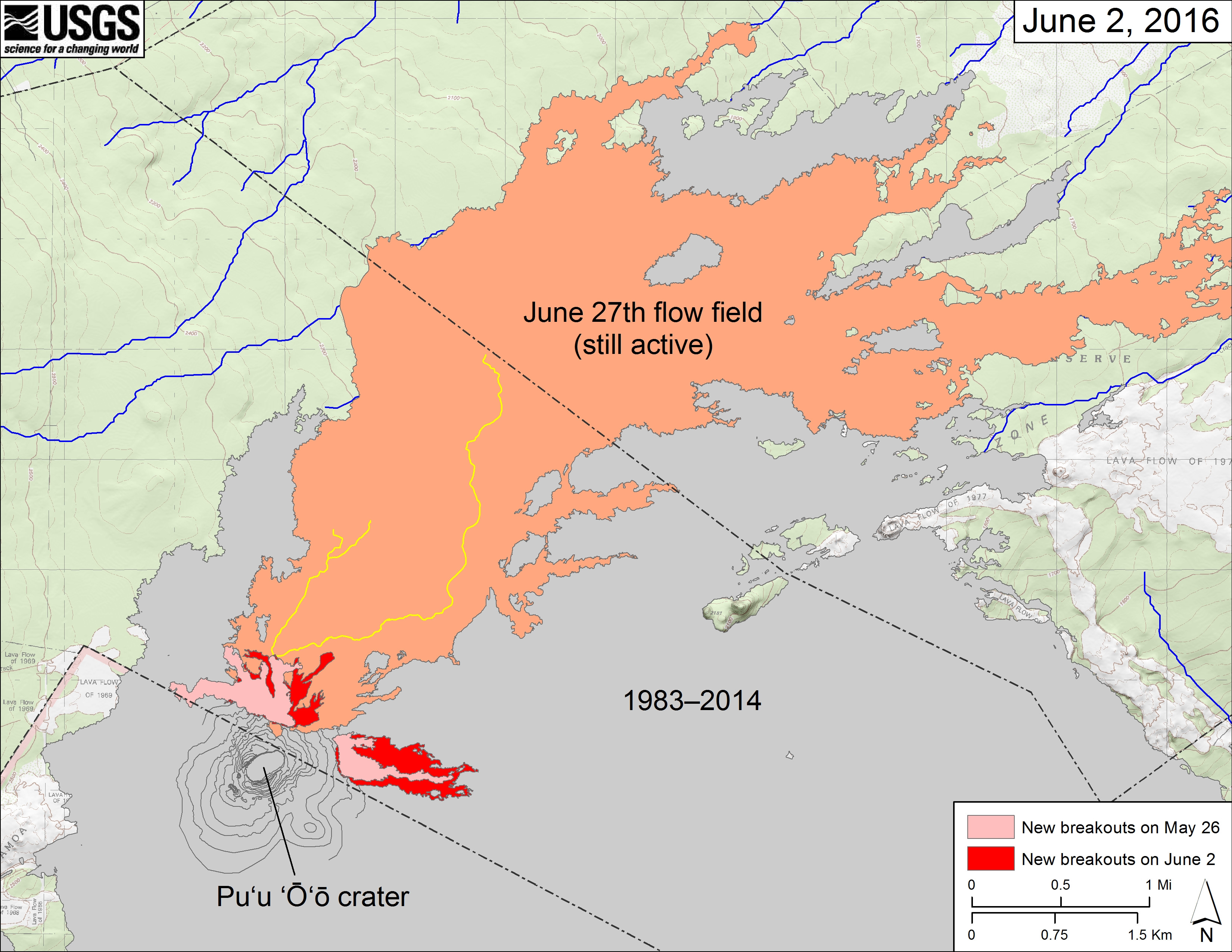
USGS map: The area covered by the June 27th flow as of June 2 is shown in orange. The areas covered by the new breakouts at Puʻu ʻŌʻō as of May 26 are shown in pink, while widening and advancement of the new breakouts as mapped on June 2 is shown in red. The yellow lines show the mapped portion of the lava tube system for the June 27th flow, which is still active in scattered areas within about 5.4 km (3.4 mi) to the northeast of Puʻu ʻŌʻō (not shown). Puʻu ʻŌʻō lava flows erupted prior to June 27, 2014, are shown in gray. Click for a closer view.
On June 3, USGS geologist Tim Orr demonstrated how he makes the maps that chart the progress of the lava flows. The video is above.

by Big Island Video News
on at
STORY SUMMARY
KILAUEA (BIVN) - USGS Hawaiian Volcano Observatory geologist Tim Orr demonstrates techniques in plotting the breakouts on Puʻu ʻŌʻō, which erupted on May 24 and continue to be active.