UPDATE – (9:35 p.m. HST) – In a third and final message for Hawaiʻi, the Pacific Tsunami Warning Center said that “based on all available data a destructive Pacific-wide tsunami is not expected and there is no tsunami threat to Hawaiʻi.”
No tsunamis were observed at nearby deep ocean gauges, the PTWC reported.
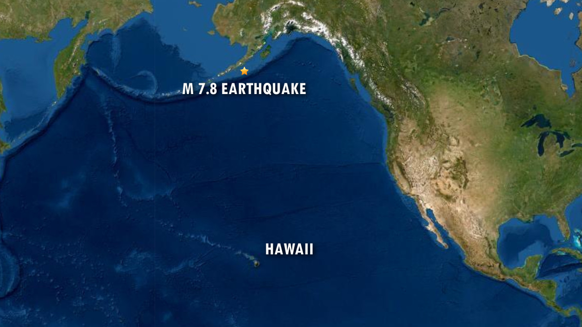
(BIVN) – A Magnitude 7.8 earthquake 75 miles south of Chignik, Alaska has triggered a Tsunami Warning from the Pacific Tsunami Warning Center, but the extent of the threat is currently unknown.
Just after 9 p.m. HST, the PTWC said a tsunami threat exists for parts of the Pacific located closer to the earthquake, “but it is still too early to determine whether there is a possible tsunami threat to Hawaiʻi.”
“If there is a tsunami threat to Hawaiʻi… the earliest estimated time the hazard might begin is 12:48 a.m. HST” on Wednesday, July 22nd.
“Further statements will be issued hourly or sooner as the situation develops,” the Pacific Tsunami Warning Center said.
The USGS provided this “Tectonic Summary” of the earthquake:
The July 22, 2020, M 7.8 earthquake southeast of Perryville, Alaska (south of the Alaska Peninsula), occurred as the result of thrust faulting on or near the subduction zone interface between the Pacific and North America plates. The preliminary focal mechanism solution indicates rupture occurred on a fault dipping either shallowly to the northwest, or steeply to the southeast. The location, mechanism and depth – and the large size of the event – are all consistent with slip occurring on the subduction zone interface between the two plates. At the location of this event, the Pacific plate converges with North America to the northwest at a rate of about 64 mm/yr, subducting at the Alaska-Aleutians trench 125 km to the southeast of the earthquake.
While commonly plotted as points on maps, earthquakes of this size are more appropriately described as slip over a larger fault area. Thrust faulting events of the size of the July 22, 2020 earthquake are typically about 120×50 km (length x width).
Large earthquakes are common in the Alaska-Aleutian subduction zone. Since 1900, 6 other earthquakes M7 and larger have occurred within 250 km of the July 22, 2020 event. The largest of these was a M8.2 earthquake on November 10, 1938, which occurred in an almost identical location as this July 22, 2020 earthquake. The Alaska-Aleutian Trench also hosted the second largest earthquake recorded by modern seismic instrumentation, the M9.2 March 27 1964 earthquake, which ruptured to within about 250 km of this event, at the eastern end of the 1938 rupture area. The 1938 event produced a small tsunami that was recorded both locally and in Hilo, Hawaii. The remote location of the earthquake resulted in little impact to people and infrastructure.
This story will be updated.

by Big Island Video News
on at
STORY SUMMARY
HONOLULU - A Magnitude 7.8 earthquake 75 miles south of Chignik, Alaska triggered a Tsunami Warning from the Pacific Tsunami Warning Center.