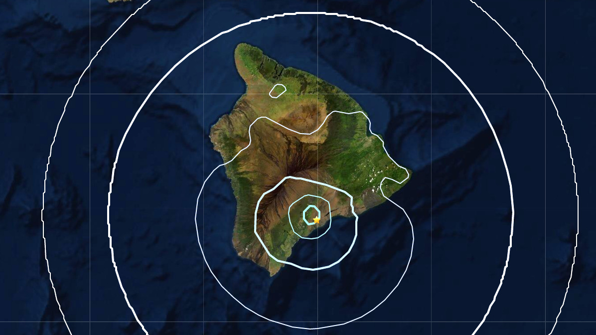
(BIVN) – A pair of earthquakes located deep below the Kaʻū region of Hawaiʻi were felt across the Big Island on Sunday.
A Magnitude 3.9 earthquake struck at 11:15 a.m. HST, followed by a Magnitude 3.8 earthquake at 11:17 a.m. HST. Both were measured at a depth of about 20 miles. Less than a hundred people on all sides of Hawaiʻi island felt the two earthquakes.
The earthquakes appear to be a part of the ongoing Deep Pāhala swarm. From a previous Volcano Watch article:
Previous geophysical studies have theorized that deep earthquake activity beneath the Pāhala region may be related to hot spot magma transport and/or faulting in the brittle upper mantle beneath the island. Interestingly, the area of elevated seismicity is almost equidistant from the summits of the three most active volcanoes in Hawaiʻi: Kīlauea, Mauna Loa, and Kamaʻehuakanaloa (Lō‘ihi Seamount).
Whether this region has a possible connection to the shallower magma storage and transport systems of Kīlauea or Mauna Loa is unclear, but there are no obvious indicators of magma transport from this region to the surface. Previous studies relied on data collected from HVO’s widely-spaced permanent seismometers in the region, which were not configured to study this area in detail.
Earlier this month, the USGS Hawaiian Volcano Observatory installed seismic nodes in the Kaʻū district along the on the Southwest Rift Zone of Kīlauea volcano.
“With permission from Hawai‘i Volcanoes National Park and other landowners, the seismic nodes are being temporarily deployed over the summer to record ground shaking generated by earthquakes,” the USGS reported. “HVO scientists will use the data to create images of the structure of the Earth beneath Pāhala from as great as 40–50 km (25–31 miles) below sea level all the way to the surface.”