(BIVN) – The storm that was following behind Hurricane Hone last week is not expected to have significant impacts on Hawaiʻi, officials say.
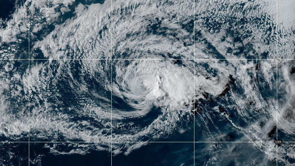
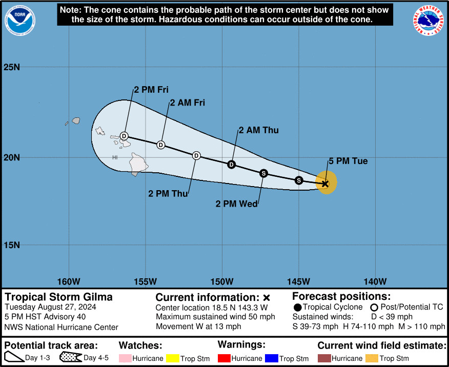
Tropical Storm Gilma, once a major hurricane, is rapidly weakening as it moves west in the Central Pacific.
The forecast track shows the remnants of Gilma should approach the Hawaiian Islands on Friday. The Central Pacific Hurricane Center in Honolulu says Gilma is expected to weaken to a remnant low by Thursday or Thursday night.
Still, there could be some weather-related hazards.
“The remnants of Gilma may bring heavy rainfall to portions of the Hawaiian Islands as early as Friday, lasting through Saturday,” the Central Pacific Hurricane Center said in a 5 p.m. update. “Easterly swell generated by Gilma will build over waters around the Hawaiian Islands today and tonight. These swells may produce high surf along east-facing shores of some islands from Wednesday into Friday.”
From the National Weather Service:
Gilma will continue to weaken and become a tropical depression as it approaches the main Hawaiian Islands and encounters a combination of cooler waters and increasing wind shear. Local impacts will depend on Gilma’s track, but will likely be minimal. The strongest winds (around 30 kts or less) are expected to remain offshore as Gilma approaches the islands and winds will actually weaken and possibly take on a more southeasterly component across land areas Friday night into Saturday. A more southerly track would bring a greater probability of wet trade wind weather. Given the uncertainty in Gilma’s track, timing of the heaviest rainfall is a little uncertain, but is currently looking like it will be Thursday evening through Saturday morning. Even so, rainfall totals are looking rather insignificant with windward areas currently expected to receive up to 1 to 3 inches of rain during the Thursday evening through Saturday morning period.
Behind Gilma is Tropical Storm Hector, which is forecast to gradually weaken over the next few days. Little to no impacts are expected from Hector at this time, the NWS says.

by Big Island Video News
on at
STORY SUMMARY
ISLAND OF HAWAIʻI - Both Tropical Storm Gilma and Tropical Storm Hector are weakening as they move west over the Pacific.