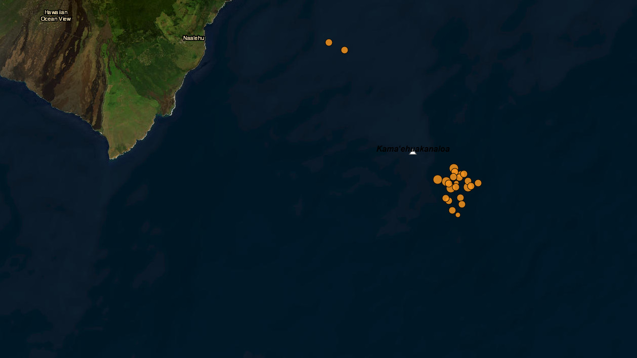
(BIVN) – An earthquake swarm was detected offshore of Hawaiʻi island overnight, at the submarine Kama‘ehuakanaloa volcano.
Formerly known as Lō‘ihi Seamount, Kama‘ehuakanaloa is an active volcano built on the seafloor south of Kīlauea, about 19 miles from shore.
Several earthquakes, ranging from magnitude-2 to 3.8, were located in the area.
The earthquake activity appears to have decreased as of Saturday morning. The swarm had no apparent effect on Kīlauea, scientists reported.
From the USGS summary describing Kama‘ehuakanaloa, written well before the latest earthquake swarm:
The seamount rises to 975 m (3,189 ft) below sea level and generates frequent earthquake swarms, the most intense of which occurred between July 16-August 9, 1996 (more than 4,000 events). An eruption at Kama‘ehuakanaloa has yet to be observed, but research indicates that eruptions are both explosive and effusive. Kama‘ehuakanaloa’s volume is 1,700 km3 (407 mi3), and it is considered to be between pre-shield and shield stage.
The summit of Kama‘ehuakanaloa is marked by a caldera-like depression 2.8 km (1.7 mi) wide and 3.7 km (2.3 mi) long. Three collapse pits or craters occupy the southern part of the caldera; the most recent pit formed during the 1996 earthquake swarm. Named Pele’s Pit, the new crater is about 600 m (1,970 ft) in diameter and its bottom is 300 m (985 ft) below the previous surface! Like the volcanoes on the Island of Hawai‘i, Kama‘ehuakanaloa has grown from eruptions along its 31-km-long (19-mi-long) rift zone that extends northwest and southeast of the caldera.
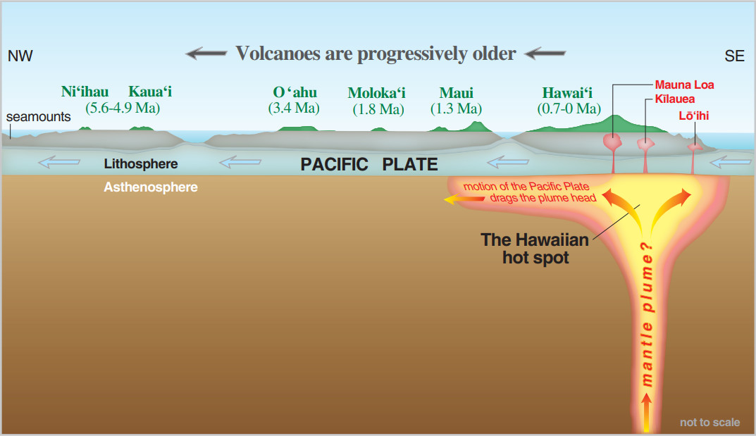
USGS image from General Information Product 135: “A highly simplified cross-section view along the Hawaiian Island chain showing the inferred mantle plume that has fed the Hawaiian “hot spot” on the overriding Pacific tectonic plate. The geologic ages of the oldest volcano on each island (Ma = millions of years ago) are progressively older to the northwest, consistent with the hot-spot model for the origin of the island chain.” (Modified from “This Dynamic Planet,” see online resources.)
It’s not known when Kama‘ehuakanaloa will breach sea level. We can speculate that with a growth rate of 5 m (16.4 ft) per 1000 years it will take as much as 200,000 years to reach the ocean surface. It all depends upon the eruption rate.
The volcano’s former name, Lō‘ihi, means “long” in Hawaiian and was introduced in 1955 to describe the elongate shape of the seamount. More recently, Hawaiian scholars have found that stories of “Kama‘ehu,” the red island child of Haumea (earth) and Kanaloa (sea) that rises from the deep in the ocean floor may also be a reference to this submarine volcano. In 2021, the Hawaii Board on Geographic Names updated the volcano’s name to Kama‘ehuakanaloa.

by Big Island Video News
on at
STORY SUMMARY
HAWAIʻI ISLAND - The offshore earthquake swarm occurred overnight at Kama‘ehuakanaloa volcano, formerly Lō‘ihi Seamount.