(BIVN) – The number of earthquakes under Kīlauea volcano is again on the rise, following a period of relative quiet in the wake of September’s brief eruption on the Southwest Rift Zone.
Kilauea is not erupting and the USGS Alert Level remains at ADVISORY.
In a weekly update, the USGS Hawaiian Volcano Observatory detailed the uptick in seismicity across the Hawaiʻi island volcano.
From the USGS HVO update posted just after noon on Tuesday, December 3:
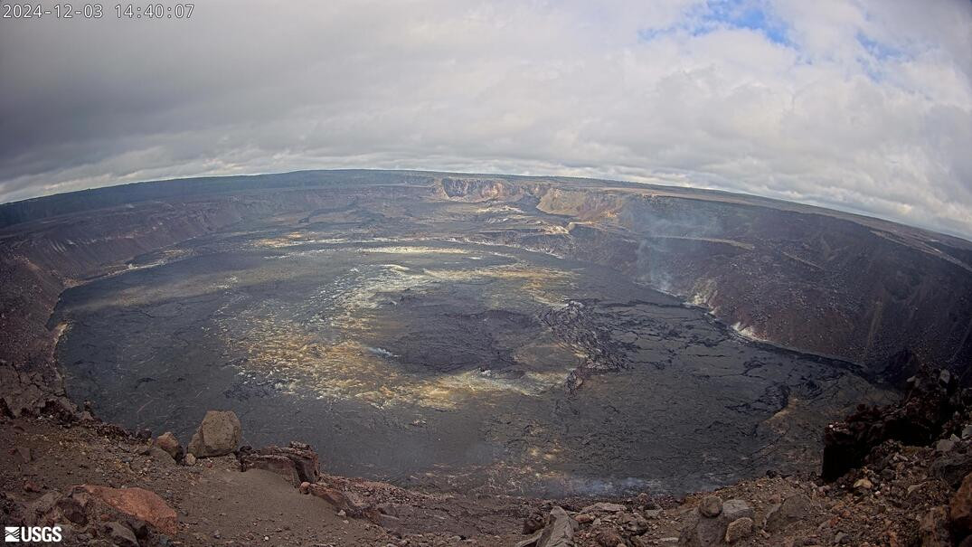
Summit Observations: Earthquake activity at Kīlauea’s summit region has increased in the past week, going from approximately 10 located earthquakes per day to 20 per day. Short-lived flurries of small earthquakes, with rates of about 6 events per hour, were observed on November 29 and December 3. Activity has generally clustered within Kaluapele and the south caldera region. Overall, there were approximately 75 earthquakes at the summit, most below magnitude-2.1. Summit tiltmeters and GPS stations have recorded steady inflation in the summit and south caldera regions. This inflation is also seen in recent InSAR measurements from satellite observation. The most recent sulfur dioxide (SO2) emission rate measurement from the summit was approximately 68 +/- 24 tonnes per day on October 17, a value representative of noneruptive conditions at Kīlauea.
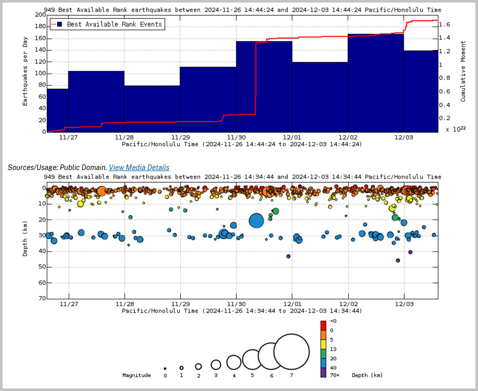
Above Top: Number of earthquakes per day during the past week (blue bars). The red line is the cumulative moment (energy) release. Bottom: Depth of earthquakes during the past week in the area shown on the map above. Depth is reported relative to sea level, which is equal to a depth of zero on the above plot. On both figures, circle-size represents magnitude, and color indicates depth. (USGS graphs)
Rift Zone Observations: The upper Southwest Rift Zone has seen a minor increase in seismicity, with approximately 25 located earthquakes below magnitude-2.0, most of which occurred over the past two days. Shallow earthquake counts in the upper East Rift Zone (ERZ) have increased over the past week, averaging between 25-60 located earthquakes per day, most of which were below magnitude-2.5. Activity in the middle ERZ was similar to the previous week, with approximately 75 located earthquakes, between Makaopuhi and Puʻuʻōʻō, all below magnitude-2.0. Deformation in the ERZ remains steady.
Analysis: The increased rates of seismicity and ground deformation observed over the past week indicate a higher level of unrest at Kīlauea’s summit region compared to previous weeks. Seismic activity reflects ongoing inflation as magma accumulates within the volcano. No unusual activity has been noted east of Puʻuʻōʻō, along Kīlauea’s lower East Rift Zone.
HVO scientists say they will continue to issue weekly Kīlauea updates on Tuesdays until further notice.

by Big Island Video News
on at
STORY SUMMARY
HAWAIʻI VOLCANOES NATIONAL PARK - In a new update, scientists confirmed earthquake activity at Kīlauea's summit region has increased over the past week.