(BIVN) – Episode 16 in the ongoing Kīlauea summit eruption has ended.
On Thursday, bright green sulfur deposits were visible on the cones of the inactive vents, and heavy steam was present in the area.
The eruptive episode that began on Monday night lasted just over 37 hours. The last 25 hours featured high lava fountains, often reaching heights of 600 to 700 feet, or 180 to 210 meters.
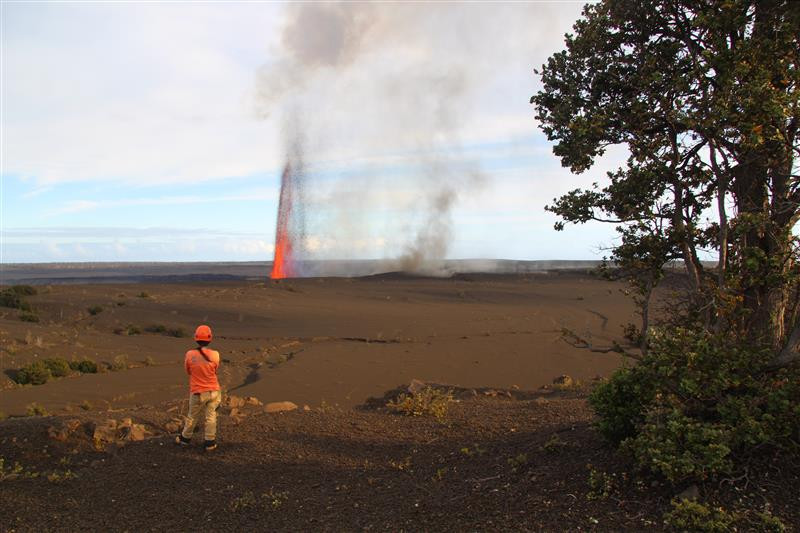
USGS: “On April 1, lava fountains from Kīlauea’s ongoing summit eruption prevented geologists from accessing the rim of Halemaʻumaʻu crater within the closed portion of Hawaiʻi Volcanoes National Park. Instead, they hung back along the closed portion of Crater Rim Drive to collect samples of tephra that was intermittently blown in their direction. Here, a USGS Hawaiian Volcano Observatory geologist watches over the tephra fallout zone from the eruption, waiting for wind conditions to permit sample collection.” (USGS photo by M. Zoeller)
Lava flows covered half of the summit crater floor.
During this event, the primary hazard of concern was the volcanic material that was deposited in closed areas of Hawaii Volcanoes National Park.
Downwind, the piles of ash and tephra grow higher with each episode. One sign, marking the Southwest Rift Zone of Kīlauea, used to stand at least 6 feet (2 meters) above the ground surface. Its now almost entirely buried.
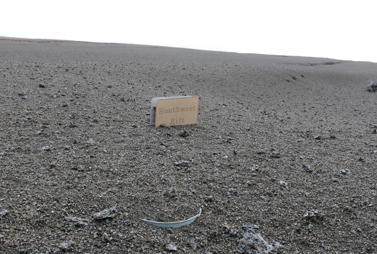
USGS photo by K. Mulliken.
Material was also reported falling on Highway 11 between mile marker 35 and 37. In this photo, tephra and Pele’s hair are visible along the centerline and on the shoulder of the highway.
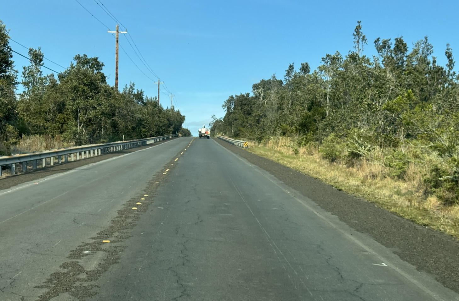
USGS photo by K. Mulliken.
Summit tiltmeter recorded just over 14 micro-radians of deflation during episode 16. When the fountains stopped, deflation switched to inflation. The summit magma reservoir is now repressurizing, and the USGS Hawaiian Volcano Observatory reports the next eruptive episode is likely to begin later next week.
It appears this cycle of episodic activity will continue, providing visitors with spectacular views outdoors; or indoors, like in the photo below, taken at the historic Volcano House. The USGS noted the last time diners were treated to a scene like this was over 65 years ago, calling it a truly a once in a lifetime experience.
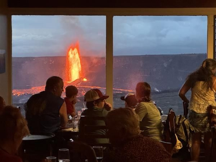
USGS photo posted to social media.
There is currently no significant activity along Kīlauea’s East Rift Zone or Southwest Rift Zone, and the Volcano Alert Level remains at WATCH.

by Big Island Video News
on at
STORY SUMMARY
HAWAIʻI VOLCANOES NATIONAL PARK - The USGS Hawaiian Volcano Observatory reports the next eruptive episode is likely to begin later next week.