(BIVN) – A tropical depression has formed to the southeast of Hawaiʻi, one of multiple disturbances that are being tracked by the Central Pacific Hurricane Center.
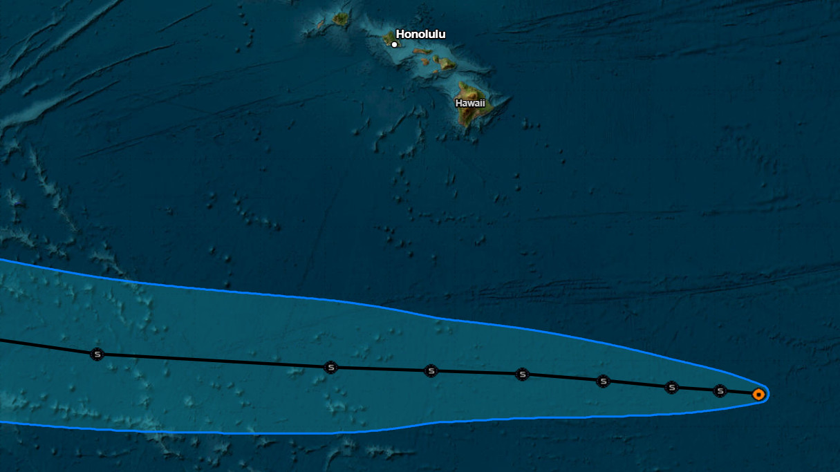
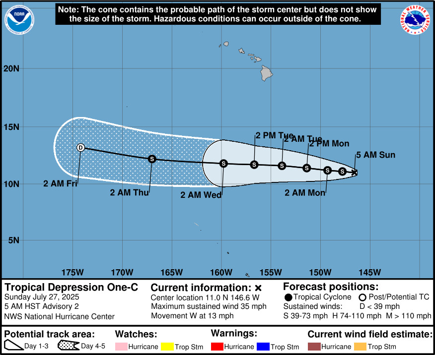
Tropical Depression One-C is 825 miles southeast of Hilo, moving west at 13 mph. Forecasters expect the depression to become a mid-grade tropical storm and pass well to the south of Hawaiʻi island.
The National Weather Service says this system is not expected to impact the Hawaiian Islands.
From the discussion posted at 5 a.m. by the NWS National Hurricane Center:
The system is moving nearly due westward at about 11 kt. A continued westward motion is expected through the week as the cyclone moves on the south side of a narrow mid-level ridge. Although there is some spread in the guidance, there is high confidence that the system should stay well south of the Hawaiian Islands. The NHC track forecast leans toward the southern side of the guidance envelope, in best agreement with the HCCA consensus aid. This forecast is quite close to the previous one.
The environmental conditions favor slow strengthening during the next couple of days, and therefore, the NHC forecast follows the previous one and shows strengthening to a mid-grade tropical storm during that time period. However, this intensity forecast is a little lower than the HCCA and IVCN models since it might take some time for the vortex to align vertically and organize. Weakening should begin beyond a couple of days when the system moves over slightly cooler waters and into an environment of drier air and moderate to strong shear. The cyclone is forecast to become a remnant low by day 5, but it could open into a trough by then.

by Big Island Video News
on at
STORY SUMMARY
HONOLULU - Tropical Depression One-C is forecast to become a mid-grade tropical storm and pass well to the south of Hawaiʻi island.