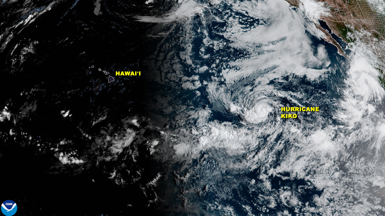
(BIVN) – Kiko has become a hurricane, less than 1,815 miles east of Hilo in the Eastern Pacific.
Maximum sustained winds have increased to near 85 mph (140 km/h) with higher gusts, the National Hurricane Center reported on Tuesdy morning. Kiko could strengthen into a major hurricane by Wednesday night.
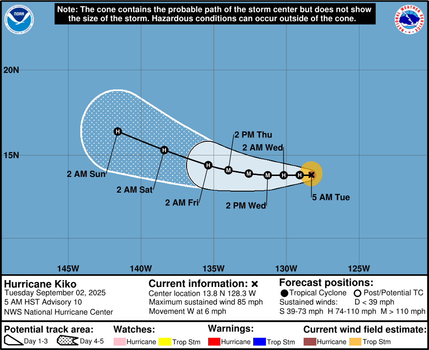
“Hurricane Kiko is moving due west at 7 MPH and should cross into the Central Pacific basin (140W) Friday or Saturday,” the National Weather Service in Honolulu said on Tuesday morning. “It remains too early to tell what, if any, impacts this system might have on local weather as it nears the islands early next week.”
From the National Hurricane Center discussion posted at 5 a.m. HST:
Over the past 6 hours, Kiko’s eye has become apparent on nighttime visible imagery, and at times it has also showed up in the infrared imagery. The small hurricane is clearly intensifying. The latest subjective Dvorak estimates from TAFB and SAB range from 77-90 kt, while the UW-CIMSS objective estimates have been running in the 60-74 kt range. The initial intensity estimate of 75 kt represents an average of these estimates.
Kiko continues moving slowly westward, or 270 degrees at 5 kt. The main steering feature continues to be the subtropical ridge located to the north of Kiko. A slow westward motion should continue for the next couple of days. A turn toward the west-northwest is forecast by days 3 and 4 as an upper-level trough north of Hawaii begins to erode the western portion of the subtropical ridge. There remains above normal along-track spread in the model suite, but not as much spread as yesterday, and the day 5 positions of the GFS and ECMWF are in fairly good agreement. The official day 5 position is relatively close to an average of those models. Only minor adjustments have been made to the official forecast, which lies close to the TVCE consensus.
Through the next 48 h, Kiko should remain over sea-surface temperatures of 27-28C, with light to moderate easterly wind shear of 10-15 kt. The environmental air is a bit dry and stable, and this might prevent rapid intensification. However, steady strengthening still appears likely over the next day or two. By day 4, Kiko will reach somewhat cooler water temperatures as it moves into a drier environment. The new NHC forecast shows a slightly higher peak intensity of 100 kt, and is near the high end of the intensity guidance suite through day 3. Some weakening is likely in 4-5 days when Kiko reaches the cooler water and drier air, but the official forecast still maintains Kiko at hurricane strength through day 5.

by Big Island Video News
on at
STORY SUMMARY
HAWAIʻI - Kiko could become a major hurricane by Wednesday night, as few days before it enters the Central Pacific basin.