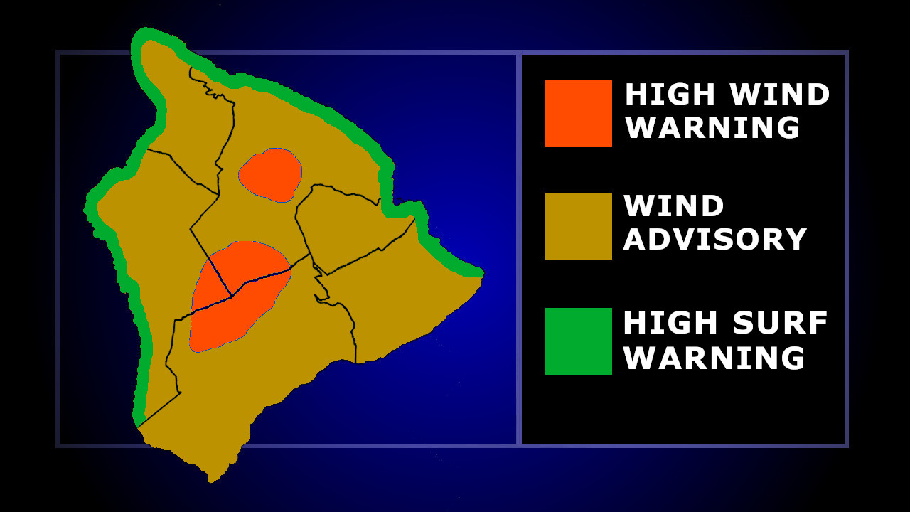
(BIVN) – A High Surf Warning has been added to the existing weather advisories for Hawaiʻi island, as an extra large northwest swell arrives to the islands.
There is already a High Wind Advisory for the lower elevations of the Big Island, and a High Wind Warning for the summits of Maunakea and Mauna Loa.
From the National Weather Service:
Surf heights are expected to rapidly build along north and west facing shores this evening, peaking Tuesday well above High Surf Warning levels along most north and west facing shores as an extra large northwest swell builds in. Overlapping pulses will keep surf elevated through Wednesday before subsiding below High Surf Advisory levels Thursday night into Friday. Additionally, the Coastal Flood Statement remains in effect through Tuesday morning, as peak monthly tides coincide with much higher than predicted ocean levels. Expect minor flooding of low-lying coastal infrastructure as well as some some beach erosion during peak high tides through the morning hours again early Tuesday.
While the north-facing shores of the other islands could see surf up to 45 feet high, Hawaiʻi island expects to see surf building up to 20 to 26 feet on Tuesday along north-facing shores. West Hawaiʻi shores could see surf building to 8 to 14 feet that same day.
“Additionally, a combination of higher than predicted tides and elevated surf will produce nuisance coastal flooding, mainly during peak high tides in the early morning hours between midnight and sunrise,” the National Weather Service stated.
Forecasters say another extra large swell is possible late Friday and Saturday.

by Big Island Video News
on at
STORY SUMMARY
HAWAIʻI - Surf heights are expected to rapidly build along north and west facing shores this evening, forecasters say.