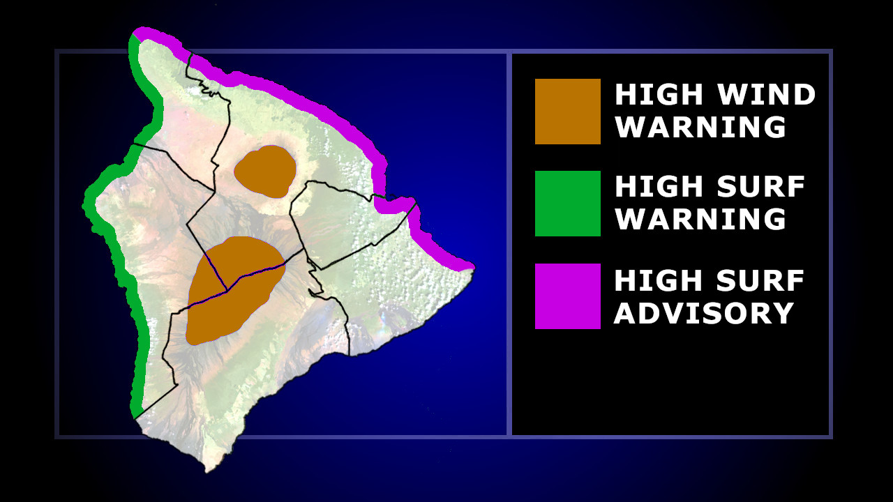
(BIVN) – The Wind Advisory for the lower elevations of Hawaiʻi island has been discontinued, and the High Surf Warning for north-facing shores of East Hawaiʻi has been downgraded to a High Surf Advisory.
The High Wind Warning that was previously issued for the summits of Maunakea and Mauna Loa remains in effect.
“Satellite and radar imagery early this morning is showing the front moving into the Big Island this morning,” the National Weather Service wrote just before 4 a.m. Tuesday morning. “Winds have decreased behind the front, thus the Wind Advisory has been cancelled. While parts of the Big Island will continue to see breezy conditions through this morning, winds have decreased below advisory thresholds. For the summits of the Big Island, a High Wind Warning remains in place, but winds are expected to gradually decrease this afternoon into tonight and we could see the High Wind Warning downgraded to an advisory sometime during the next 24 hours.”
In a public information statement, the National Weather Service provided the following on reported wind gusts:
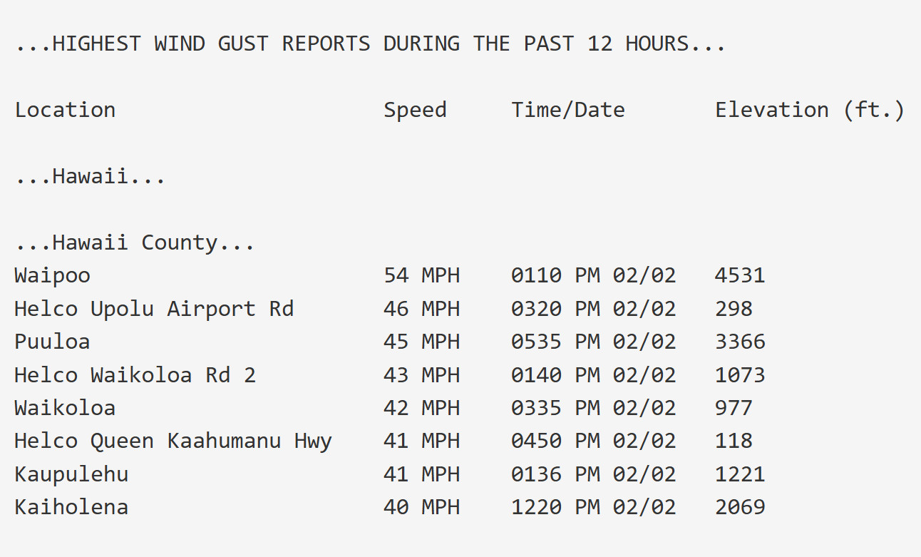
courtesy NWS in Honolulu
“The next cold front will approach the state on Friday and stall over the state over the weekend,” the forecasters wrote. “Meanwhile, in the upper levels of the atmosphere, we have a sharp trough developing into a cutoff low southwest of the state Sunday into early next week. While there are many different type of weather scenarios possible due to the forecast depending on the strength and position of the cutoff low, most of these scenarios lead to some type of high impact weather event over the state.”

by Big Island Video News
on at
STORY SUMMARY
HAWAIʻI - The High Surf Warning for north-facing shores of East Hawaiʻi has been downgraded to a High Surf Advisory.