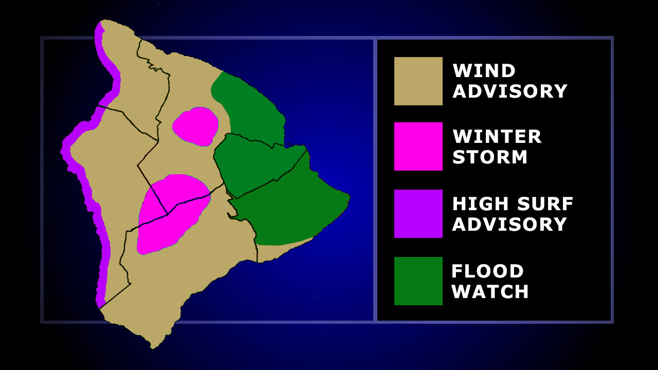
(BIVN) – Hawaiʻi island remains under a Flood Watch, with considerable flash flooding still possible, after a strong kona storm drenched the island on Saturday, closing roads and knocking out power.
The High Wind Warning has been discontinued for the lower elevations. A Wind advisory is now in place for the interior and leeward side of the Big Island. A Winter Storm Warning continues for the summits of Maunakea and Mauna Loa.
As of 7 a.m., officials say Highway 11 in Kaʻū remains closed from mile 52 near Kawa Flats to 66 in Waiohinu. Crews are working on clearing debris.
Highway 11 between the 50-mile marker and Kamani Street in Pahala is now open. However, the east end of Wood Valley Road remains closed due to road damage.
On Sunday morning, motorists were also asked to avoid Hualalai Road in Kona, between Kakalina Street and Hienaloli Road, due to roadway damage from rain and flooding.
Following several closures in Kawaihae overnight, the police department on Sunday morning reported the following roads are now OPEN:
- Queen Kaʻahumanu Highway between Hapuna Beach and Kawaihae Road intersection
- Kawaihae Road near Spencer Beach Park and Kawaihae Harbor
- Akoni Pule Highway at the 4 MM.
Hawaiian Electric says about 27,000 customers were without power as of 9 a.m. Sunday morning, “mostly in Puna, North and South Kona and South Point, with nearly 5,000 restored overnight.”
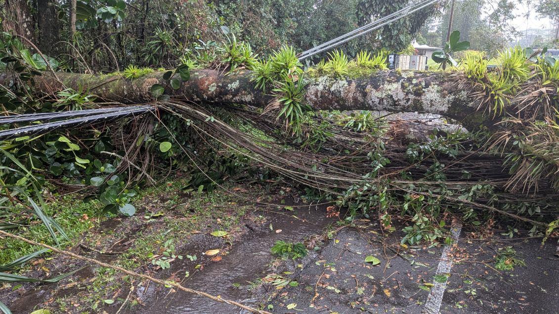
photo shows trees over downed power lines in Puna, photo courtesy Daryl Lee
“Today’s focus will be on field inspections and repairing transmission lines,” the utility said.
In the 9 a.m. forecast discussion, the National Weather Service explained why Hawaiʻi island should expect to see more rain on Sunday, even as the rest of the state sees improving conditions:
The kona low has lifted well north of the area and the surface low is approaching 40N early this morning. However, the islands remain enveloped in the southern periphery of large scale cyclonic flow aloft which itself is anchored over the central North Pacific. Deep moisture is remains established over and upstream of the Big Island while dry mid-level air is wrapping in from the south over Kauai. This dry air was evident in this morning`s Lihue sounding which indicated weak capping developing around 6kft. Further east, morning satellite and radar reveal meaningful showers persisting over Leeward Big Island. Strong SW flow will continue to capitalize on orographic lift in maintenance of continued showers over this area until the next wave of deep moisture arrives this afternoon. This will represent another opportunity for heavy showers to train over the Leeward and potentially SE slopes of the Big Island. It is unlikely to be as intense as yesterday as large scale large scale forcing has waned substantially, but actively cooling cloud tops upstream nonetheless indicate potential for deep convection and heavy rainfall capable of producing flash flooding. Confidence is high that the Flood Watch will remain in place through tonight for the Big Island. It remains unclear whether this activity will reach Maui, but current trends suggest that may miss to the south. In that case, consideration would be given to ending the Flood Watch for them this afternoon.
“My team and I are in contact with state and local leaders and closely monitoring the devastating storm impacting communities across Hawai‘i,” said U.S. Senator Brian Schatz, commenting on the situation from Washington, D.C.
“The priority right now is keeping people safe and supporting first responders. We will continue working with federal, state, and county partners to ensure Hawai‘i gets the federal resources it needs in the days and weeks ahead,” Senator Schatz said.

by Big Island Video News
on at
STORY SUMMARY
HAWAIʻI ISLAND - An update on the various road closures and weather alerts for the Big Island on Sunday morning.