(BIVN) – After a weekend of flash flooding, the National Weather Service cancelled the Flood Watch for Hawaiʻi island early Monday morning.
“Remnant bands of moderate showers continue to affect leeward Big Island and portions of Maui County, and are expected to persist through at least tonight and possibly through Tuesday,” the National Weather Service wrote. “However, recent observations indicate hourly rainfall rates remain below a tenth of an inch across both islands. In response to the reduced rainfall intensity and improved flooding thread, the Flash Flood Watch for Maui County and the Big Island has been cancelled with the issuance of this morning`s forecast package.”
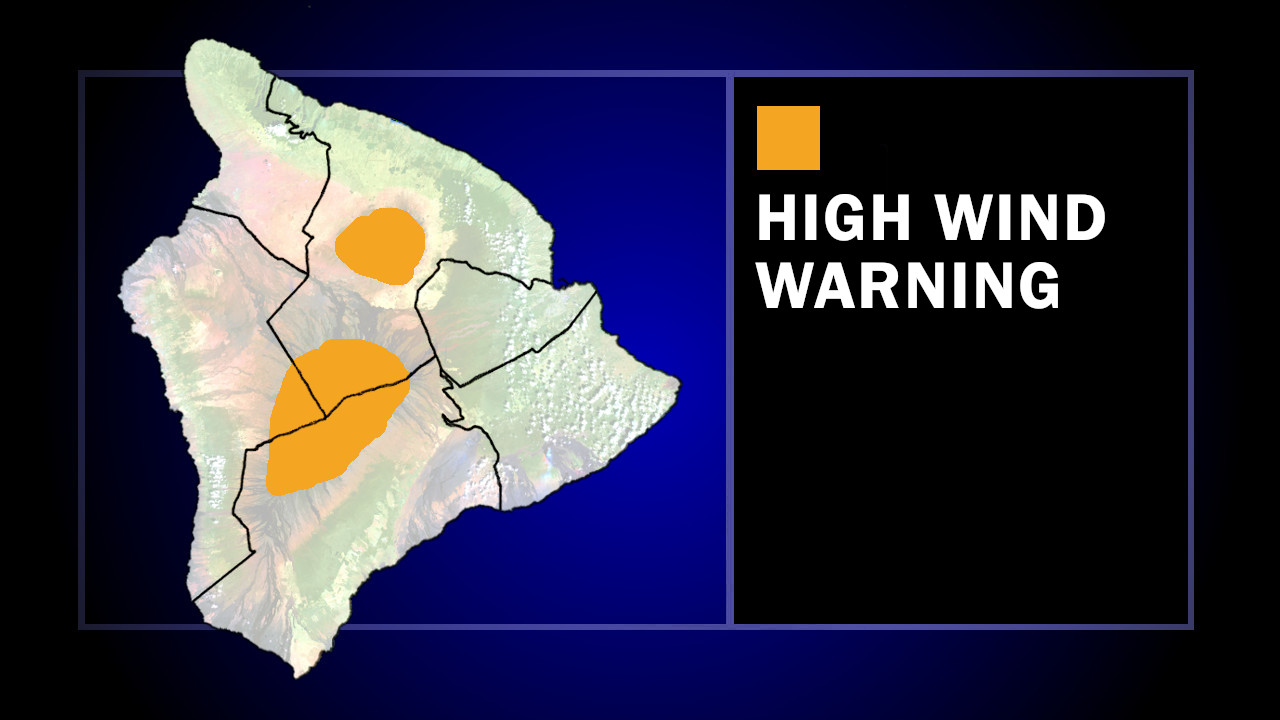
A High Wind Warning remains in effect for the tops of Maunakea and Mauna Loa. Southwest winds 50 to 80 mph, with gusts up to 100 mph, are possible on the Big Island summits.
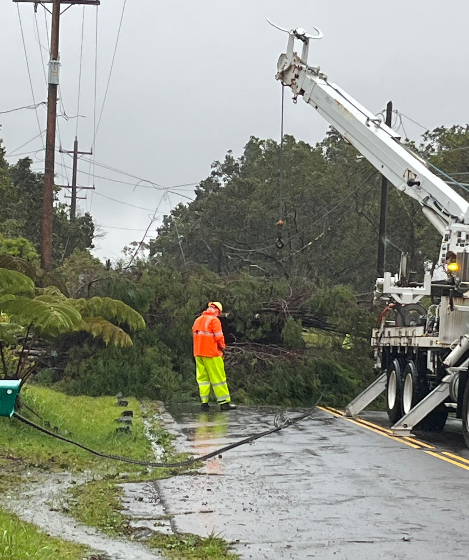
A downed tree on Wright Road, photo by Hawaiian Electric
As of Sunday night, Hawaiian Electric reported about 14,500 customers on Hawaiʻi island (16% of customers) are without power. “Two transmission lines also were repaired, and repairs to a third line are expected to be completed” by Monday, Hawaiian Electric said. “Damage assessments were conducted in accessible areas in Kaloko, Holualoa, South Point, Volcano Village, Mauna Loa Estates, Royal Hawaiian Estates, and Nanawale Estates. In total, 30 damaged or broken poles were identified.”
The County of Hawaiʻi announced on Sunday evening that it will return to normal operations on Monday.
The National Weather Service is also reporting that there is another threat of heavy rain anticipated toward the latter end of the week, as low pressure develops west of the islands. Forecasters wrote:
Toward the latter part of the week, model guidance diverges somewhat, with the GFS depicting a flatter and more progressive surface low while the ECMWF suggests a deeper and slower-moving system. The latest GFS run has trended closer to the ECMWF solution, increasing confidence that organized low pressure could develop over or near the island by late week. Given the uncertainty at this range, the forecast will continue to be refined in subsequent updates.

by Big Island Video News
on at
STORY SUMMARY
HAWAIʻI ISLAND - After a weekend of damaging winds and flash flooding, only remnants of the kona low continue to produce scattered showers over the Big Island.