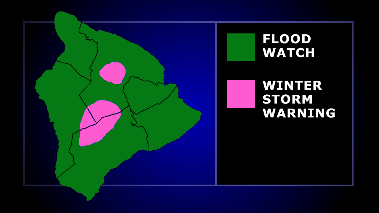
(BIVN) – A Flood Watch remains in effect for the entire island of Hawaiʻi, and a Winter Storm Warning continues for Big Island summits.
From the National Weather Service discussion posted early Sunday morning:
The upper-level trough and associated surface kona low remain positioned north of the Hawaiian Islands and continue to drift northeastward away from the state while gradually weakening. Despite this trend, lingering moisture and instability will support continue shower activity across the islands through this evening, with the greatest coverage over Maui County and the Big Island and more scattered activity elsewhere. As a result, the Flash Flood Watch remains in effect for Oahu, Maui County, and the Big Island through 6 PM this evening. Furthermore, the Winter Storm Warning remains in effect for the Big Island summits through 6 PM this evening as well.
Summit weather conditions are obscuring observatory webcams atop Maunakea, although a few are providing enough of a view to see the heavy snow. Total snow accumulations up to 10 inches were expected.
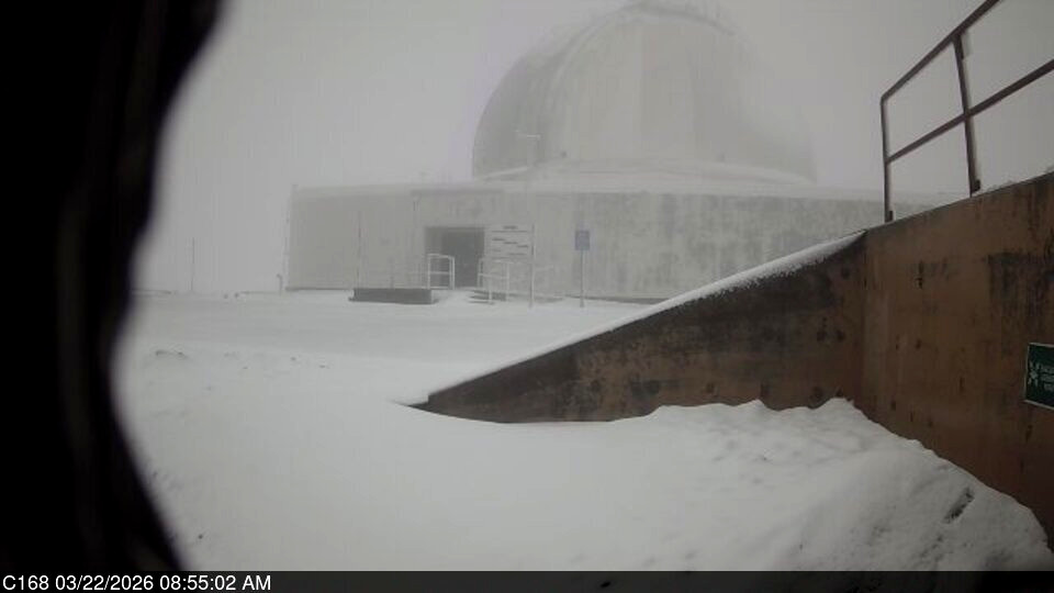
Maunakea observatory webcam captures snow at the summit on Sunday morning
The Hawaiʻi County Civil Defense says that due to the Flood Watch, be advised:
- Residents in flood prone areas please remain prepared for the possibility of heavy rains and potential flooding
- Be aware that road closures may occur without notice
- Do not attempt to cross flowing water in a vehicle or on foot; turn around don’t drown.
- Remember, if lightning threatens your area, the safest place to be is indoors.

by Big Island Video News
on at
STORY SUMMARY
HAWAIʻI ISLAND - Flash flooding continues to be possible, as a surface kona low pressure system continues to meander away from the islands.