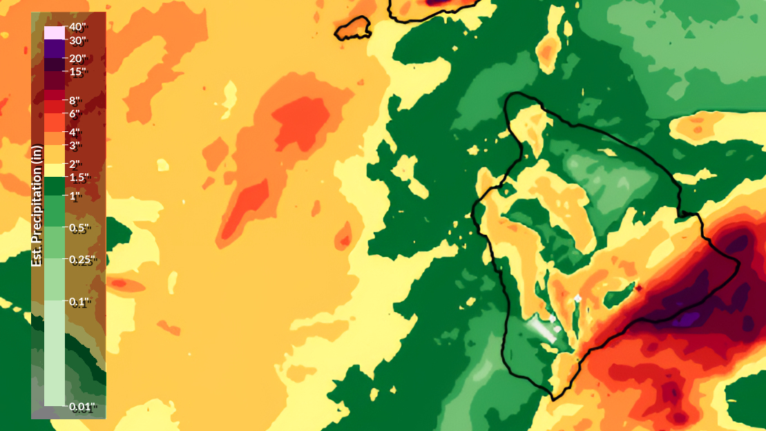
(BIVN) – The Puna and Kaʻū districts of Hawaiʻi island saw some of the heaviest rainfall during the April storms, according to a report by the National Weather Service.
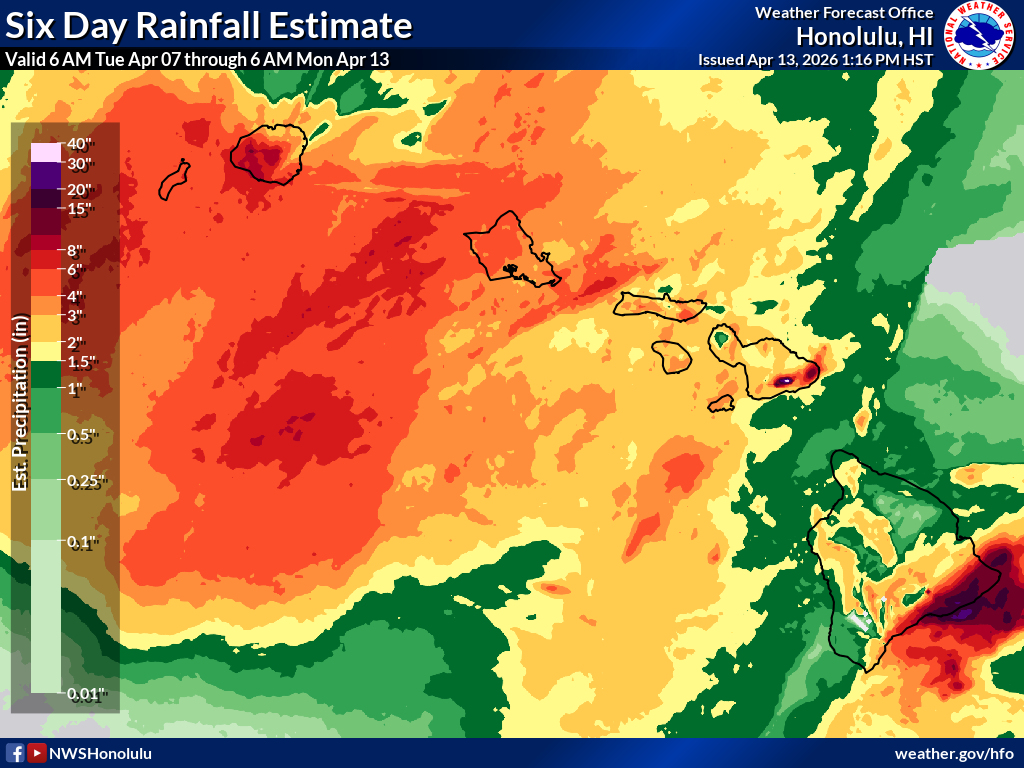
The Honolulu-based forecasters recently produced a six day rainfall estimate map, showing the areas in the Hawaiian Islands that experienced the most precipitation from Tuesday, April 7th through Monday, April 13th.
The report provided some preliminary rainfall measurements for the time period. The location that saw the most rainfall on Hawaiʻi island was Kealakomo within Hawaiʻi Volcanoes National Park, with 18.68 inches.
Two locations in Pāhoa also recorded high rainfall totals, at 13.77 inches and 11.38 inches.
Kapapala and Pāhala in Kaʻū both saw just over 10 inches of rainfall.
The National Weather Service in Honolulu summarized:
Surface low pressure with an associated frontal system developed to the west of the state, along with an upper level trough to the northwest, drawing an area of deep tropical moisture up from the south. This setup resulted in intermittent rounds of heavy rain and isolated thunderstorms over a 6-day period. The heaviest rain fell on the 7th into the 8th for the Big Island under pre-frontal southeast flow, then Kauai, Oahu, and Maui County from the 9th into the 11th as the dissipating front moved eastward down the island chain, washing out around the Big Island on the 11th.
Full National Weather Service map showing radar-estimated rainfall from 6 a.m. Tuesday, April 7, through 6 a.m. Monday April 14, 2026.
Another shortwave rotated through the upper trough the night of the 11th into the 12th, tapping into lingering moisture to bring another round of heavy rain and thunderstorms to portions of the western and central islands. The heavy rain resulted in several road closures due to flooding and land/rock slides, mainly on Kauai, Oahu, and southeast Big Island.

by Big Island Video News
on at
STORY SUMMARY
HAWAIʻI ISLAND - The southeast-area of Hawaiʻi island, including Puna and Kaʻū, saw some of the heaviest rainfall from April 7th through April 13th.