
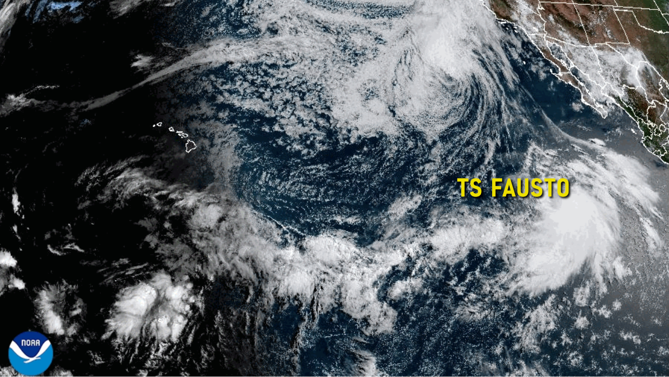

UPDATE – (5 p.m.) – Fausto has become a hurricane. The National Hurricane Center says steady to rapid strengthening is expected during the next couple of days, with Fausto forecast to be near major hurricane intensity by Wednesday, with a projected path towards the west northwest. We will have more information in an update later this evening.
(BIVN) – The National Hurricane Center in Miami is tracking Tropical Storm Fausto as it moves northwest and strengthens in the Eastern Pacific.
As of Monday, the center of Tropical Storm Fausto was located near latitude 14.2 North, longitude 116.7 West, putting it about 745 miles southwest of the southern tip of Baja California. Maximum sustained winds are near 70 mph (110 km/h) with higher gusts.
Fausto is expected to strengthen into a hurricane later today or tonight.
The National Weather Service in Honolulu is also keeping an eye on the storm, which could begin to influence island weather patterns next week.
“Tropical Storm Fausto, currently located several hundred miles west southwest of southwestern Mexico, is steadily strengthening,” the Honolulu-based forecasters wrote on Monday. “Fausto is expected to achieve hurricane strength this evening with a northwest becoming more westerly track through Wednesday. Deterministic model guidance has Fausto reaching 140W in about a week with it weakening along its northwesterly track as the cyclone encounters western ridging and cooler waters.”
If Tropical Storm Fausto stays on a northwesterly track, forecasters say “localized trade flow will be interrupted with much weaker trades expected early to mid next week.”
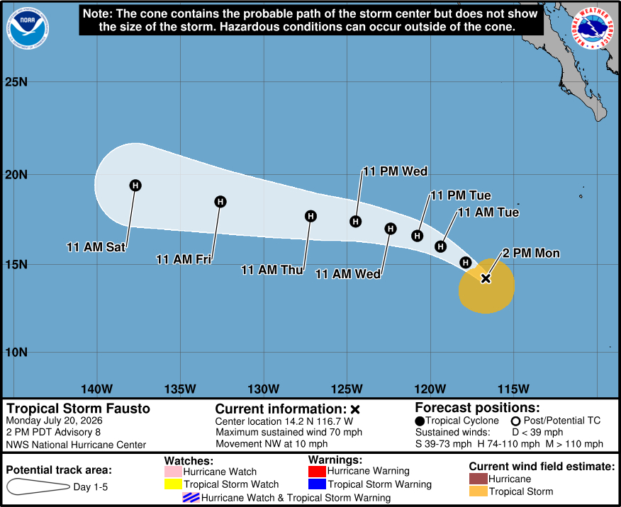
From the National Hurricane Center discussion on Monday afternoon:
A microwave pass that occurred around 1330 UTC showed that the center was north of the convection at that time. The recent subjective Dvorak fix from TAFB was 3.5/55 kt. A recent ASCAT-C pass shows several vectors over 50 kts and that the inner core is becoming better organized. Most recent satellite images have also shown that the convection is becoming better organized over the low-level center of Fausto. Based on the ASCAT pass and the improved satellite presentation over the past several hours, the initial intensity is increased to 60 kt for this advisory.
Fausto should move into a region of lighter shear while remaining in a moist environment over warm sea-surface temperatures. The SHIPS model suggests that rapid intensification is still possible. The timing and possibility of the intensification will be tied to how quickly the system is able to get organized. The current NHC intensity forecast is slightly slower than the previous advisory and remains still on the higher end of the model guidance. The current NHC forecast does have Fausto becoming a hurricane by tomorrow and start to approach major hurricane status in a couple of days. Gradual weakening is expected toward the end of the week once Fausto moves into an environment of progressively cooler waters and drier air.
The storm is slowly gaining latitude, with the initial motion estimated to be 305/9 kt. Fausto will continue to move toward the northwest and slow down during the next day or two as it tracks toward a weakness in the ridge left behind by Elida. By Wednesday, however, the global models show the ridge strengthening northeast of the system, and that should cause Fausto to move faster to the west-northwest and continue in that direction into the weekend. The current NHC track has been slightly adjusted to the right of the previous track, but remains within the middle of the guidance envelope.
