
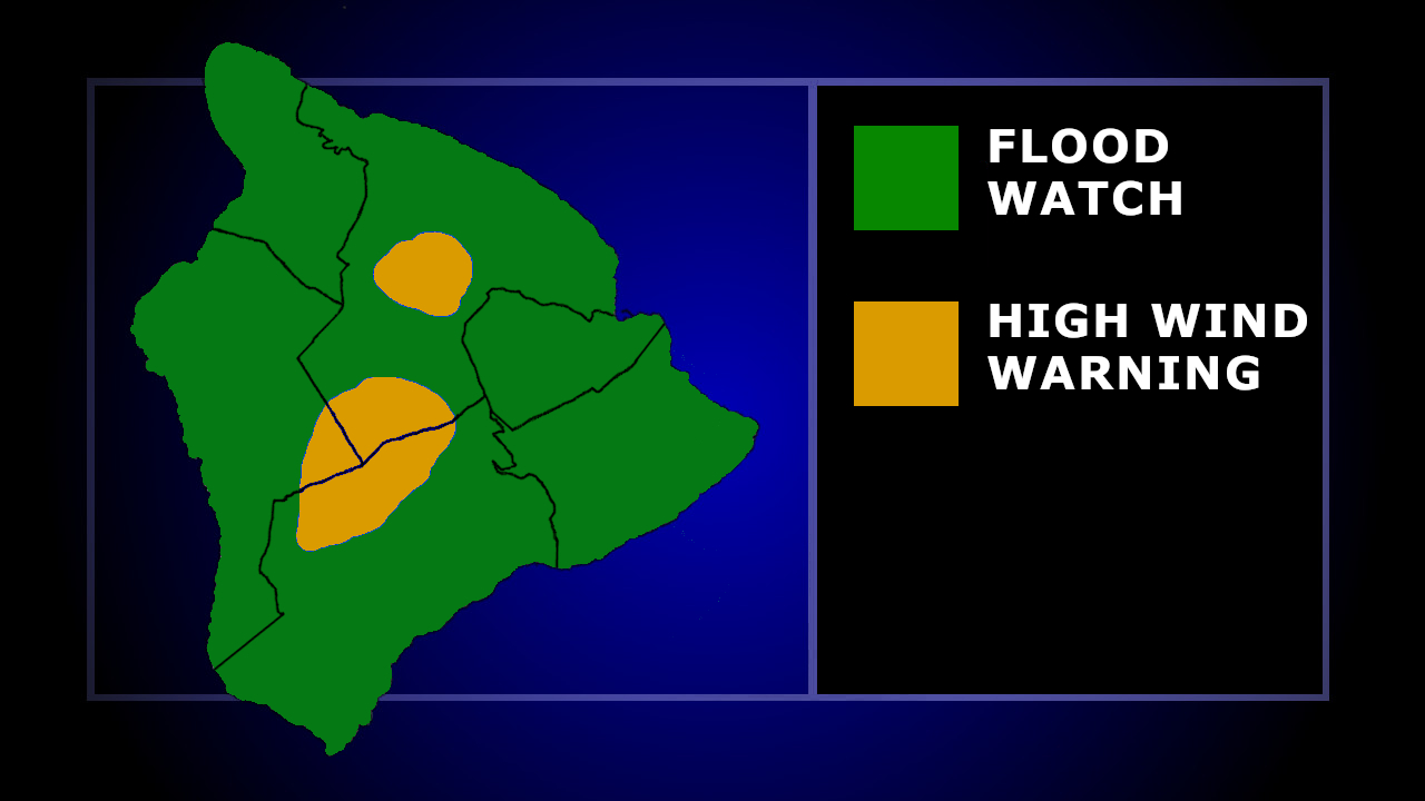

(BIVN) – A Flood Watch is in effect for the Hawaiian Islands, and a High Wind Warning has been added for Hawaiʻi Island summits, as a trough moving over the state will bring abundant tropical moisture through at least Wednesday night.
“Heavy showers and isolated thunderstorms with intense rain rates may develop at any time through Wednesday night as a trough moves over the state from the west,” the National Weather Service stated. “While the greatest flood threat will be focused over Oʻahu and Maui County, all islands are at risk.”
The Hawaiʻi County Civil Defense issued a radio alert on the potential for heavy showers and possible thunderstorms, and advised residents to monitor local radio broadcasts for official advisories and updates, “and please anticipate possible hazardous road conditions and possible interruptions in power and communications.”
A High Wind Warning has also been issued for the summits of Maunakea and Mauna Loa, where southwest winds of 30 to 40 mph, with gusts up to 80 mph, are expected. The warning is in effect until noon on Wednesday.
From the National Weather Service discussion posted on Tuesday:
No major changes to the forecast with the afternoon package. The High Wind Warning for the Big Island summits continues, as winds have reached advisory levels late this afternoon and are expected to continue to increase tonight. There were some minor tweaks made to the PoPs and associated fields for the first part of tonight as the rain is not spreading across the islands as quickly as we anticipated this morning.
While clouds have been plentiful over the islands today, rainfall totals have been light. Radar this afternoon shows heavier rainfall moving over the Kauai Channel, with light rain moving over the leeward and south portions of Oahu, Molokai and Lanai. Expecting the moderate to heavier shower activity to spread across the islands in the next few hours.
Satellite derived precipitable water (PW) continues to show over 3 inches about 325 miles southwest of the islands. This is twice the normal PW for this time of year. The 2 inch satellite derived PW is approaching the islands of Maui County this afternoon. The afternoon sounding from Hilo have 2.30 inches of PW and Lihue had 1.76, both about the normal value around 1.5 inches.
The remnants of Olana are more than 1300 miles southwest of the islands, with a monsoon trough extending nearly 800 miles to the east-northeast of the remnants, and trough extending to the east and then northeast of that. The trough remains south of the islands, with some surface lows forming along the trough. The low of most concern was analyzed about 530 miles southwest of Oahu this afternoon. The GFS and ECMWF models forecast the low to be a little further north at this time, but both agree with a weak low moving towards the islands. Satellite shows a broad area of layered clouds with embedded thunderstorms near the low and in the area between the low and the main Hawaiian islands. This area corresponds with the elevated PW mentioned above.
A north-northeast to south-southwest oriented upper level trough is about 800 miles northwest of Kauai, and is expected to move to the east over the next 24 hours, and will help to destabilize the airmass over the islands as the jet moves over the islands.
The Flood Watch is in effect through tomorrow night. The highest rainfall totals are expected to be focused over Maui County and Oahu. However, all islands remain under the Flood Watch with the potential for thunderstorms and locally heavy rain. Slow moving cells may become anchored along the terrain of the islands, which could lead to flash flooding anywhere. Breezy east winds could form just north of the low, while gusty southerly winds form to the south. Strong thunderstorms with localized damaging gusty winds may develop along and just south of the surface trough.
The threat of heavy rainfall will diminish Thursday and Friday. The jet stream aloft will lift to the north as the upper level trough moves to the west and an upper level low develops along the trough. The weak surface trough, with ample moisture will likely linger, providing some chance for spotty heavy showers that could require the Flood Watch to be extended.
Friday night into Saturday a brief period of trade winds may return as the lingering moisture associated with the trough is pushed south of the islands. The GFS and ECMWF are showing breezy northeast winds developing Sunday as a shallow front moves near or over the state.
